
- Highlights: Cave, great views from White Rocks
- Distance: 9.8 mile balloon
- Elevation Change 2,349 feet
- Trail Surface: Dirt and numerous rocky sections
- Difficulty Level: Strenuous
- Trailhead Parking: Thomas Walker Civic Park, Ewing VA
- Trail Markings: signs at trail junctions
- Website: AllTrails
- Beer Pairings: Bays Mountain Brewing Co.—Barney’s Brown Ale & 2280 IPA
Trail Map:
The Hike:
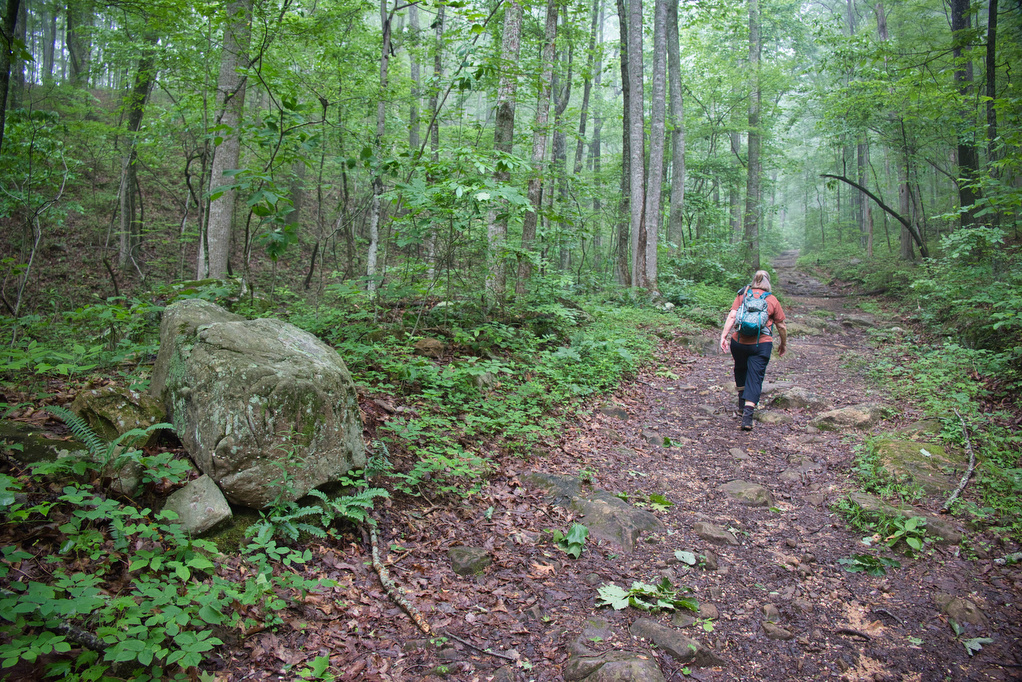
This hike in Cumberland Gap National Historical Park is challenging. The Ewing Trail is steep and rocky in places, although the elevation gain of 2,000+ feet is spread over 3+ miles. There are a series of steep steps to descend down to the cave and a rock scramble to climb up to the White Rocks Overlook.
We hiked clockwise on the Ewing Trail. The trail was muddy after heavy rains the night before and we encountered several down trees. The Ewing Trail is multi-use and we encountered several horseback riders. Follow the signs to the Ridge Trail and then the spur trail to Sand Cave. While most of the Ewing Trail is in Virginia, Sand Cave is in Kentucky.
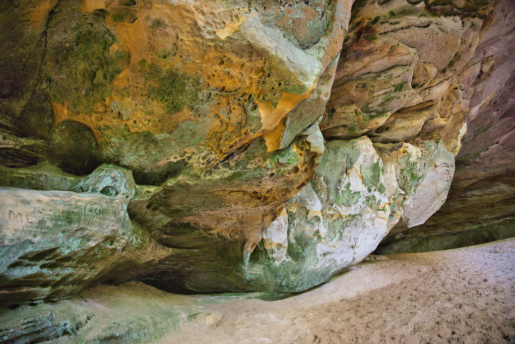
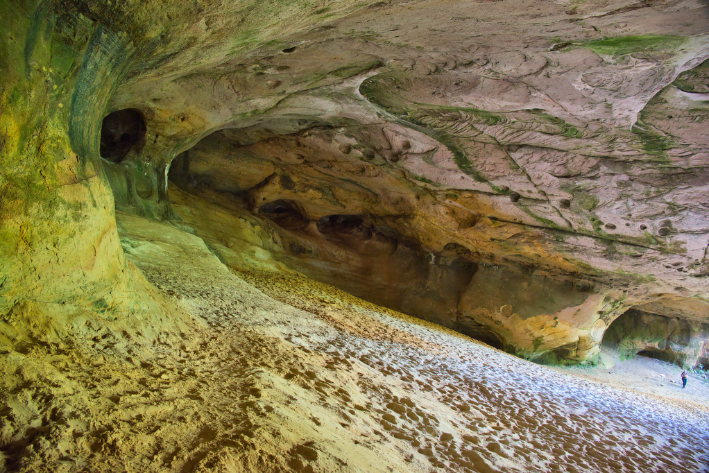
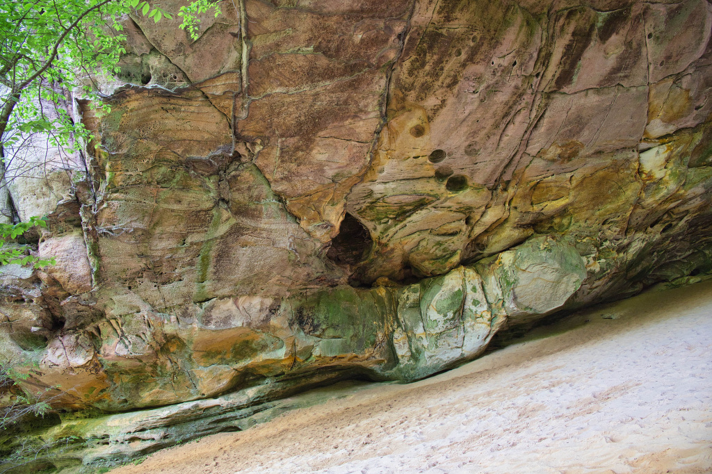
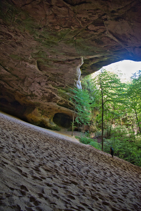
Sand Cave:
The trail to Sand Cave was a bit confusing. At an unmarked junction, bear left and follow a series of wooden steps down to the cave. Several down trees near the cave required a bit of bushwhacking to reach the cave.
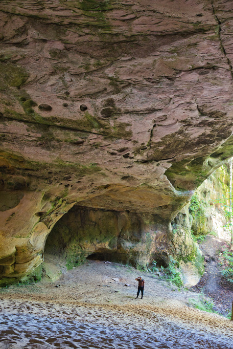
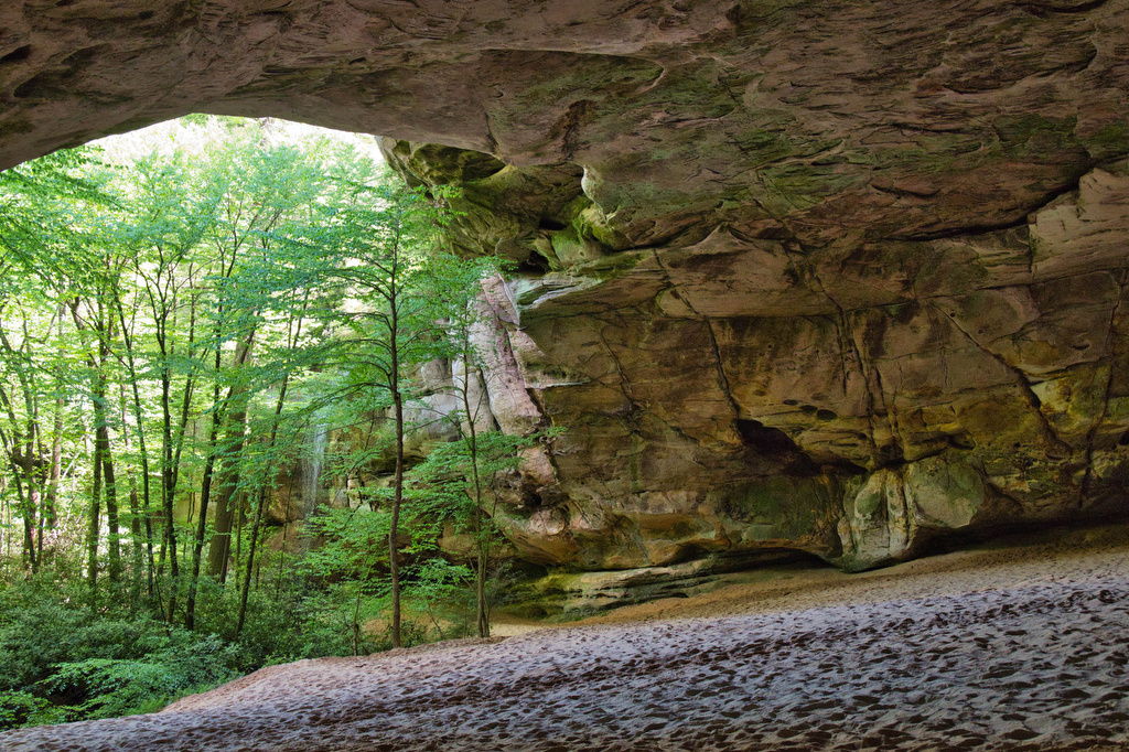
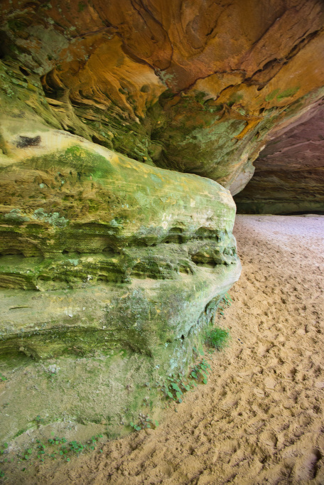
Sand Cave, unlike the other nearby caves, was formed by wind, not water. This sandstone cave is nearly the size of a football field and is filled with, you guessed it, sand. Take time to explore the cave. Throughout the cave, the color of the sandstone is a blend of brown, green, orange, and white. The acoustics are excellent, feel free to belt out your favorite song.
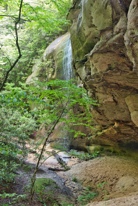
Just to the left of the cave opening is a small waterfall.The flow may be just a trickle in the hot, dry summer. After the heavy rains, the falls had a steady—but small—flow. Enjoy the cave and then climb back up to the Ridge Trail and follow the signs to White Rocks Overlook
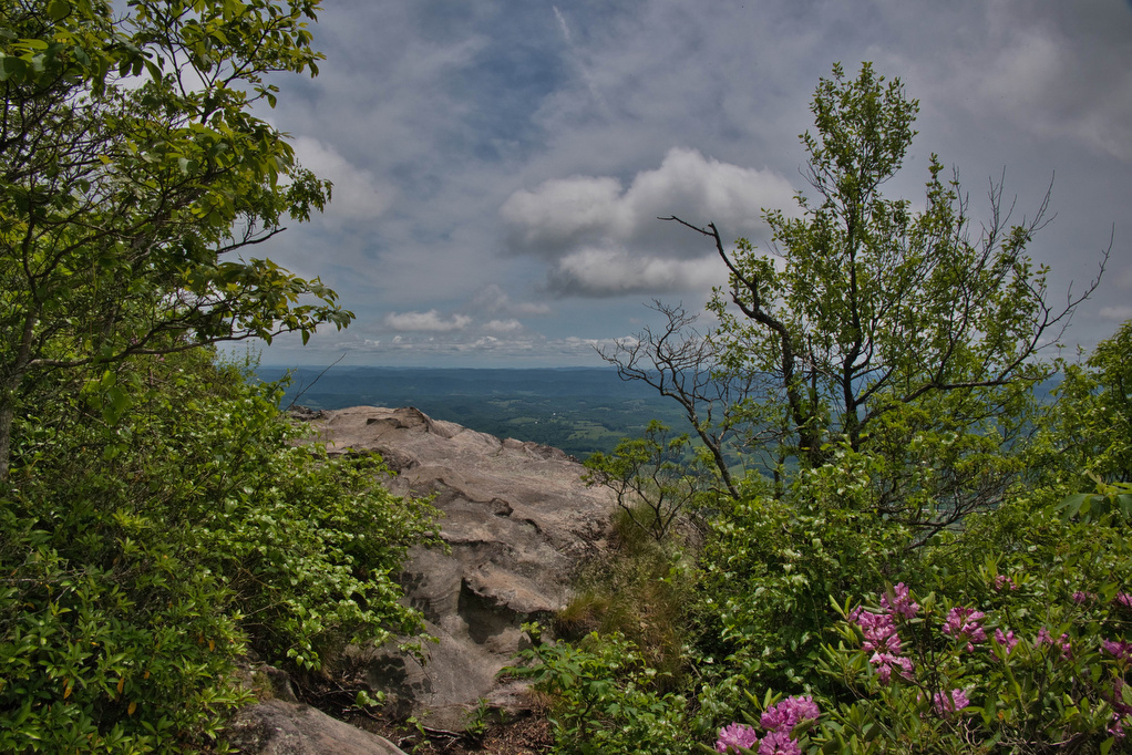
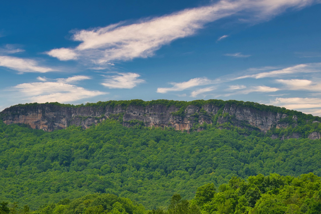
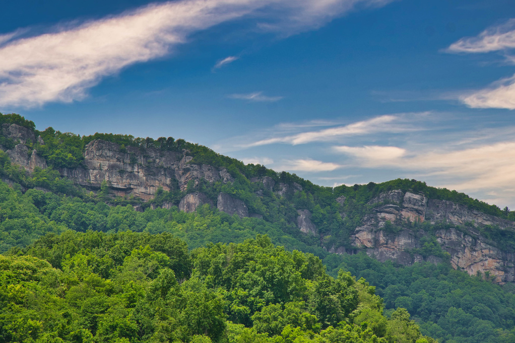
White Rocks:
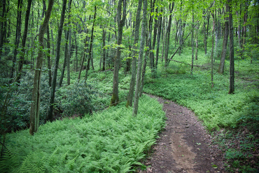
The trail follows the top of the ridge and the hiking is easier. Pockets of ferns, rhododendron, and mountain laurel dot the path.. A short, steep, spur trail leads to the overlook. The trails passes between two large boulders in a rhododendron thicket. While not technically a rock scramble, hikers may need to use both hands to navigate this steep, rocky section of the trail.
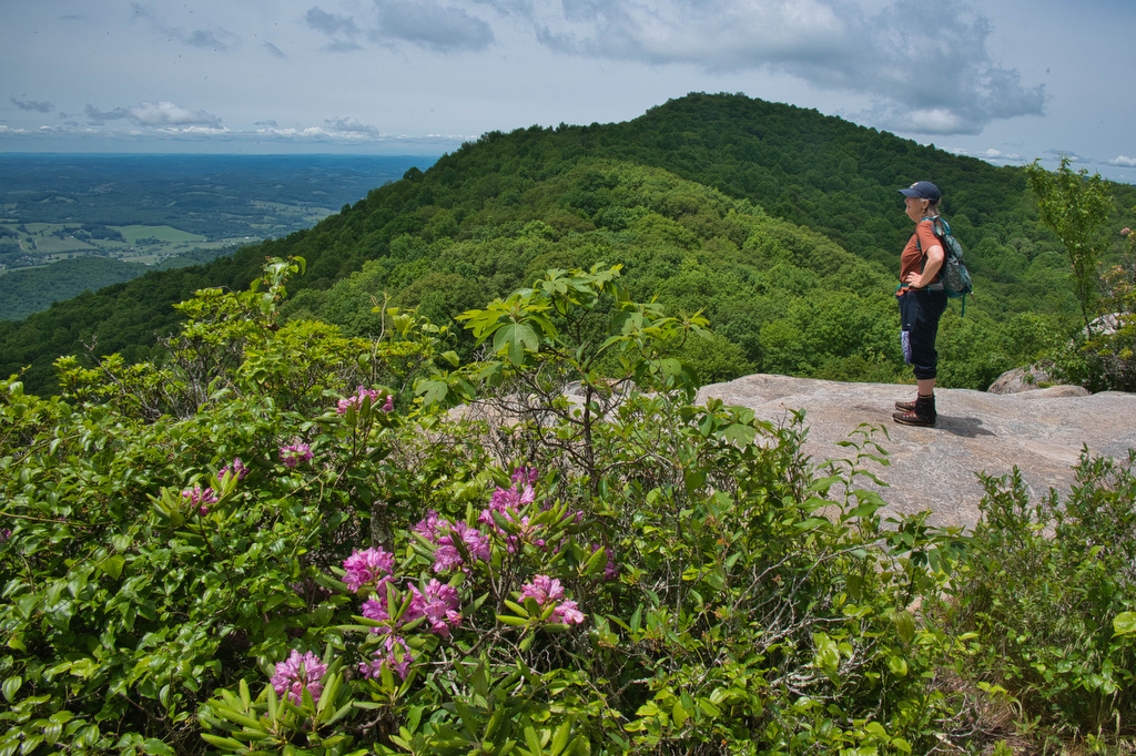
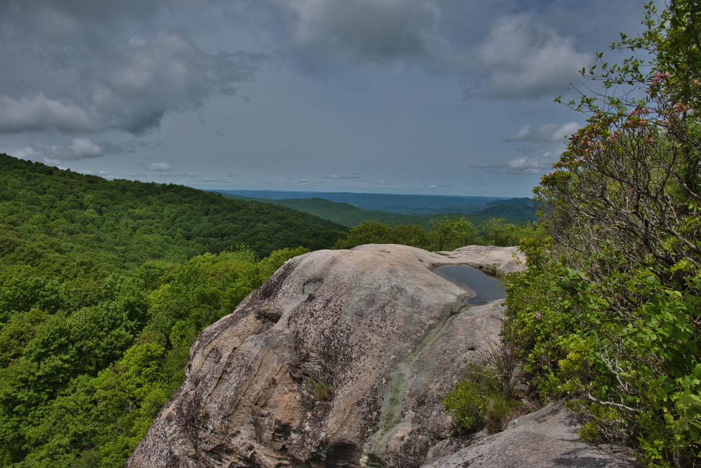
The views are well worth the effort. Several short, unmarked spur trails lead off to the right. We prefer the view from the 2nd trail. White Rocks is a 500-foot sandstone cliff with excellent views the east and south with views of the Poor Valley and Powell River Valley. On clear days, the Great Smokies and Clingmans Dome are visible to the southeast—over 75 miles away.
Enjoy the views and hike back down to the Ridge Trail and follow the signs to the Ewing Trail and the parking area.
Hike Photos:


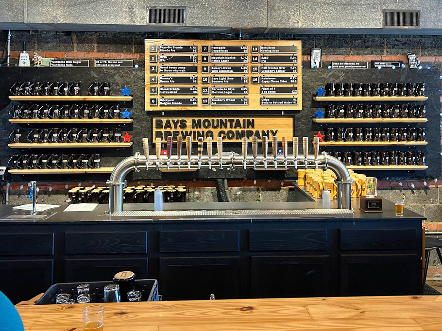
Beer Pairing:
Bays Mounting Brewing in Kingsport TN is about 65 minutes from the trailhead. This family-friendly brewery has 16 taps of craft beers kid and dog friendly, and food trucks visit on weekends. We met lots of nice people here who had just finished a hike to nearby Bays Mountain. The brewery is located next door to Reedy Creek Bicycles.
Kathy enjoyed a cold pint of 2280 IPA (5.3% ABV • 33 IBU), which gets its name from the elevation of Bays Mountain, the nearby namesake of the brewery. 2280 is brewed with Cascade and Mosaic hops and is hoppy and bitter—just the way we like our IPAs. Pete really liked Barney’s Brown Ale (5.8% ABV) named after the legendary bear of Bays Mountain. Barney’s is a classic brown ale; malty and toasty, with notes of caramel and toffee. Cheers!

Hike and drink responsibly. Never drink and drive. Stay safe, be responsible, and leave no trace.