
- Highlights: Appalachian Trail, bald summit, amazing views
- Distance: 13.6 miles out and back
- Elevation Change 3,250 feet
- Trail Surface: Dirt with several rocky sections
- Difficulty Level: Strenuous (distance & elevation change)
- Trailhead Parking: Sam’s Gap parking area, Flag Pond Road, Mars Hill NC
- Website: AllTrails
- Beer Pairings: Mad Co. Brew House—Marshall Pale & Western IPA
Trail Map:
The Hike:
This hike on the Appalachian Trail is a long one—and several sections are a bit steep. The views from the summit of Big Bald make it all worthwhile—especially on a gorgeous day with blue skies. The parking area on Flag Pond Road (near the NC/TN state-line and a stone’s throw from Interstate 26) has room for about 15 vehicles.
The AT is well marked and well maintained. Cross Flag Pond Road and pass through the gate. Follow the white blazes heading north on the AT. The trail passes beside the Interstate for about 200 yards and soon enters the Pisgah National Forest. The climb begins and steps and switchbacks help with the ascent.
At 2 miles, reach a small meadow with nice views to the north of Big Bald (5,516’), the highest peak in the Bald Mountains range. Appalachian balds are unique to this region. Bald mountains have elevations over 4,000 feet and typically the summits are grassy with spectacular views.
Continue north on the AT which soon returns to the forest. Ferns, moss, and hardwoods dominate this section of “the big green tunnel”. Stay straight on the AT as several other trails join the AT. The climb is steady but gradual.
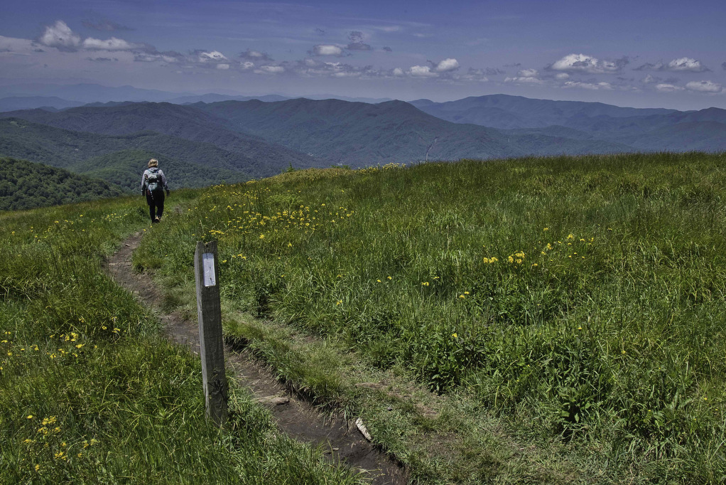
At 6.5 miles, the climb becomes steeper (and rockier) as you begin climbing to the summit. The AT soon breaks out of the forest as you enter the grassy bald. Wildflowers and great views abound in all directions.
On a clear day, the Great Craggy Mountains and Black Mountains are visible to the southeast. Unaka Mountain and the Roan Highlands are to the northeast direction. The Great Smoky Mountains loom off to the southwest.
Just ahead to the north, the AT passes through the grassy meadow of Big Stamp. If you want to add another mile to this hike (and see another side of Big Bald), follow the AT north to Big Stamp. If 13+ miles is enough, retrace your steps southbound on the AT to Sam’s Gap and your vehicle.
Hike Photos:
Click on an image below for an enlarged view.


Beer Pairing:
Mad Co. Brew House in nearby Marshall NC is about 30 minutes from the trailhead. They have 15 taps of craft beer and cider, wine and seltzer, and really good pizza. The deck has views of the French Broad River. Dogs are welcome outside.
Kathy liked Marshall Pale Ale (5.5% ABV) brewed with Simcoe hops it has a bitter finish and a great aroma. Pete enjoyed a pint of Western IPA (7.75% ABV) brewed with Amarillo and Chinook hops and then dry-hopped with whole-cone Centennial and Mosaic hops. It was tasty with a nice west-coast piney bitterness.


Hike and drink responsibly. Never drink and drive. Stay safe, be responsible, and leave no trace.