Bald Mountain

Max Patch Revisited

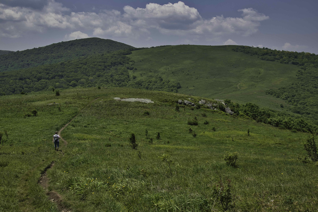
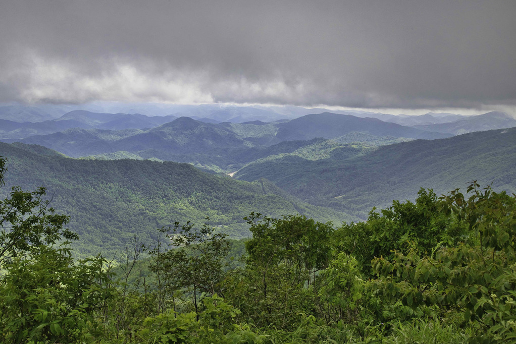
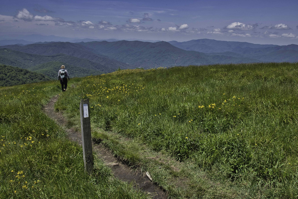
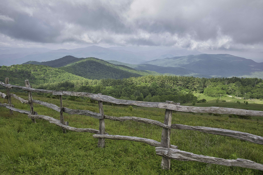
Trail Map: The Hike: We first visited Max Patch on a rainy day in 2020 and clouds and fog hid most of the views. On our 2023 western NC hiking trip, we decided to revisit Max Patch. The weather cooperated and we were treated to the outstanding views of which Max Patch is famous. Max […]

Max Patch Revisited Read More »

Big Hump & Little Hump Balds

Trail Map: The Hike: This Appalachian Trail section hike reaches two bald summits—Little Hump and Big Hump. The road to the trailhead is gravel/dirt for the last two miles or so. There are some deep ruts and washed-out areas. Our AWD Subaru had no problem. The parking area is on the left, a gate blocks

Big Hump & Little Hump Balds Read More »

Beauty Spot

Trail Map: The Hike: Beauty Spot is a popular local destination. The Appalachian Trail passes through this bald summit. However, most visitors drive here over a bumpy dirt road. The day of our hike, the weather wasn’t cooperating. The forecast called for clouds and scattered showers much of the day. We waited for the heavy

Beauty Spot Read More »

Cole Mountain Loop

Highlights: Appalachian Trail, bald summit, great views, wildflowers, wildlife Distance: 6.1 mile loop Elevation change: 1,200 feet Difficulty level: Strenuous Trailhead Parking: Wiggins Springs Road (route 755) becomes Hog Camp Gap Road (Fire Road 48), parking at the AT crossing at Hog Camp Gap. For additional parking, continue past Hog Camp Gap for .25 miles

Cole Mountain Loop Read More »

Huckleberry Knob & Hooper Bald

Highlights: Bald mountains, wildflowers, great views Distance: 3.2 miles out and back Elevation change: 500 feet Difficulty level: Easy Trailhead Parking: Cherohala Skyway mile post 8, Huckleberry Knob parking is on the right (westbound) and Hooper Bald parking is on the left a bit further west  Website: US Forest Service Beer Pairings: Nantahala Brewing—28779 Pale

Huckleberry Knob & Hooper Bald Read More »

Andrews Bald & Clingman’s Dome

Highlights: Great Smoky Mountains National Park, bald summits, great views, wildlife Distance: 4.8 miles, out and back Elevation change: 1,490 feet Difficulty level: Moderate/Difficult Trailhead Parking: Clingman’s Dome Visitor Center parking area, Great Smoky Mountains National Park Website: Great Smoky Mountains National Park Beer Pairings: Boojum Brewery—Graveyard Fields porter and Gem & Juice IPA The

Andrews Bald & Clingman’s Dome Read More »

Hemphill Bald

Highlights: Great Smoky Mountains National Park, bald summits, great views, wildlife, history, birdwatching Distance: 9.7 miles, out and back Elevation change: 1,639 feet Difficulty level: Difficult Trailhead Parking: Purchase Knob trailhead, Hemphill Road/Purchase Road, Haywood County, NC; park at National Park gate. Website: Purchase Knob and AllTrails Beer Pairings: Frog Level Brewery—Dragonfly Session IPA &

Hemphill Bald Read More »

Siler Bald via the AT

Highlights: grassy summit, views, fall foliage, Appalachian Trail, Nantahala National Forest Distance:  3.6 mile out and back Elevation change:  1,000 feet Difficulty level: Moderate Trailhead Parking: Wayah Gap picnic area on Wayah Road, about 14 miles west of Franklin NC Website: AllTrails Beer Pairings: Lazy Hiker Brewing: Springer Fever pilsner and 20 Mile IPA The

Siler Bald via the AT Read More »