
- Highlights: Bald summit, Appalachian Trail, amazing views
- Distance: 2.3 mile loop
- Elevation Change 479 feet
- Trail Surface: Dirt
- Difficulty Level: Easy
- Trailhead Parking: Max Patch Road, Appalachian Trail crossing parking area, this small parking area on the left before the main Max Patch parking area has space for 3-4 vehicles
- Website: AllTrails and US Forest Service
- Beer Pairings: Spring Creek Tavern, Hot Springs—Innovation Spaceman Pale Ale & Hidden Pipe Porter
Trail Map:
The Hike:
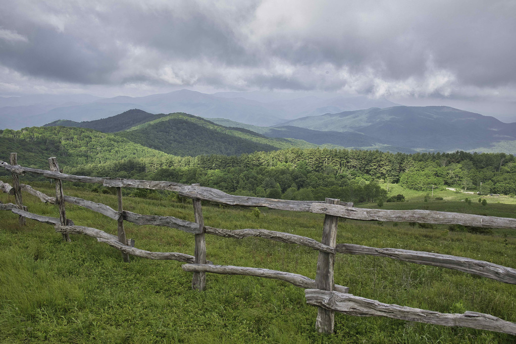
We first visited Max Patch on a rainy day in 2020 and clouds and fog hid most of the views. On our 2023 western NC hiking trip, we decided to revisit Max Patch. The weather cooperated and we were treated to the outstanding views of which Max Patch is famous.
Max Patch is a popular hike and the parking area can fill quickly. We opted to park at the Appalachian Trail parking area on max Patch Road, about 500 yards before the main parking area. This stretch on the AT is somewhat nondescript but anytime on the AT is worthwhile in our opinion.
From the parking area, cross Max Patch Road and follow the white-blazed AT north. The trail enters a hardwood forest with rhododendron, ferns, and moss. Follow the AT over an easy crossing of West Fork Little Creek and begin a gradual descent before reaching a trail junction at .4 miles with the Max Patch Loop.
Stay straight on the AT as the trail continues to climb to the 4,616’ summit of Max Patch. Views open up as you approach the summit. Tennessee and the Cherokee National Forest are to your left and Pisgah National Forest is to the north, east and south.
Continue on the AT hading north and at 1 mile, bear left on the blue-blazed Max Patch Loop as it begins a gradual descent through blaze orange azaleas. Views open up on the right to Tennessee and then on the left to Max Patch.
The trail leads to the main Max Patch Parking area. Pass the trail head kiosk and stay left on the blue-blazed Max Patch Loop as the trail begins a gradual ascent. Views of Max Patch are on the left and more azaleas and mountain laurel line the trail.
Parts of the trail are designated as habitat restoration areas for the Golden-Winged Warbler. At 1.9 miles, bear right on the AT heading south to return to the parking area and your vehicle.
Hike Photos:
Click on an image below for an enlarged view.


Beer Pairing:
The Spring Creek Tavern in Hot Springs NC is located about 45 minutes from the trailhead. They have 12 taps of craft beer and a variety of great pub fare. They have indoor and outdoor seating with a nice patio overlooking Spring Creek.
Pete enjoyed a pint of Raleigh Brewing Co. Hidden Pipe Porter (6.3% ABV • 35 IBU). This porter has a lot going on with robust flavors of cocoa, creamed coffee, espresso, and molasses. Kathy liked Spaceman Pale Ale from Innovation Brewing (5.4% ABV). This American style Pale Ale dry hopped with Mosiac and Galaxy hops.


Hike and drink responsibly. Never drink and drive. Stay safe, be responsible, and leave no trace.