
- Highlights: Great views, ridgeline, rock scramble
- Distance: 6.8 miles out and back
- Elevation Change 860 feet
- Trail Surface: Mostly dirt with a few rocky sections
- Difficulty Level: Moderate
- Trailhead Parking: State Route 770, Collierstown Road, Pete’s Cave Trailhead on Google Maps. State Route 770 is a narrow gravel road.
- Website: AllTrails
- Beer Pairings: Jack Mason’s Tavern & Brewery—Hiram’s Hooch Imperial Stout & Happy Knack IPA
The Hike:
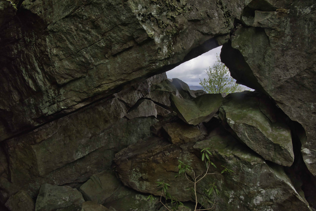
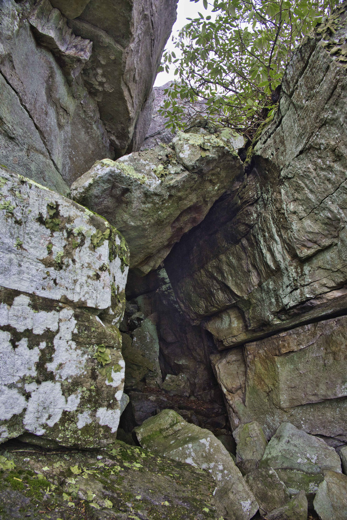
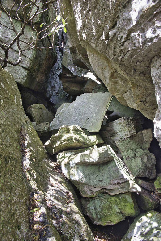
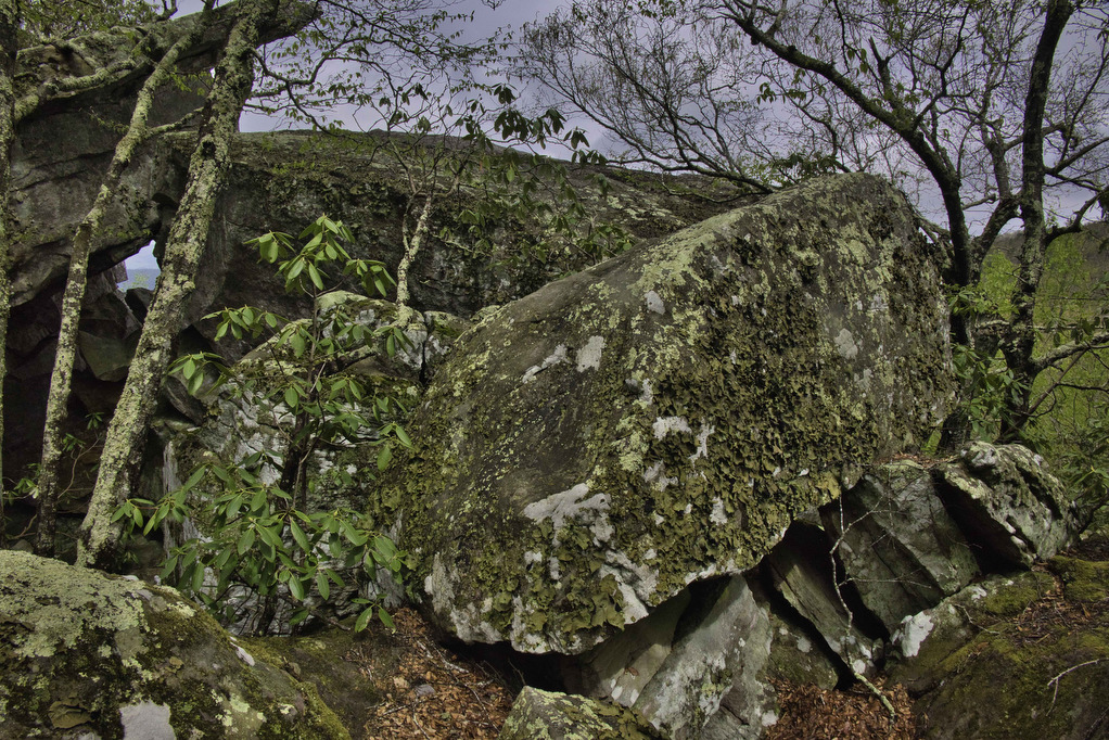
Full disclosure 1: Pete’s Cave isn’t named after Hoppy Hiker Pete, despite his claims to the contrary. Full disclosure 2: There really isn’t a cave, just a large jumble of boulders. Despite the poetic license of “cave”, this is a great hike.
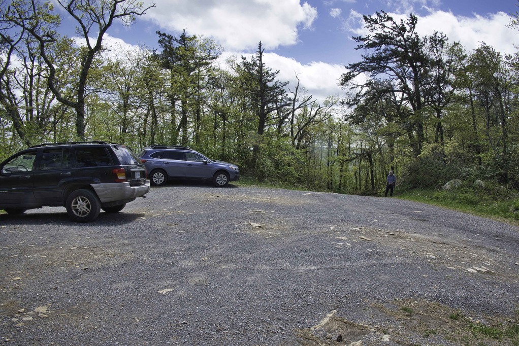
Getting to the trailhead is a bit of an adventure. State Route 770 twists and turns as it climbs to the trailhead. The road surface is gravel and we had no problems with our AWD Subaru. At 4 miles, reach an intersection. Turn right on Route 770 and in a few hundred yards, reach a small parking area on the left with room for 4-5 vehicles.
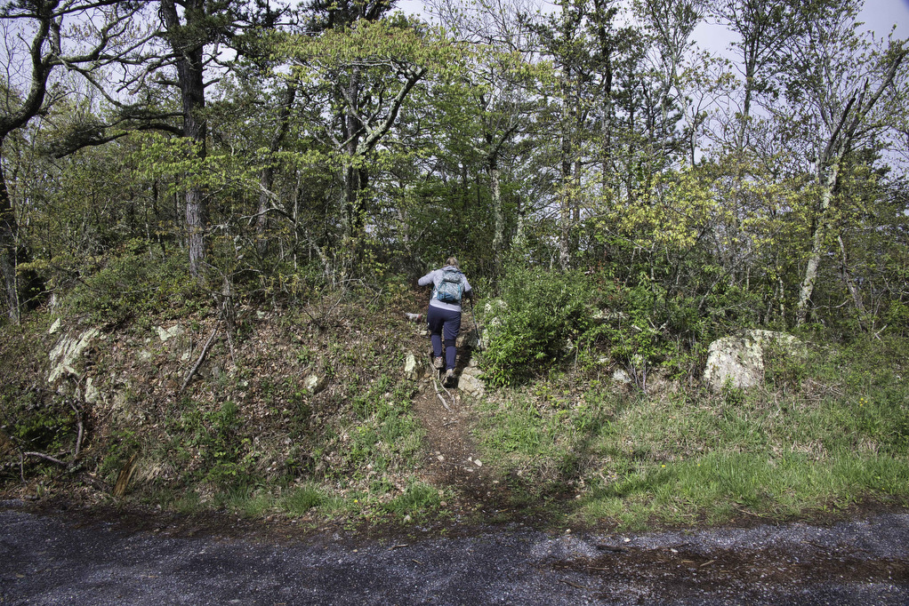
The trail begins across the road, look for a rock with a bit of red paint. The trail is marked by blue blazes. However, the blazes are infrequent and often faded. Fortunately, the path is well defined and easy to follow.
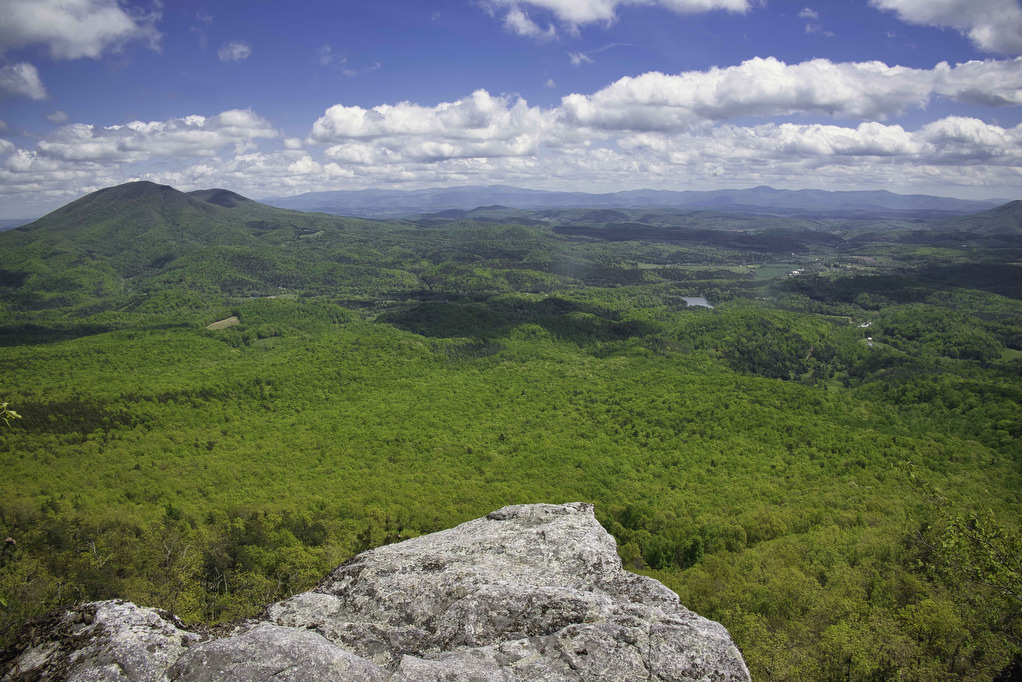
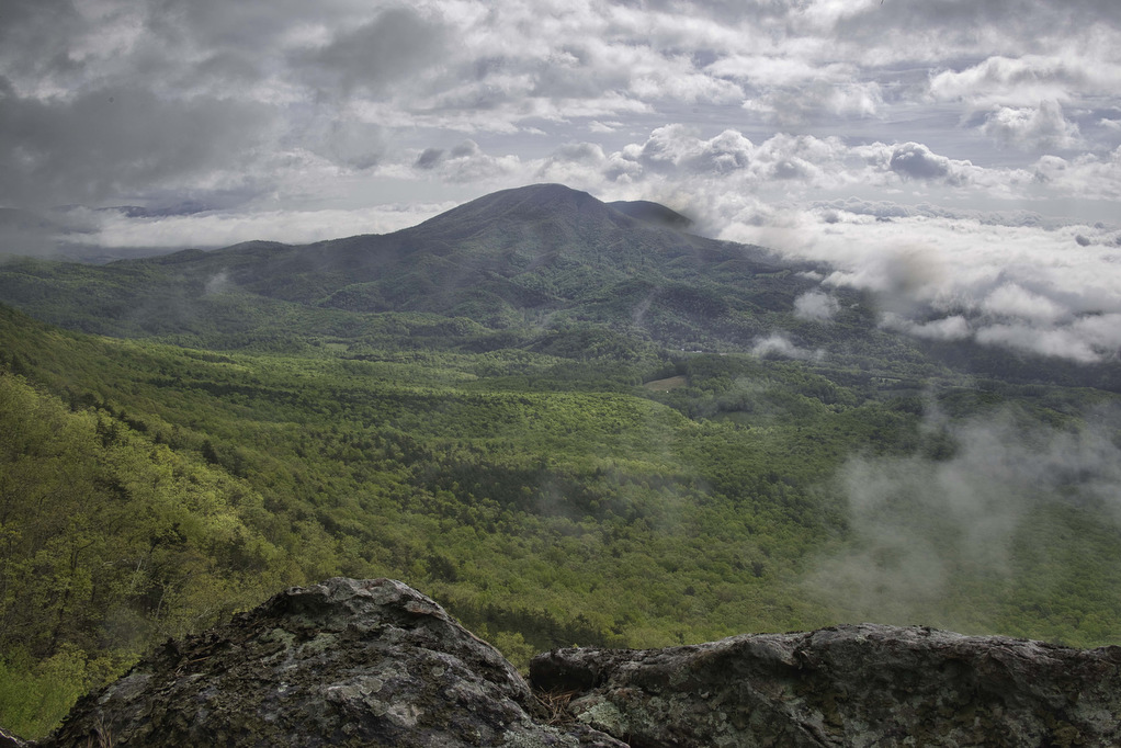
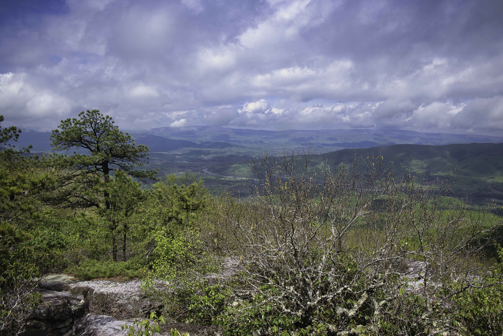
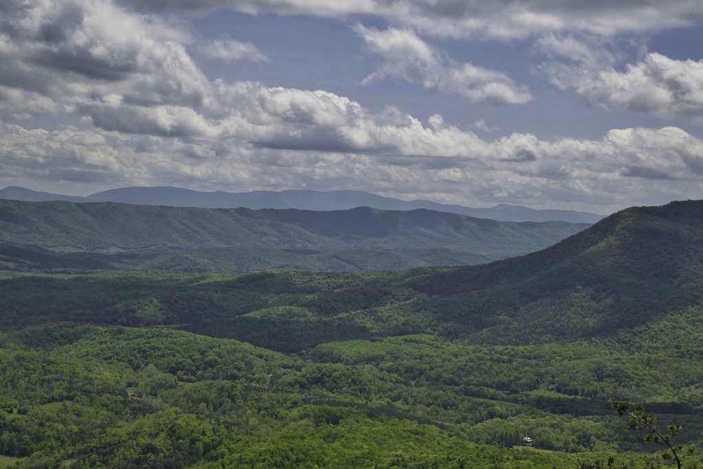
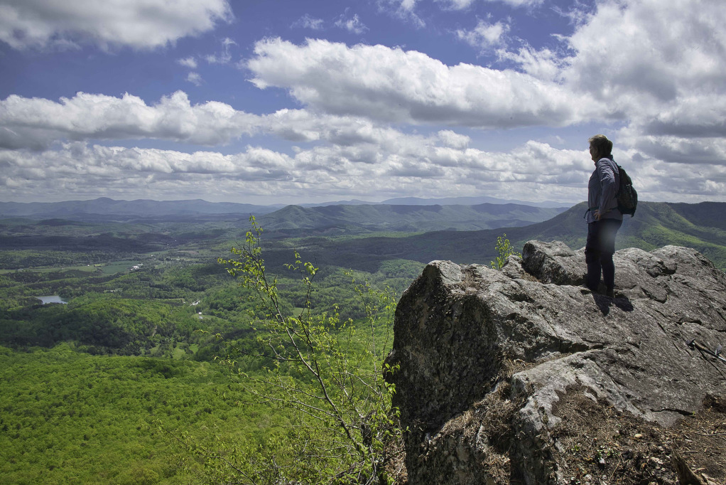
On our early morning hike, fog and clouds provided only partial views. However, the sun soon broke through and we were treated to some awesome views at Pete’s Cave and on our return hike. Pete’s Cave is a series of rock formations with rock scrambling opportunities for some amazing views. This hike has great views for those who prefer not to partake in the rock scramble.
The first .5 miles of this hike has outstanding views. Several short unmarked spur trails on the left lead to views of the valley and surrounding mountains. Big and Little House Mountains are on your left and Lake Robertson is directly below. The city of Lexington and the Blue Ridge Mountains lie further east.
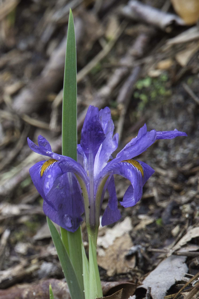
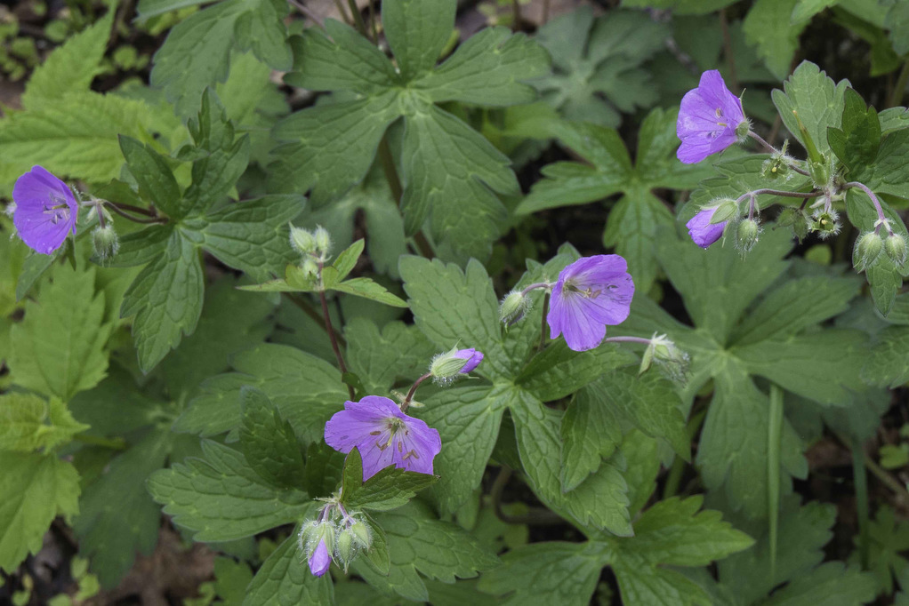
The trail follows the ridgeline to North Mountain. Rhododendron and mountain laurel line sections of the trail. In spring and summer, a variety of wildflowers add color to the trail. Reach a campsite at 3.2 miles with some nice views to the east.
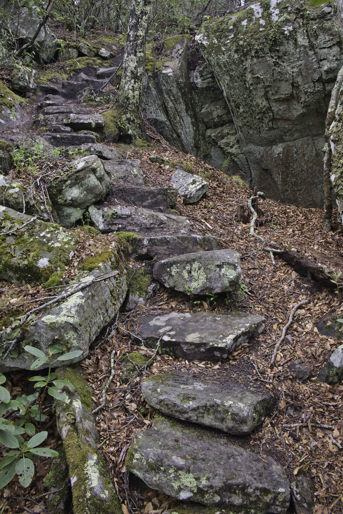
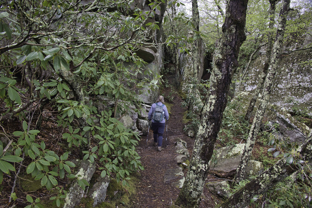
A series of stone steps at 3.4 miles signal your arrival at Pete’s Cave. A series of large rock formations on either side of the trail contain a maze of openings and “caves”. Explore below and scramble above. Climb the rocks on the right side of the trail for some nice views to the west.
Rocks on the left side have views to the east. Pockets of rhododendron manage to survive between the rocks. Use caution if the rocks are wet. Climbing up sometimes is easier than coming back down. Take in the views and enjoy the geology and the scrambles. You’ll have additional opportunities for great views as you retrace your steps to return to the parking area.
Hike Photos:
Click on an image below for an enlarged view.


Trail Map:
Beer Pairing:
Jack Mason’s Tavern & Brewery is about 30 minutes from the trailhead in Clifton Forge. This brew pub has eight taps of craft beer. They serve wine and cider and have a full service bar. The pub offers a wide variety of food items including burgers, wraps, sandwiches, salads, and tavern fare.
Pete really liked Hiram’s Hooch (8.0% ABV • 55 IBU), an Imperial Stout. This stout has a nice roasted malt flavor with notes of chocolate and coffee which are not overwhelmed by the high alcohol content. Kathy was enjoying a glass of sauvignon blanc with dinner so Pete felt obligated to sample another beer, Happy Knack (6.6% ABV • 54 IBU). This IPA is a cross between a hazy New England and a west coast IPA. The fruitiness from the hops play a supporting role which is just the way Pete likes his IPAs.


Hike and drink responsibly. Never drink and drive. Stay safe, be responsible, and leave no trace.