

- Highlights: Chesapeake Bay views, bird watching
- Distance: 3.2 mile loop
- Elevation change: 23 feet
- Difficulty level: Easy
- Trailhead Parking: Route 605, Kilmarnock VA, the small parking area accommodates 11 vehicles
- Website: Virginia Dept. of Conservation and Recreation
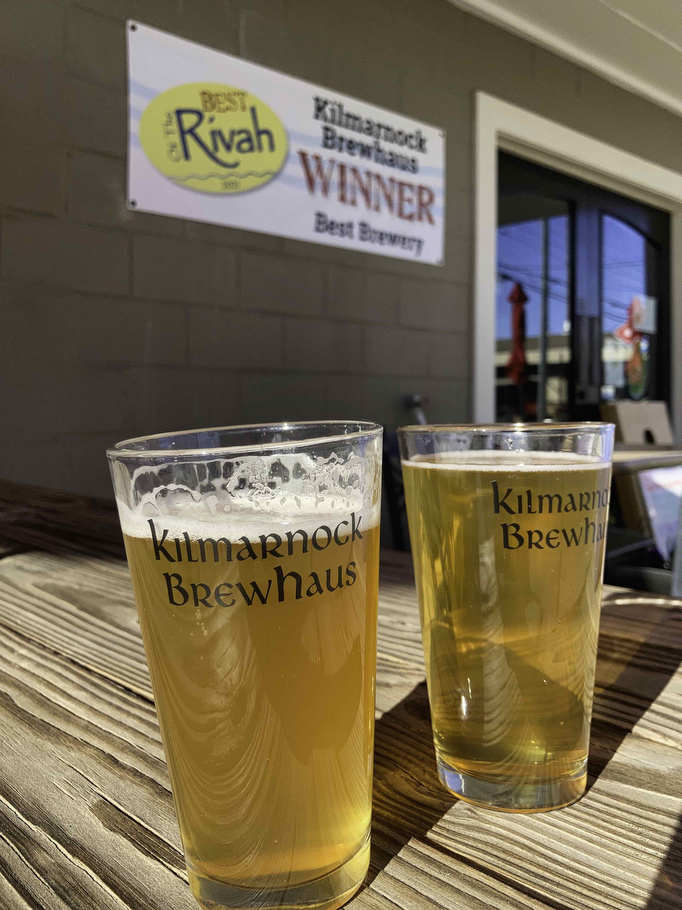
- Beer Pairings: Kilmarnock Brewhaus—Grier’s Gaire Pilsner & Edelweiss IPA
The Hike:
Located on Virginia’s Northern Neck, Hughlett Point Natural Area Preserve is situated on a small peninsula on the western shore of the Chesapeake Bay. A short trail loops through the preserve offering pristine views of sand dunes, woodlands, and wetlands. The trail is well marked and well maintained.
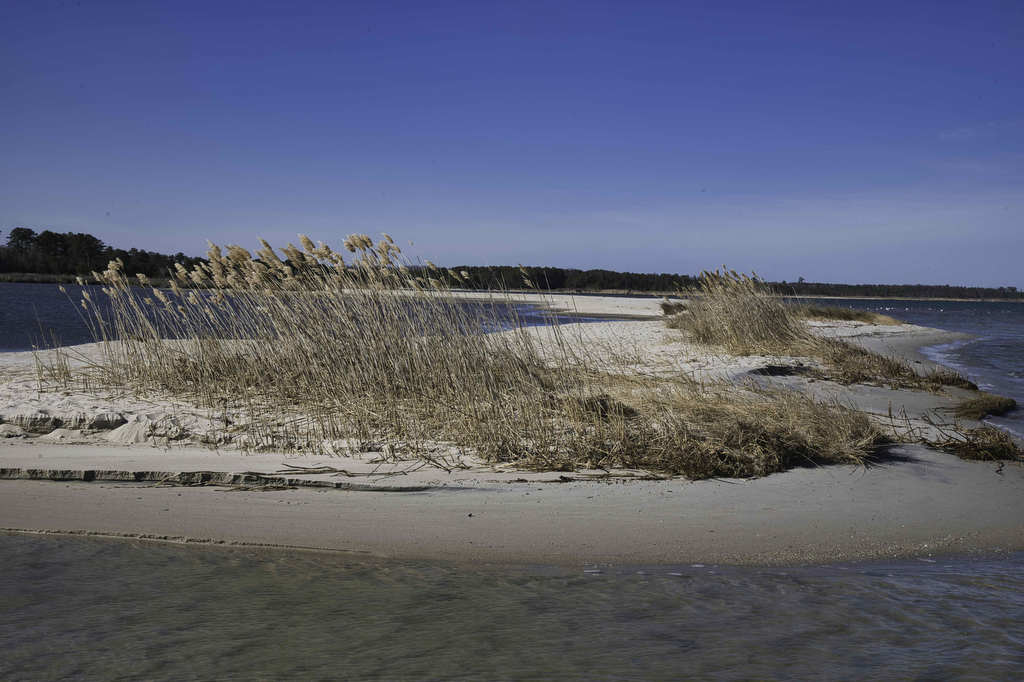
Part of the trail passes along the beach and may be under water at high tide. In the summer months, this can be a pleasant walk through the bay. In the colder months, walking through knee high water may not be fun. Check the tide tables if you want to keep your feet dry.
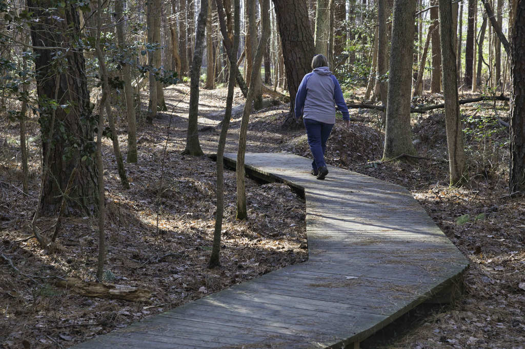
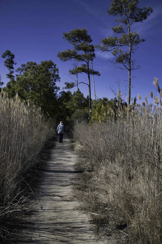
At the trailhead near the parking area, a kiosk provides information about the preserve and the ecology of the area. From the kiosk, the trail enters a pine forest passing over several short boardwalks. The trail soon reaches a junction with the Shoreline Loop. While you can hike in either direction, we recommend bearing left here on Shoreline Loop North hiking clockwise.
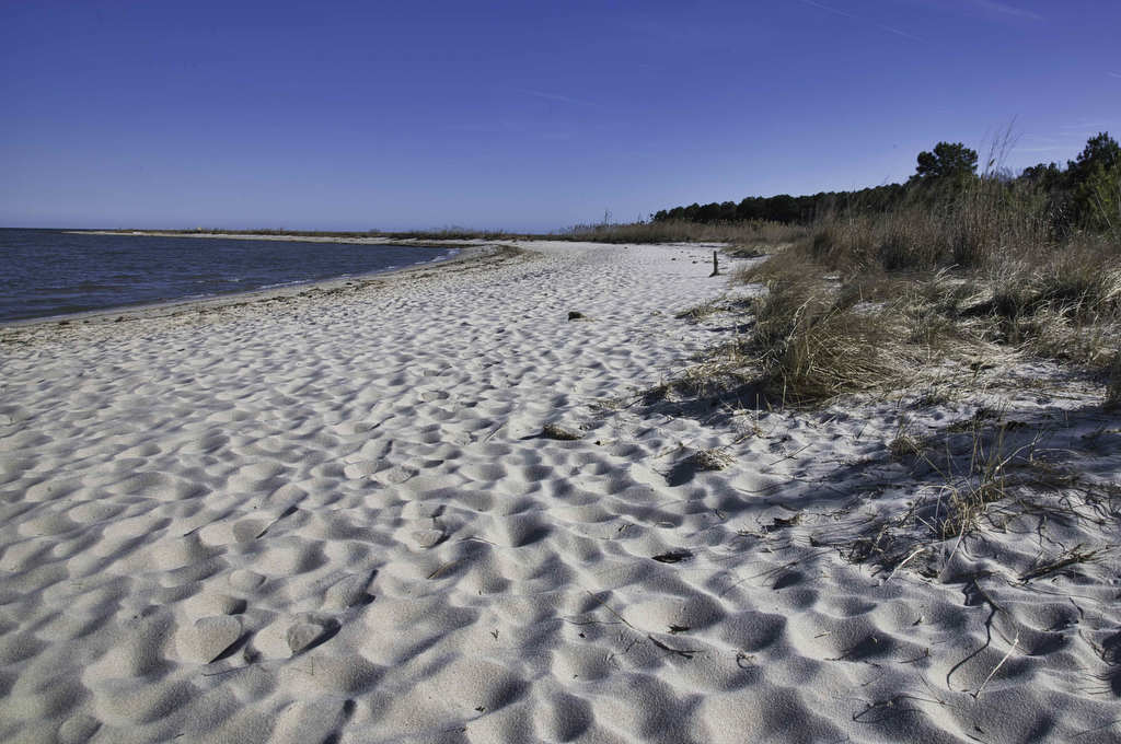
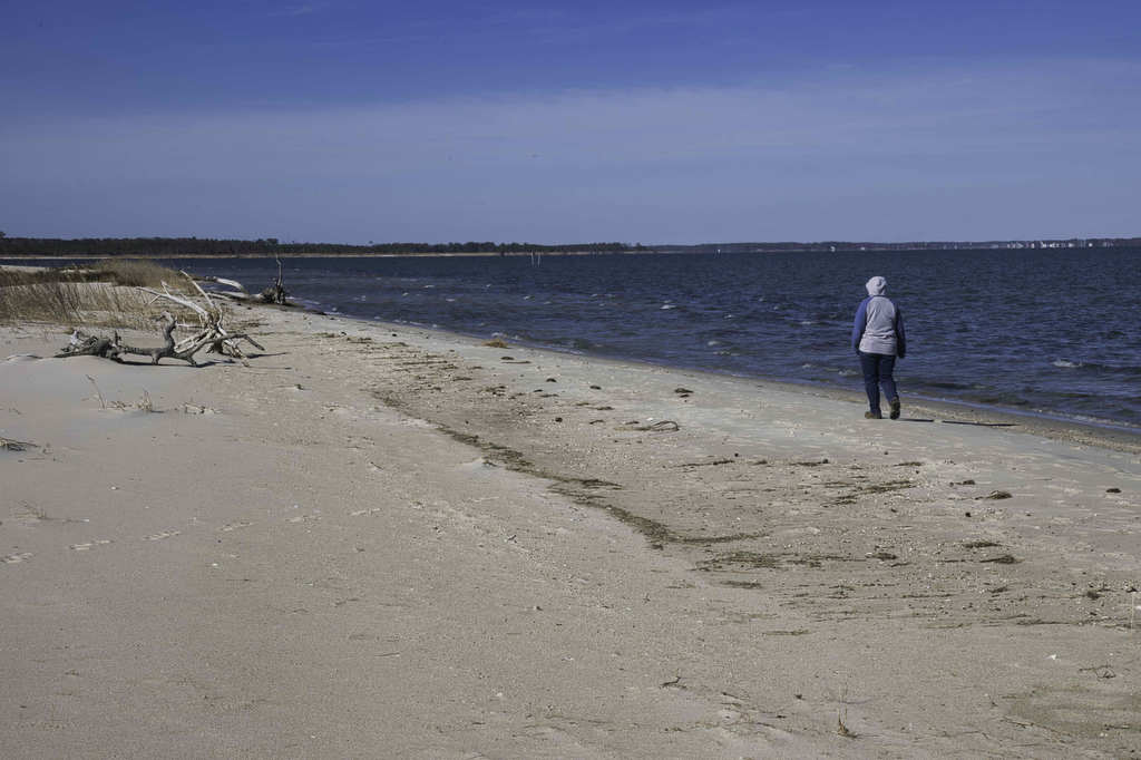
In a few hundred yards, the trail reaches the beach. Bear to the right here walking along the beach. At high tides, this section of the trail may be under water. If the tide is high and you don’t want to get wet, turn around and go counterclockwise on the loop.
The hike travels along the beach with the Chesapeake Bay on the left and tidal and non-tidal wetlands on the right. This area is home to a federally protected insect species and contains important habitats for waterfowl, songbirds and birds of prey.
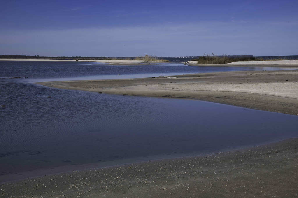
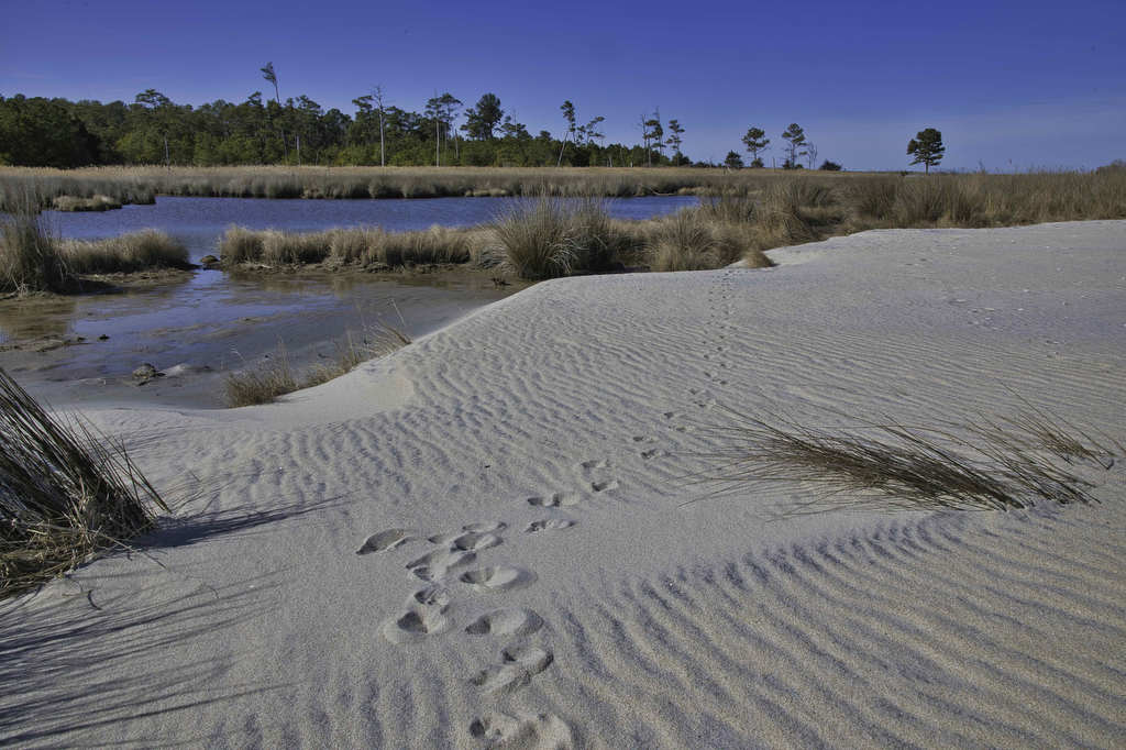
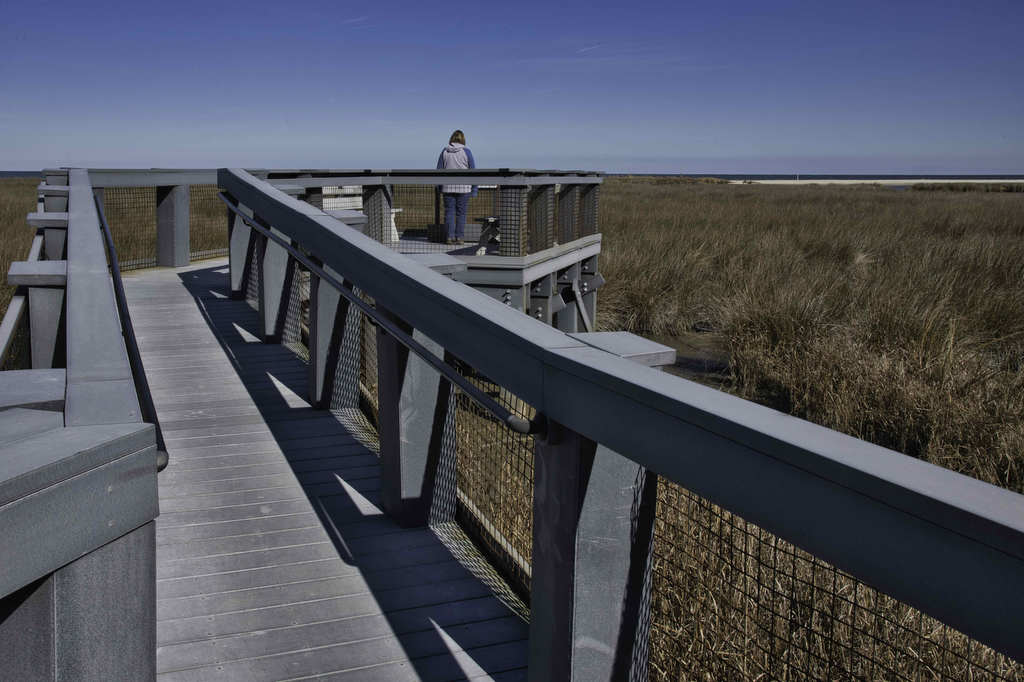
At .7 miles, note an observation deck and trail post on the right. This will be the return route. Continue walking along the beach for another 1/2 mile. A sign will mark the end of the preserve. Turn around and retrace your steps back to the observation platform and bear left following the Shoreline Loop trail as it leaves the beach and enters the woodland.
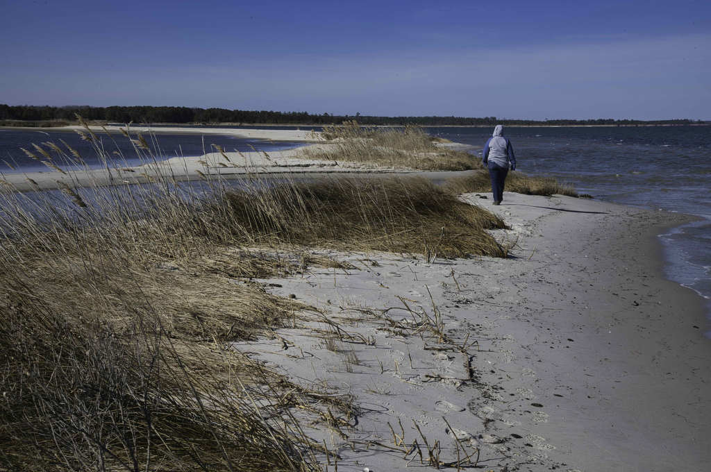
A short spur trail on the right leads to at the North observation deck with views of the wetlands and bay. Return to the Shoreline Trail and continue to the junction with the Boardwalk Trail. Bear left here to return to the parking are and your vehicle.
Hike Photos:
Click on an image below for an enlarged view.
Beer Pairing:
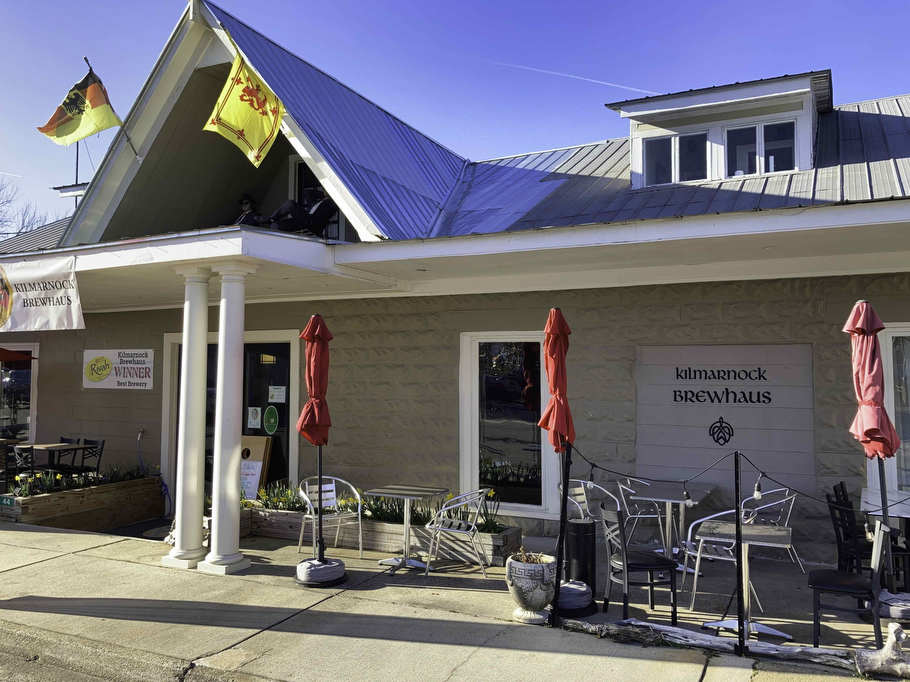
The Kilmarnock Brewhaus is located about 15 minutes from the trailhead. They serve beer and wine with a variety of food options including local crabs and oysters. They feature live music most nights and have indoor and outdoor seating.
Owner/brewer/musician Don brews all the beer on site and specializes in German-style beers. Pete really liked Grier’s Gaire Pilsner, a Czech-style pilsner brewed with Tettnang hops, German pilsner, and wheat malt. It’s light, crisp, and refreshing. Kathy enjoyed Edelweiss IPA brewed with Cascade and Centennial hops.
Hike and drink responsibly. Never drink and drive. Stay safe, be responsible, and leave no trace.