

- Highlights: Great views, rocky summit, stream crossings, wildflowers, wildlife
- Distance: 6.0 mile loop
- Elevation change: 1,270 feet
- Difficulty level: Strenuous
- Trailhead Parking: Wiggins Springs Road, route 755, becomes Hog Camp Gap Road (Fire Road 48). Continue past the first parking area at Hog Camp Gap for .25 miles. Bear right park near the trailhead kiosk, following US Forest Service signs.
- Website: US Forest Service
- Beer Pairings: Devil’s Backbone Brewing—Hiker Trash IPA & Eight Point IPA
The Hike:
The most difficult part of this hike may be getting to the trailhead. Route 755, Wiggins Springs Road is paved for about 1.5 miles. It turns into an unpaved fire road for 1.5 miles and leads to the 2nd parking area. A 2-wheel drive low-clearance vehicle may have difficulty if the road is muddy. Our Subaru made it through without any issues.
The blue-blazed Henry Lanum trail is a 4.75 mile loop. The trail to the summit of Mount Pleasant branches off from the Lanum Trail. The trail to the summit is .5 miles each way with two spurs for East and West viewpoints. The Lanum Trail begins and ends at the 2nd parking area. We chose to hike counterclockwise, but either direction will get you to the summit. The elevation gain is similar each way.
The counterclockwise hike begins with a gradual descent for 1.3 miles and then gains nearly 800’ over then next mile. The trail is rocky in places with several small stream crossings. There are several large boulders and rock outcroppings along the way. Wildflowers, rhododendron, and mountain laurel line the trail.
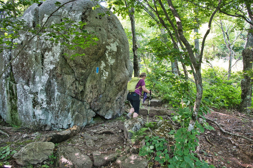
At 2.25 miles, reach the spur trail to the summit. Turn right here and the trail becomes very rocky. Climb steadily, past a side trail to a spring, for the next .5 miles to a “T” junction at the summit. Trails lead to the East and West with great views. Both of these side trails have small rock scrambles. Take in the views from each viewpoint and then retrace your steps back to the junction with the Lanum Trail. Turn right here and follow the blue-blazed trail as it winds up and down as you make your way down.
At 4.1 miles there is a small, unmarked spur trail off to the right with nice views. This is the summit of Pompey Mountain. The trail ends at your starting point in the parking area. The trailhead for Cole Mountain via the Old Hotel Trail and AT also begins in this parking area and this is another great hike.
Hike Photos:
Click on an image below for an enlarged view.
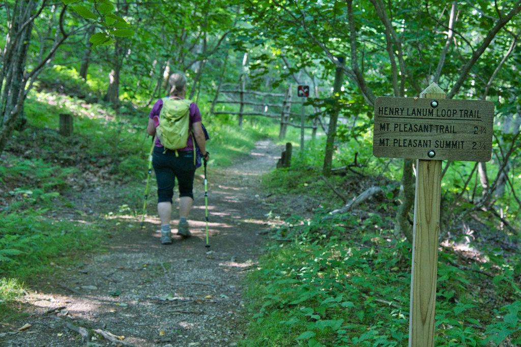
Lanum Trailhead 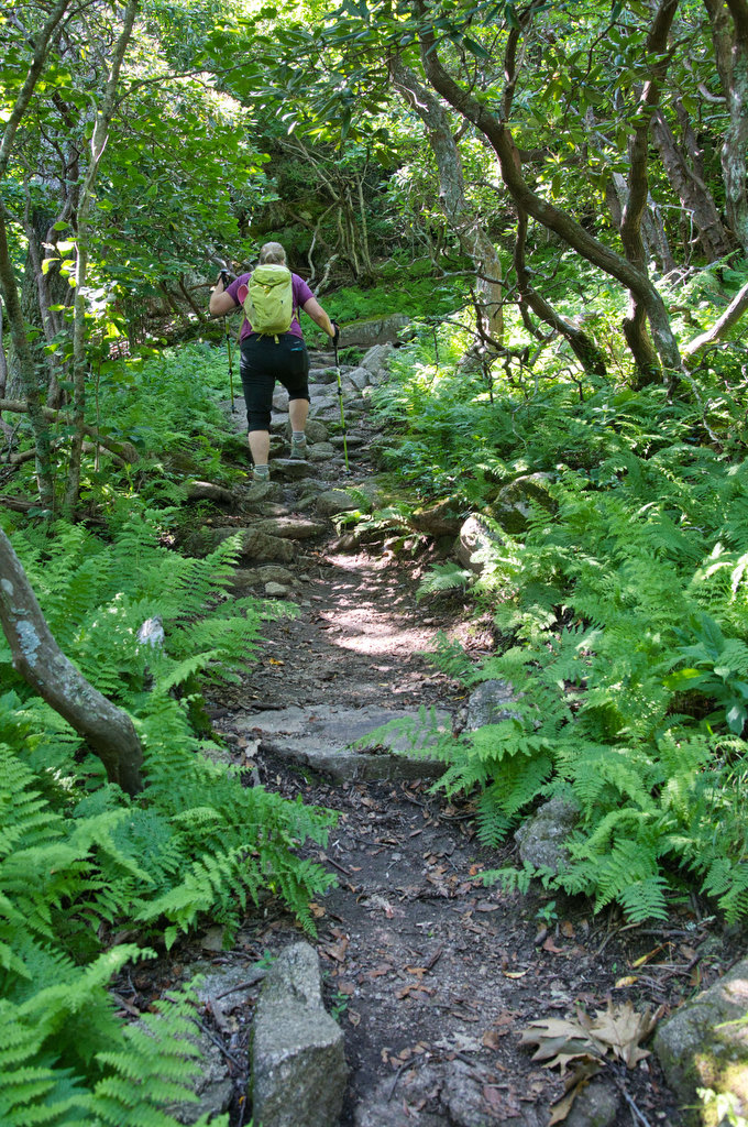


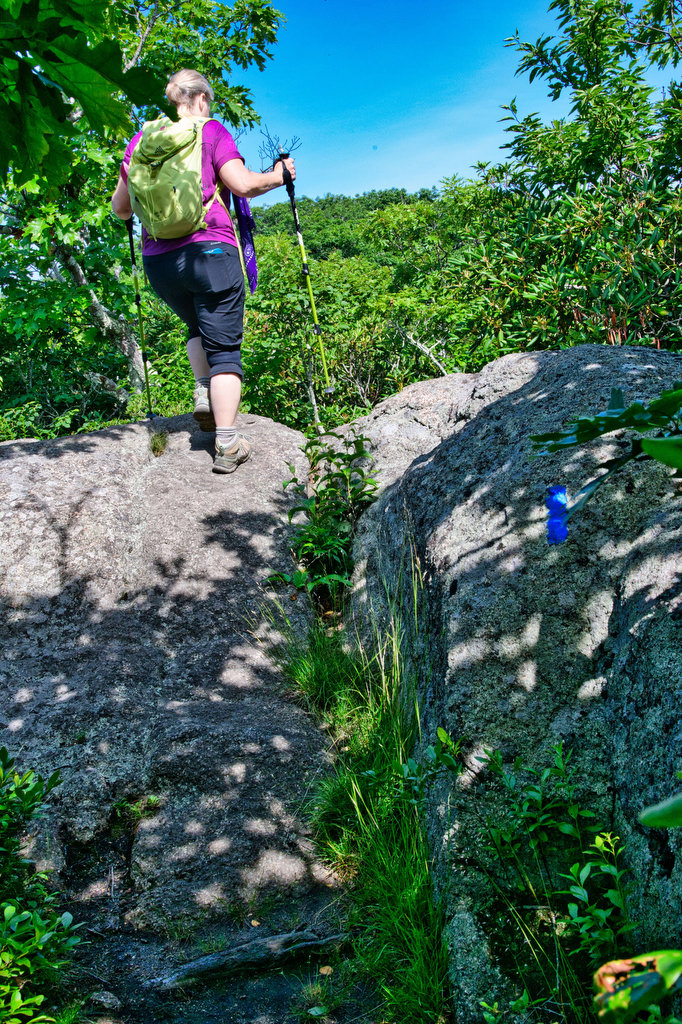

Southeast view from summit 
East view 


West view 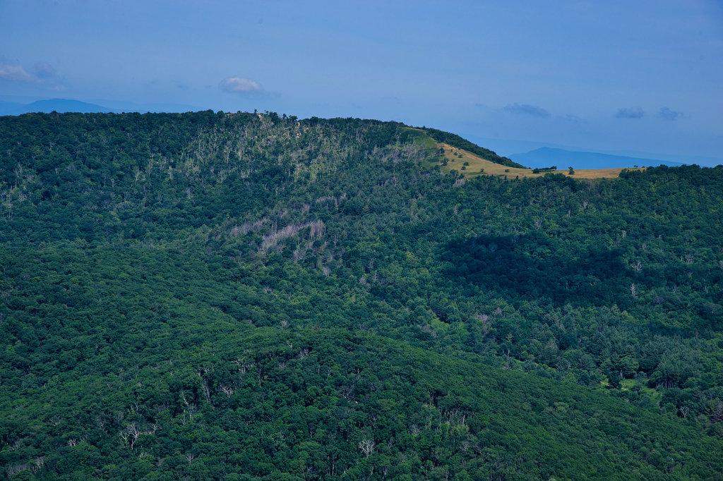
West view with bald summit of Cole Mountain
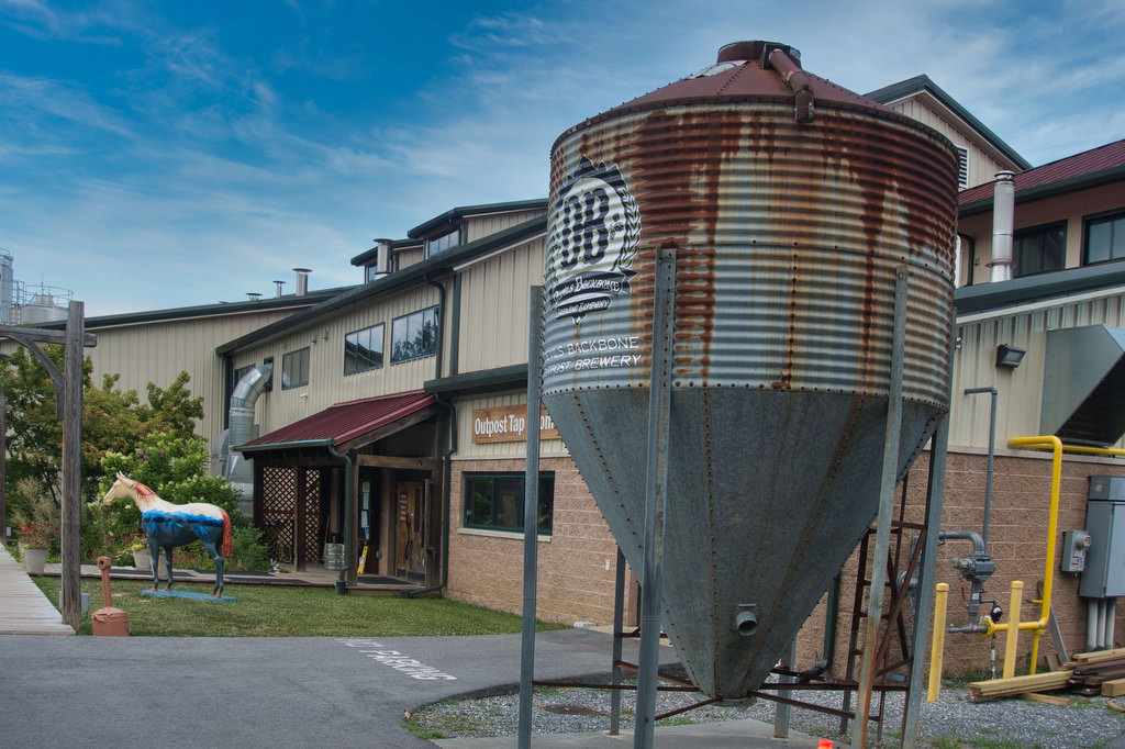
Beer Pairing:
We were big fans of Devil’s Backbone Brewing Co. for many years until they were acquired by a mega brewery conglomerate. We very much believe in supporting small, independent craft breweries. So how did we end up at Devil’s Backbone?
We were told DB still has considerable autonomy and has retained many key members of their brewing staff. We also heard DB has an employee whose title is “chief hiking officer” and this marketing ploy warmed our hearts a bit. Pete thought at least the food would be good, so in we went.
In the good old days, Eight Point IPA was one of our go-to IPAs. We were pleasantly surprised that it was as good as we remembered. Pete tried Hiker Trash IPA, hopefully not named in honor of their chief hiking officer. Hiker Trash is a New England-style double IPA made with Amarillo, Azacca, Cascade, and Idaho 7 hops. It is part of their Innovation Brewhouse program and it was pretty good. Will we go back? Probably not, but it wasn’t as bad as we feared.

Hike and drink responsibly. Never drink and drive. Stay safe and be responsible.