
- Highlights: sandstone arches, waterfall, cliffs, forest, wildlife
- Distance: 14.1 mile loop
- Elevation change: 2,035 feet
- Difficulty level: Difficult
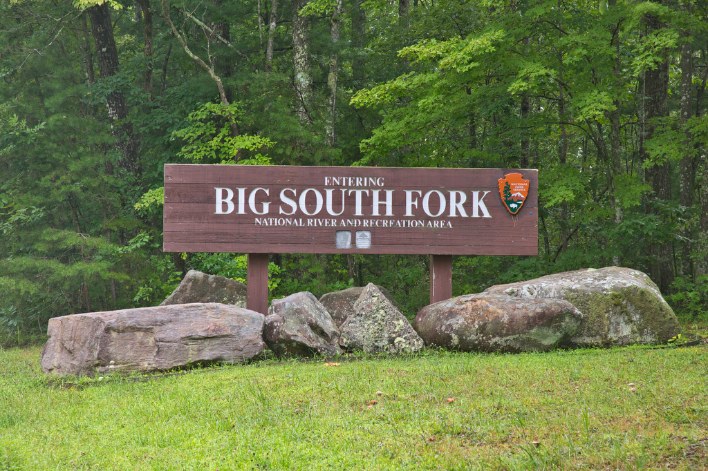
- Trailhead Parking: Twin Arches Road, Great South Fork National Recreation Area, Jamestown TN; see link below for more information.
- Website: National Park Service
- Beer Pairings: Wiseacre Brewing Company, Tiny Bomb pilsner & Ananda IPA
The Hike:
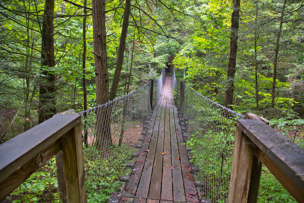
This hike is a bit outside of our normal hiking zone in Virginia and North Carolina, but well worth the trip. The Big South Fork National Recreation area stretches over 125,000 acres of Tennessee and Kentucky. We spent two days here and easily could have stayed for a week. This area has scenic gorges and sandstone bluffs and one of the largest concentrations of natural stone arches in the East. This hike visits two of the largest arches in the park, several smaller arches, and Slave Falls. It is possible to split this long hike into two hikes: Slave Falls Loop and a Twin Arches Loop. This would eliminate the Connector trail and reduce the distance by 4.5 miles.
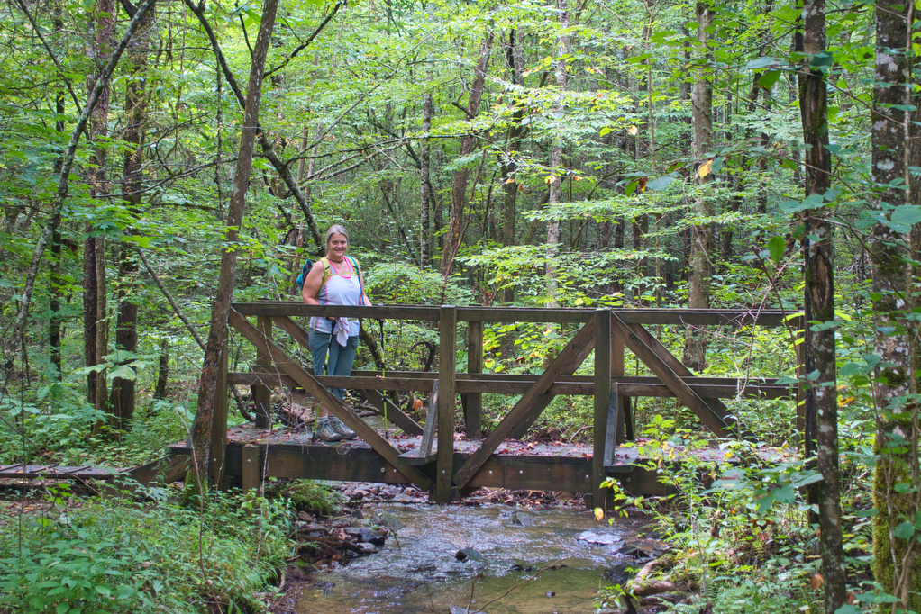
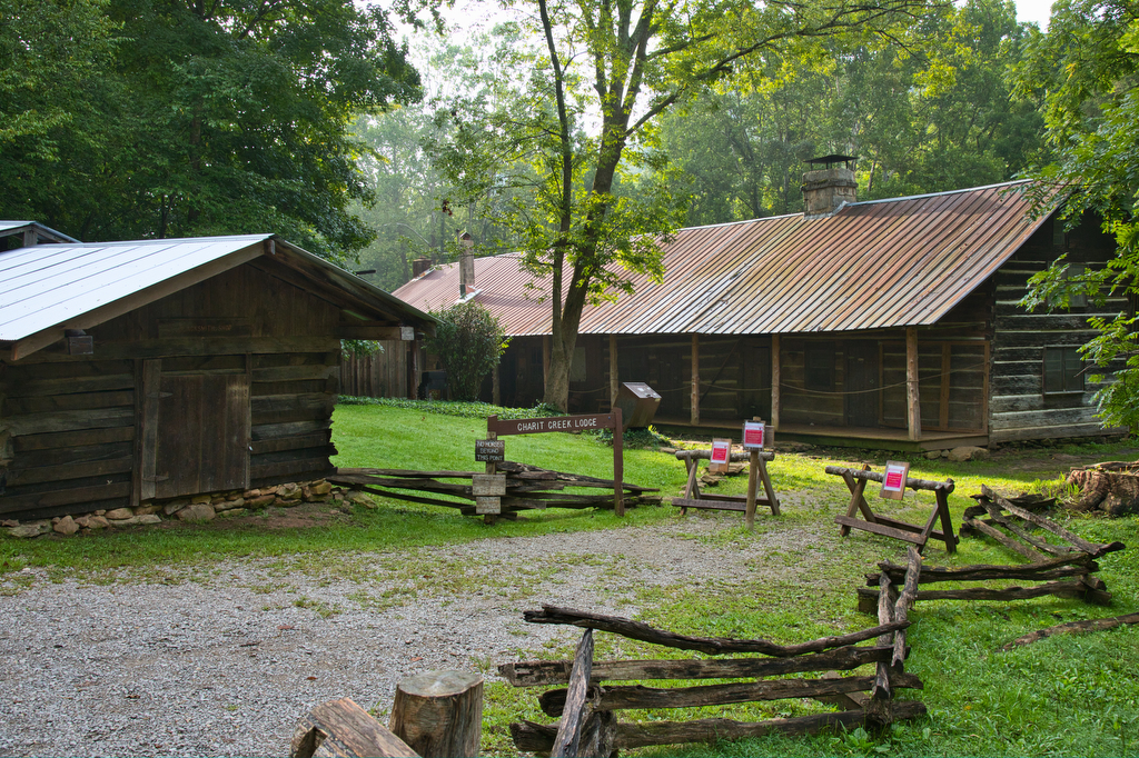
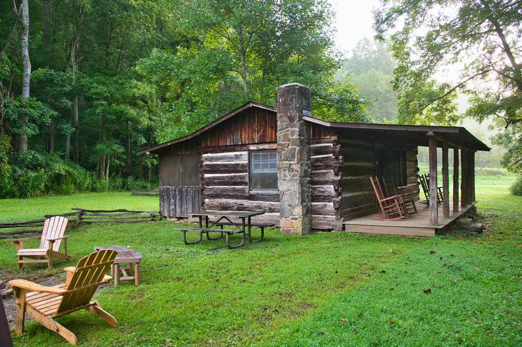
We began our hike from Charit Creek Lodge (see below) on the valley floor. The 1.1 mile trail to the lodge is part of the Sheltowee Trace, a 319-mile National Recreation Trail that spans the Daniel Boone National Forest and Big South Fork National River and Recreation Area in Kentucky and Tennessee.
It is also possible to begin the hike on the top of the bluff or cliff on Twin Arches Road. AllTrails has a description of the hike from The Twin Arches Road parking area. We started this hike in a clockwise direction from the Lodge. The trail is well marked and a kiosk at the trailhead has a large trail map.
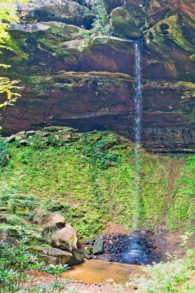
The trail begins on a fire road, we tend to prefer trails over fire roads, but the road runs beside a creek for 1/2 mile and has the foundations of several pioneer cabins. In about 1.5 miles the trail reaches a junction with a connector trail to the Slave Falls Trail. Turn left at the junction for 2.2 miles and follows Mill Creek much of the way. The Connector is mostly level for the first mile and then gains elevation in the last mile through a series of switchbacks. After the switchbacks, look for signs to Slave Falls. Take a short .2 mile trail to reach the base of the falls. We visited in September after a rainy summer and the falls were flowing at a pretty good rate. During dry spells, the flow can be significantly reduced. Take the short trail back to the connector trail.
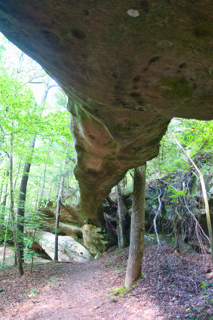
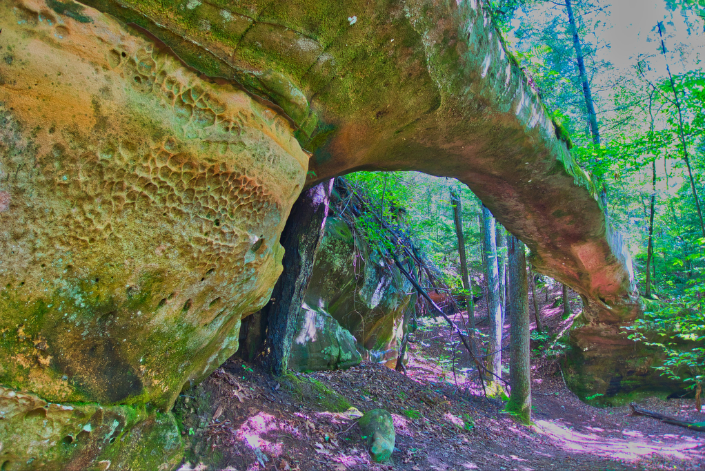
There are several smaller stone arches and other cool geologic formations along the Connector trail including Needle Arch. Signs describe the geology and provide some history of the area. The Connector eventually joins up with the Slave Falls Loop Trail. The loop trail is 4.3 miles with an elevation gain of only 377 feet. It was a nice walk through a hardwood forest. The trail loops back to the Connector and it is another 2.2 miles back to the junction with Twin Arches Trail.
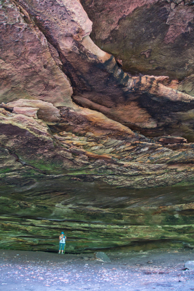
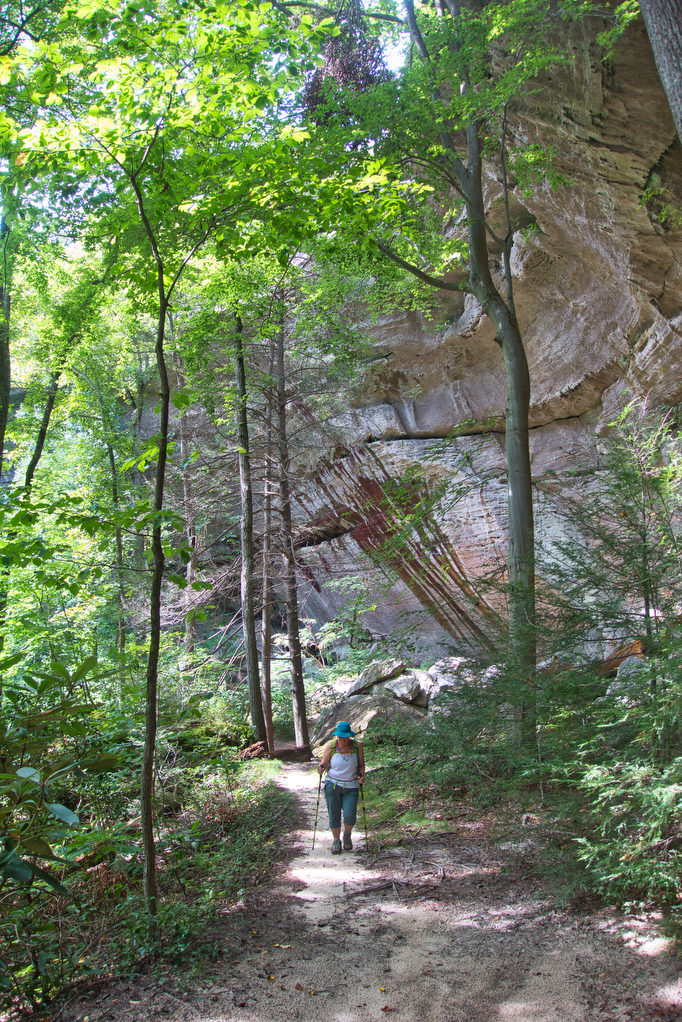
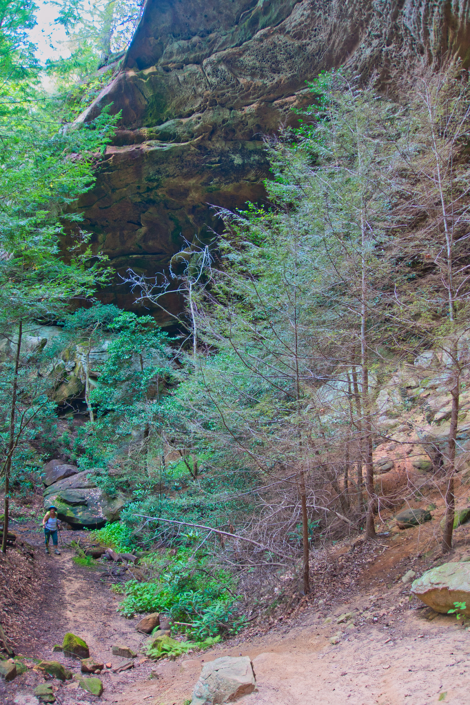
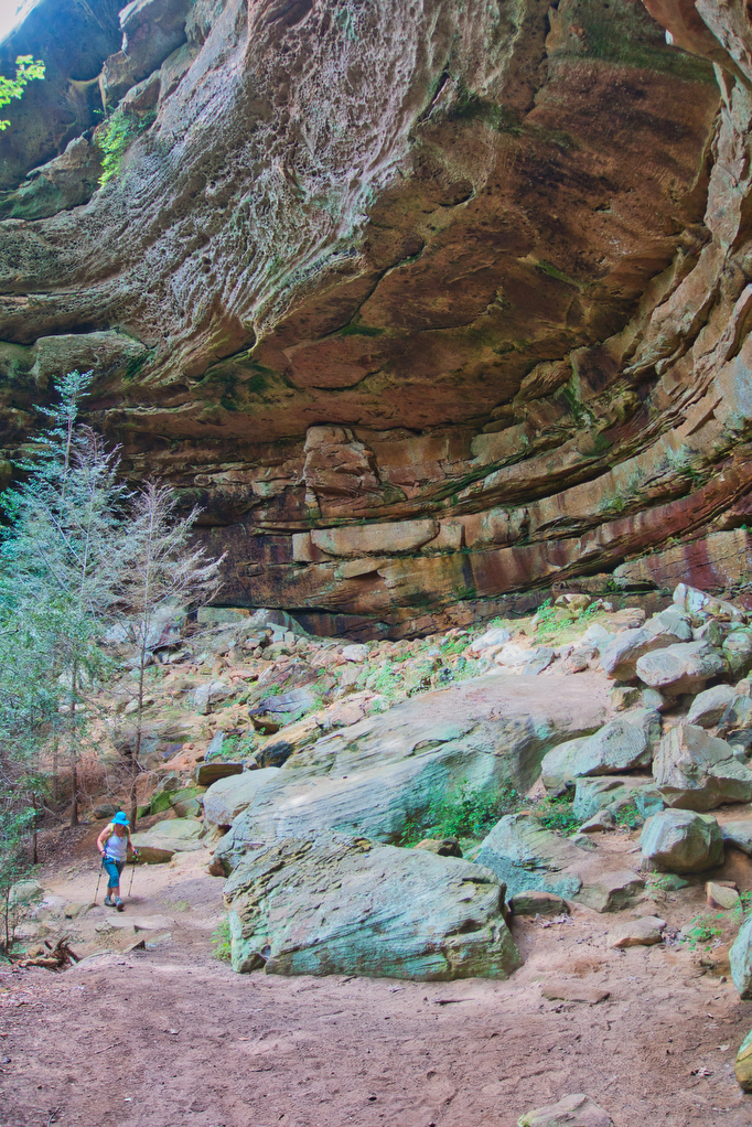
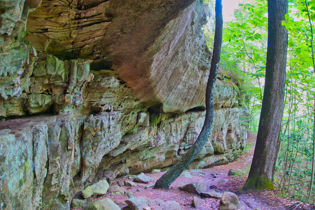
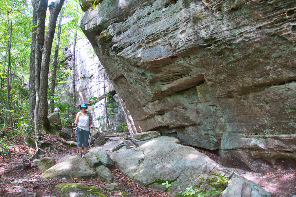
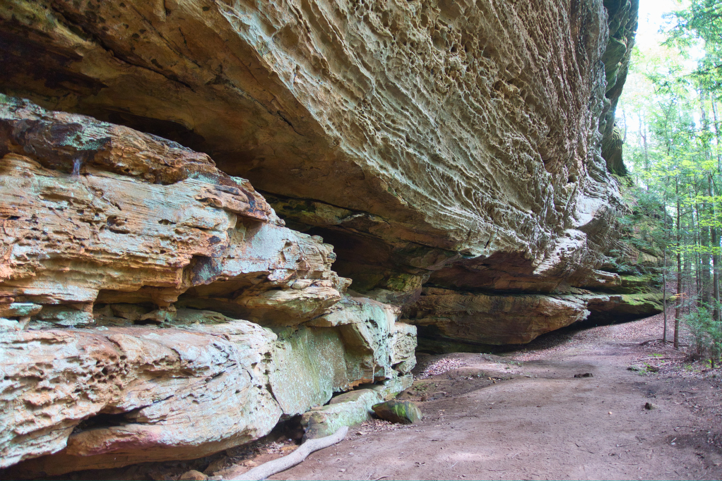
Stay left on the Twin Arches Trail, following the signs. Pass by Jake’s Place, the former homesite of Jake Blevins built in the 1880s. The buildings from this site were relocated to Charit Creek Lodge. Sandstone cliffs begin to come into view along the left and several switchbacks begin a gradual ascent and then descent. At times the trail follows right beneath (and even under) the cliffs, the tops of which are well over 100 feet above. The scenery is incredible. It reminded us of our hikes in Arizona and Utah.
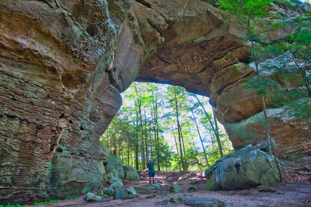
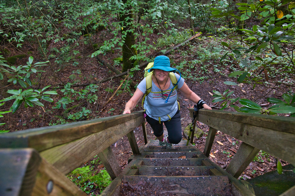
The Twin Arches are unlike anything we have seen in the eastern US. The first arch to appear is the smaller North Arch is the smaller of the two with a span of 93’ and a height of 62’. A few hundreds yard away is the South Arch with a span of 135’ and a height of 103’. We spent at least an hour exploring around and under the arches. We were visiting in the offseason and did not encounter any other hikers at the arches. After admiring the power of nature, the trail descends through a series of stairs and switchbacks to the valley floor and Charit Creek Lodge.
Hike Photos:
Click on an image below for an enlarged view.


Beer Pairing:
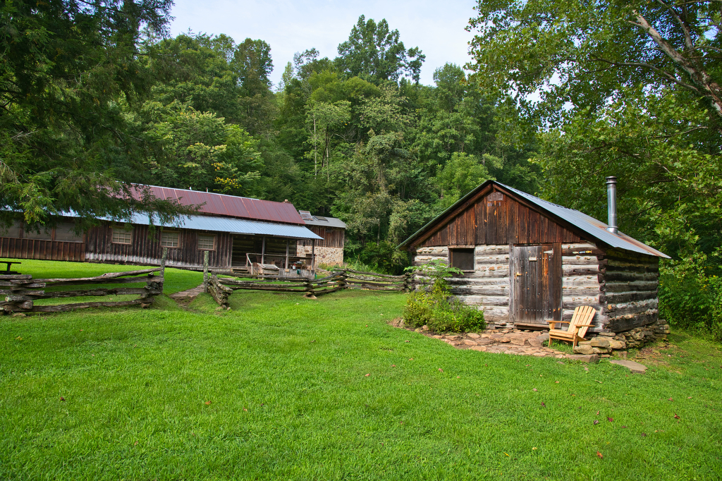
We stayed at Charit Creek Lodge for two nights and did this long hike as a day hike. Charit Creek is a rustic wilderness lodge located in a valley in the heart of Big South Fork. It is accessible by hiking, biking or horseback only. The hike to the lodge is an easy downhill 1.1 miles. The hike back out is 1.1 miles uphill. The lodge is completely off the grid. They do not have electricity and each cabin is equipped with lanterns and a wood burning stove. The lodge provides meals, a comfortable bed, showers and restrooms. They also offer wine and beer (the kitchen has propane gas for cooking and refrigeration). The food was excellent and the staff was great. Definitely plan to stay here if you are hiking in the area.
Greg is the manager of the lodge and in addition to being an avid hiker, he is really into beer. The lodge has a limited selection of beer. After a long, hot day of hiking, we really were looking forward to a cold beer. Greg introduced us to Wiseacre Brewing of Memphis. Kathy really liked Wiseacre’s Ananda IPA, made with Cascade and Centennial hops and scoring a respectable 75 IBUs. The bitterness of the hops was balanced nicely by the addition of malted wheat resulting in a great tasting IPA. Pete really liked the Tiny Bomb pilsner. Greg told us that Memphis gets water from Artesian wells which is ideal for brewing beer. This beer is made with German pilsner malt and is spiked with local wildflower honey. It was crisp and refreshing—perfect on a hot summer afternoon.


Hike and drink responsibly. Never drink and drive. Stay safe and be responsible.