
- Highlights: Waterfalls, mountains, Shenandoah National Park, stream crossings
- Distance: 7.3 mile loop (many sources, including our GPS, show this hike to be about 9 miles)
- Elevation change: 2,743 feet
- Difficulty level: Very Strenuous
- Trailhead Parking: Boundary Trailhead on route 600 near Syria (see link below) or Skyline Drive mile 45.6
- Website: National Park Service
- Beer Pairings: Cape Charles Brewing Company, Assateague Island IPA & Ole Reliable lager
The Hike:
This is another classic Virginia hike. It has eight waterfalls and many fantastic views. However, it is a very strenuous hike. The National Park Service officially lists the distance as 7.3 miles. Many hikers, including us, have reported a distance closer to 9 miles when measured with a hiking app. The elevation gain is over 2,700 feet. This is not a hike for unprepared hikers. There are shorter section hikes and the park website above describes these options.
There are multiple trailheads for this hike: several inside the park on Skyline Drive and a Boundary trailhead near Syria. Both options require an entry fee or park pass. If you begin the hike from Skyline Drive at the Hawksbill Gap parking area you descend to the bottom of the canyon and then climb back to the top. Starting at the Boundary trailhead begins at the bottom of the canyon with a steep climb to the top and then a return descent. Either way, hikers have a very steep uphill and a very steep downhill.
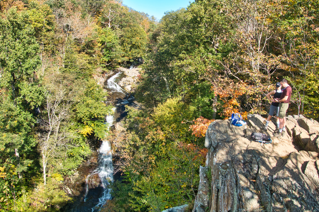
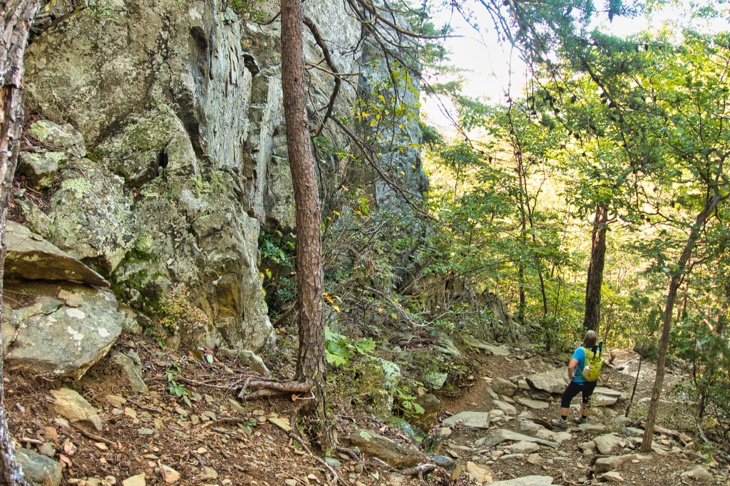
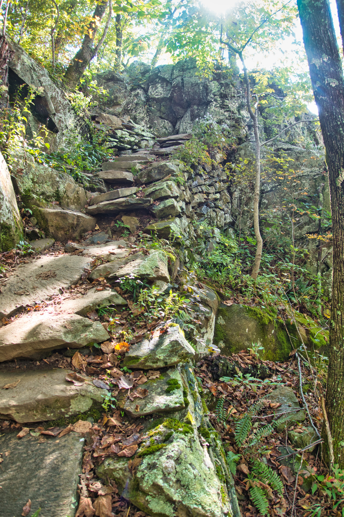
We began this hike from the Boundary parking on a weekend in September. We were in the parking area by 7:30am and we were surprised how many cars were already here. This is a very popular hike and while both parking areas are large, they do reach capacity later in the day, especially on weekends. The first decision to make is which direction to begin this loop trail. The Cedar Canyon side is a bit steeper and has stone stairs in many sections. We elected to go in a counterclockwise direction beginning with the slightly less steep Whiteoak side. Our knees wished we had gone the other direction as steep downhills are a bit painful.
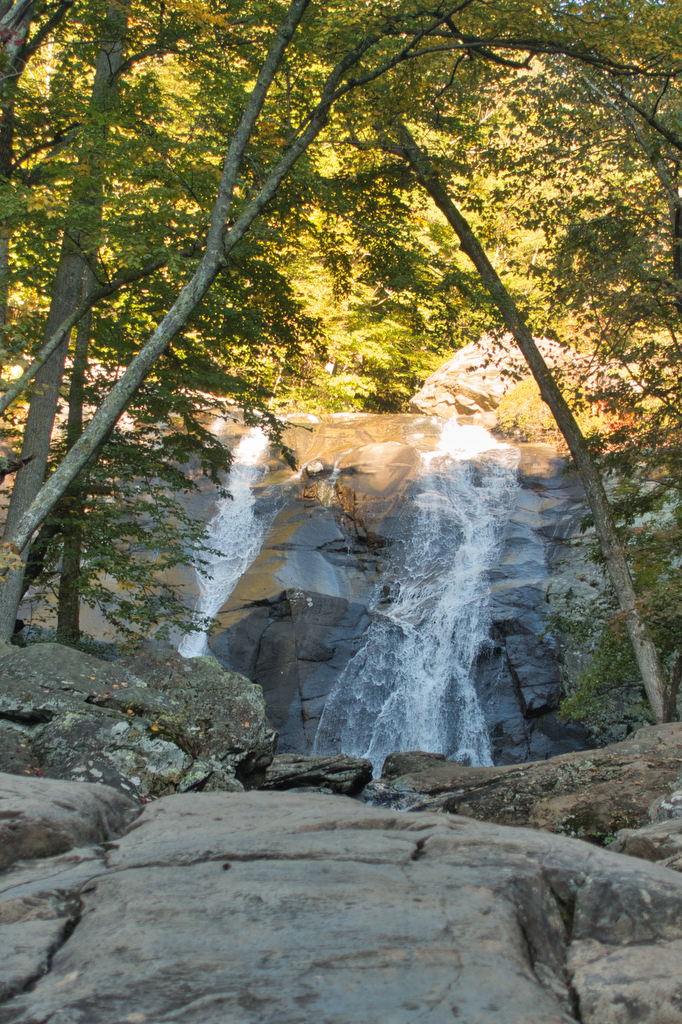
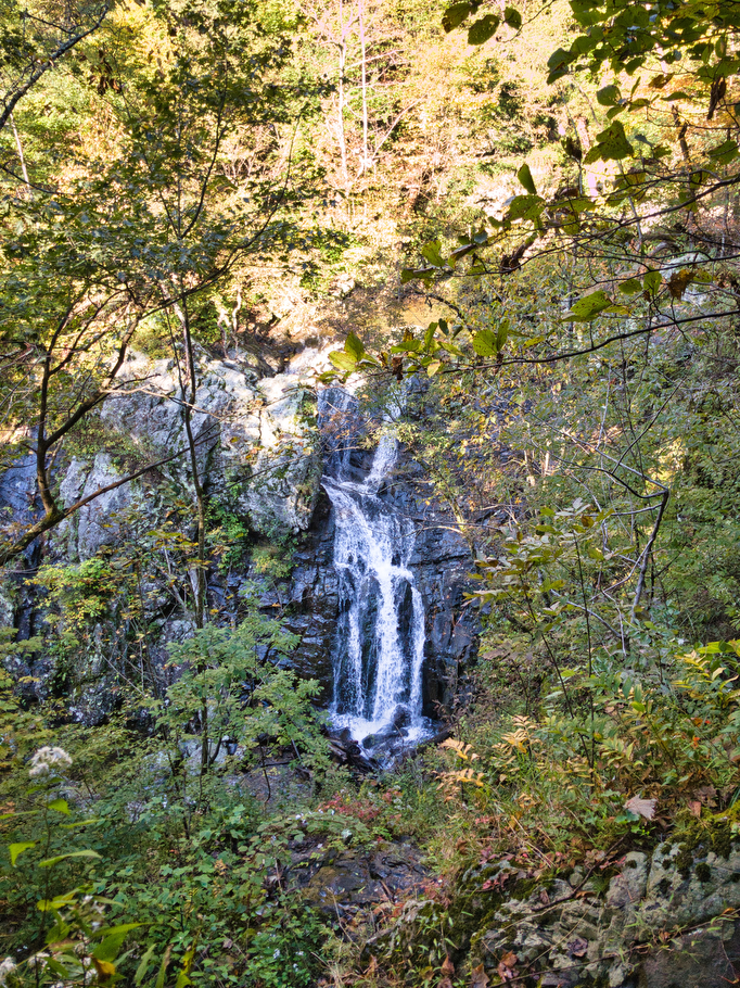
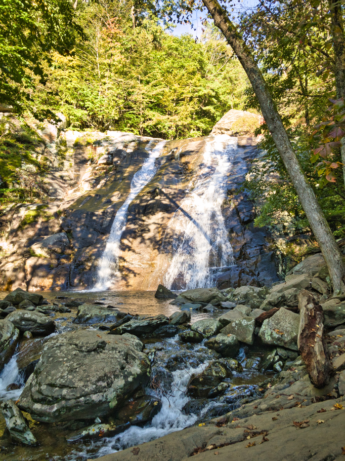
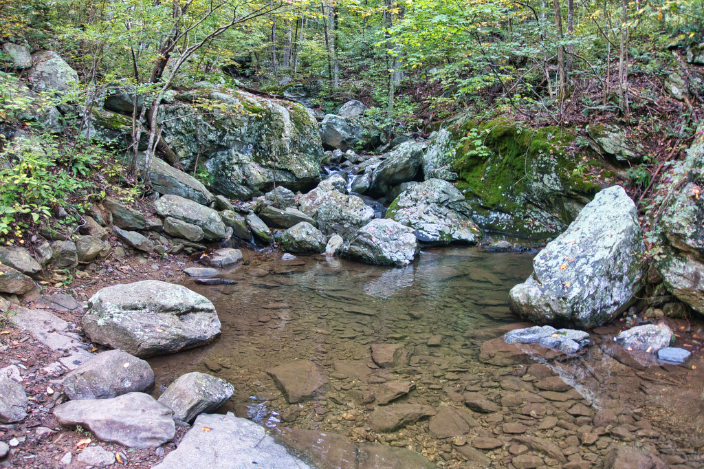
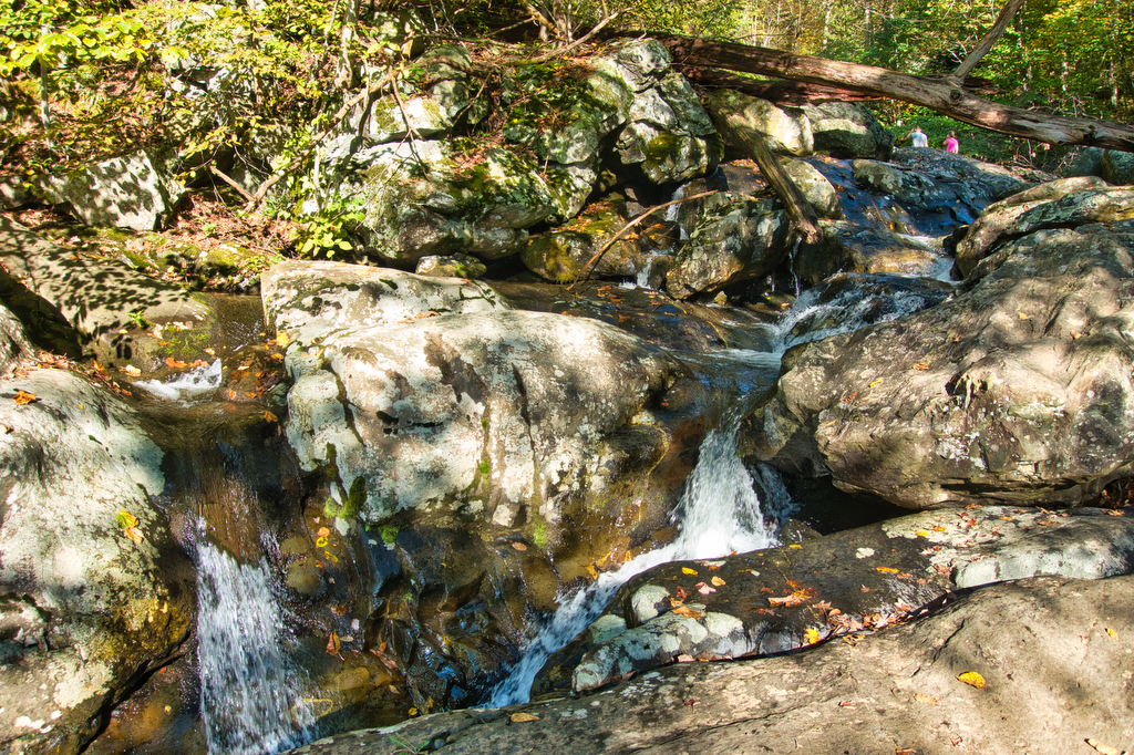
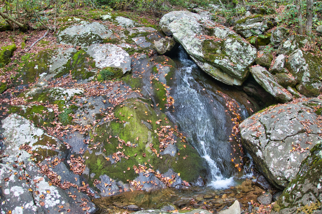
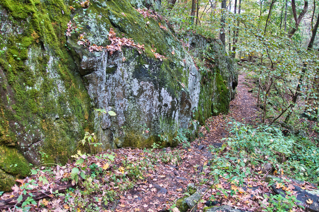
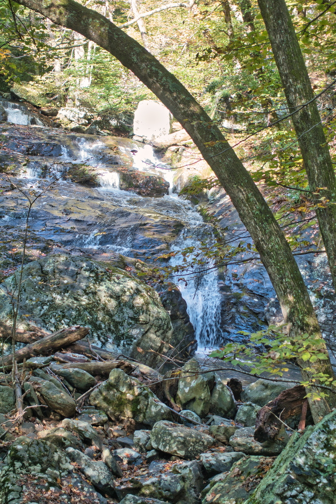
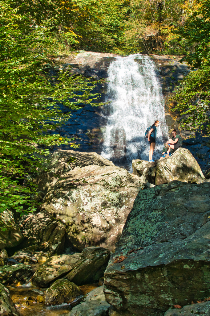
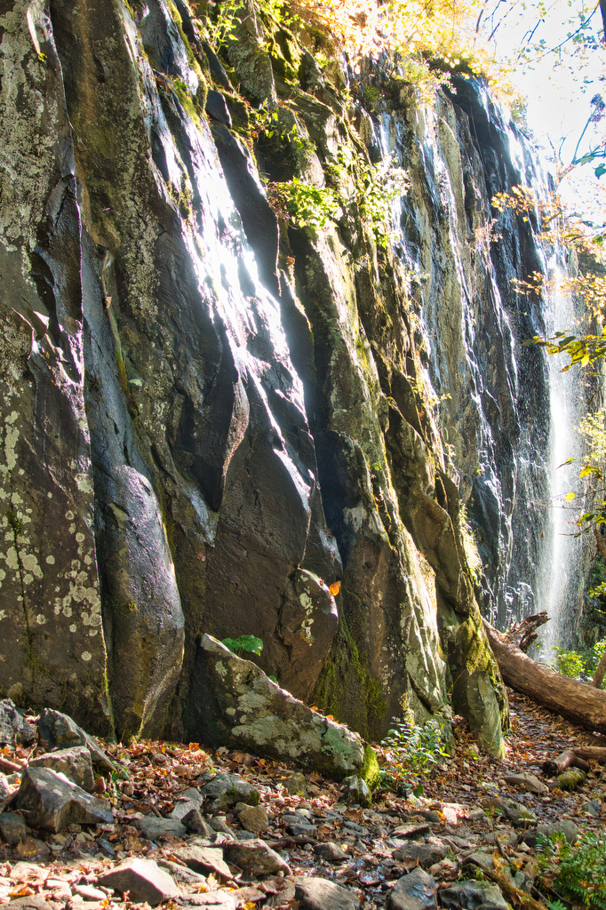
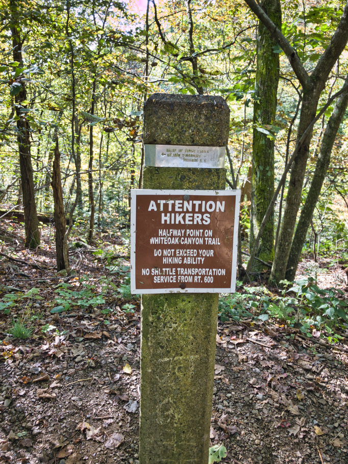
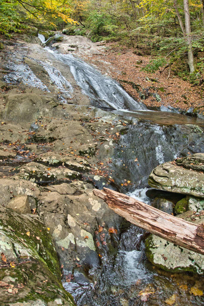
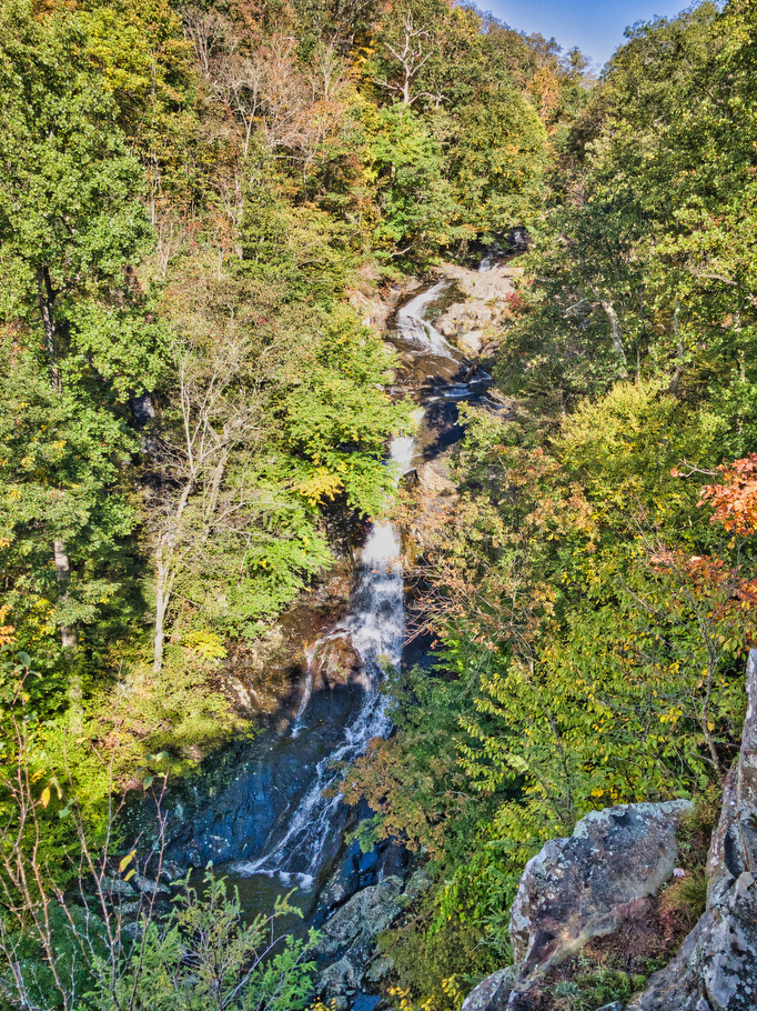
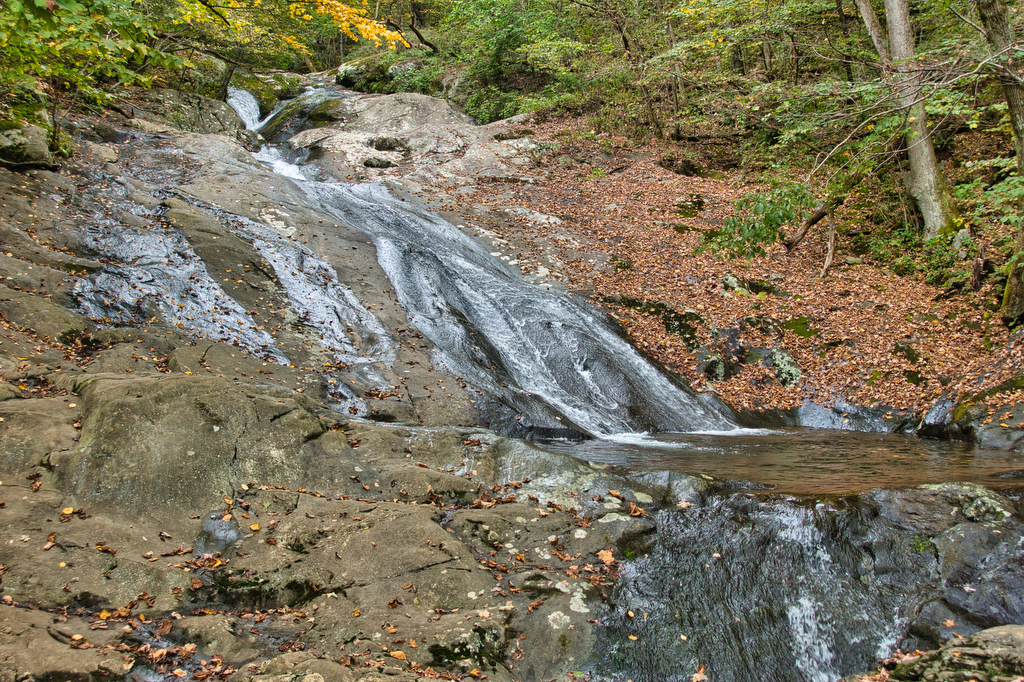
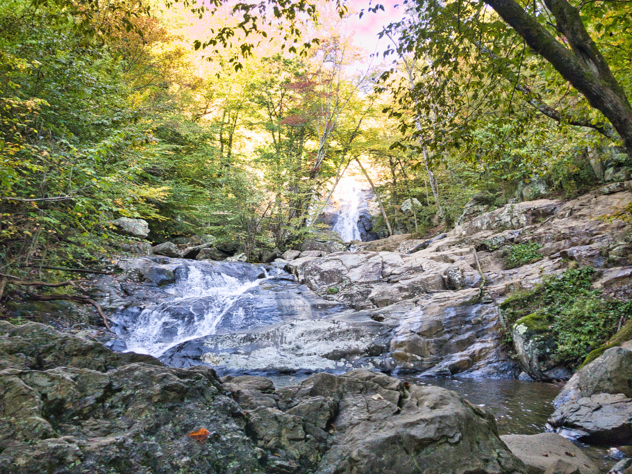
This hike is very well marked with blue blazes and you will not be alone so navigation its pretty simple. The Whiteoak Canyon Trail has six waterfalls ranging from 35’ to 86’ high. Some of the falls are partially obscured from the trail. Even though this hike is steep in some places, there are many great viewpoints where you can rest and enjoy your surroundings. Numerous switchbacks and stairs help with the climb. The largest (and possibly most scenic/famous) waterfall is Upper Whiteoak Falls, which is the sixth and final falls on this side of the canyon. There is a shorter and less strenuous trail from the Skyland area (mile 42.6) and some people attempt to descend further down the canyon, hence the warning signs posted here.
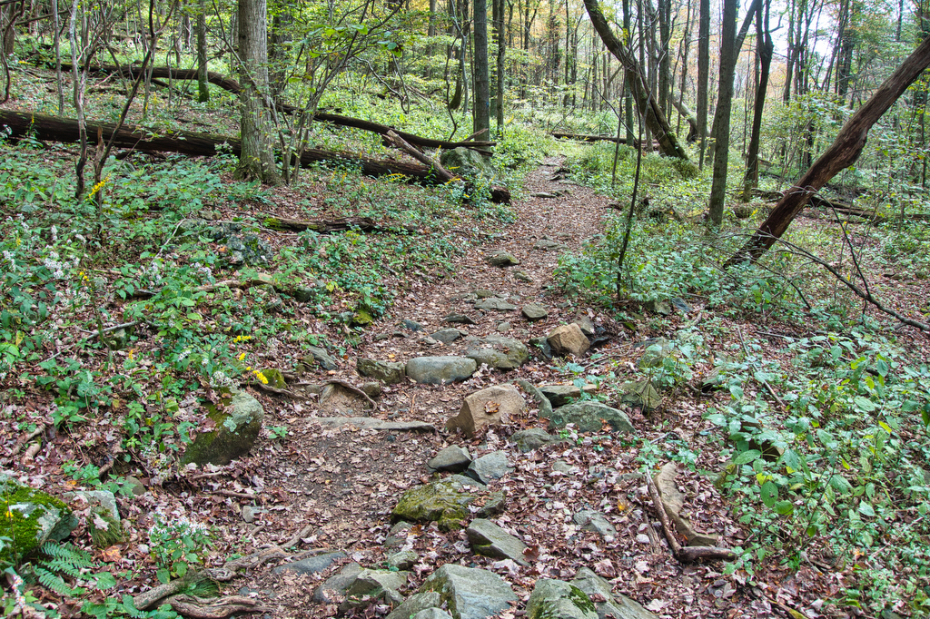
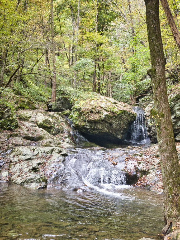
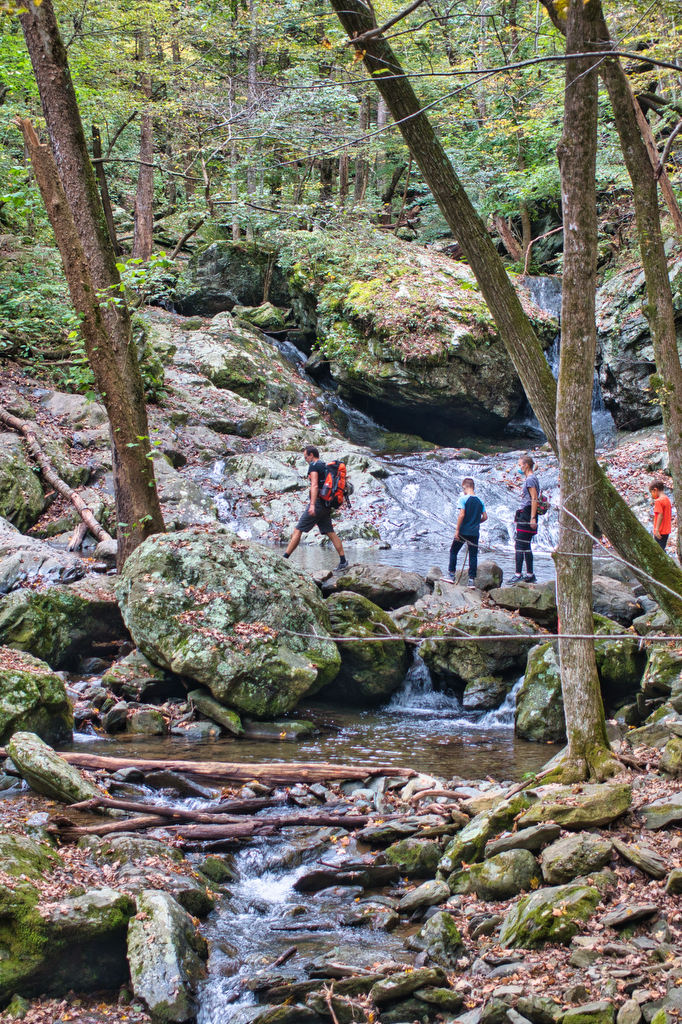
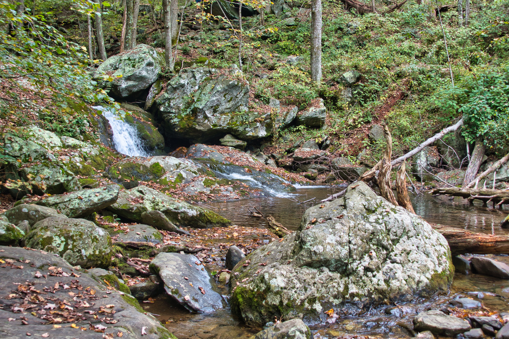
Just past Upper Whiteoak falls, the trail crosses a stream and joins the yellow-blazed Whiteoak Canyon Fire Road on the left. The fire road is also a horse trail and while the trail still climbs, it is a much more gradual ascent than the canyon trail. In 1.6 miles the fire road will veer to the right. Stay left on the yellow-blazed trail and reach the Hawksbill Gap parking area. Take a left on the blue-blazed cedar Run trail. There are two waterfalls and several stream crossings on this side. The trail has several switchbacks and many stone steps.
The trail begins to level out near the valley floor and the Whiteoak-Cedar Run Link Trail appears on the left. Stay straight on the Cedar Run trail to return to your vehicle. After this great hike its time for a beer.
Hike Photos:
Click on an image below for an enlarged view.
Beer Pairing:
A great hike like this one deserves a great beer. There are several good breweries nearby. We have visited Hopkins Ordinary, Bald Top Brewing, and Shotwell Run Brewing after other hikes and they are great options. However, on this hike, we had sandwiches and some great beer on ice in the cooler and the beautiful early fall weather was just right for a post-hike picnic.
Our good friend Mark introduced us to Cape Charles Brewing located on Virginia’s Eastern Shore. It may seem odd to pair a Shenandoah hike with an Eastern Shore beer; however, there is a connection. Mark was born and raised near Whiteoak Canyon in Washington, Virginia and he knows a good beer when he finds one. Cape Charles makes some great beer.
Assateague Island IPA is a New England style IPA brewed with Citra and Mosaic hops. It is unfiltered and doesn’t have the bitterness of some overly hopped IPAs. Ole Reliable is a Helles style Lager with a crisp, clean taste and it is a perfect sippin’ beer for a hot day or after a hot hike. Virginia’s Eastern Shore is a bit far to drive for a post hike beer. We suggest picking up a few cans of Cape Charles beer and keeping them cold in the cooler to enjoy after your hike.
Hike and drink responsibly. Never drink and drive. Stay safe and be responsible.