
- Highlights: Great views, two great rock scrambles, Massanutten Mountain
- Distance: 9.3 miles out and back
- Elevation Change 1,860 feet
- Trail Surface: Rocky with a few dirt sections
- Difficulty Level: Strenuous (distance, elevation gain, extremely rocky sections)
- Trailhead Parking: Gap Creek Trailhead, Crisman Hollow Road (FR 274) search Google Maps for “Gap Creek Trailhead”. Note: Crisman Hollow Road is typically closed in winter.
- Website: AllTrails
- Beer Pairings: Ridge Runner Farms & Brewery—Ploughman’s Pale Ale & Amaryllis IPA
The Hike:
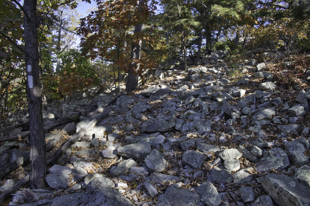
This hike is “non-stop rocks”. The scrambles are rocky and the trails are rocky. Wear really good shoes and take your time. The two scrambles are amazing. It is possible to do these as two separate hikes. Duncan Knob is 3.3 miles out and back and Strickler Knob is 5.4 miles out and back. This hike combines both knobs using the Scothorn Gap Trail as a connector.
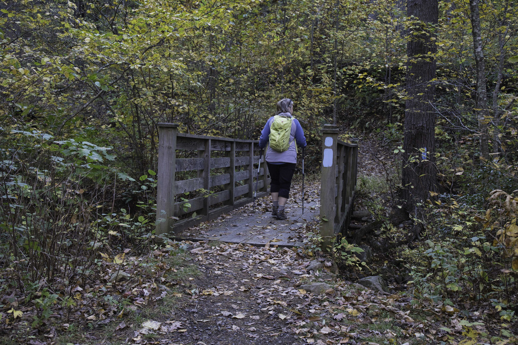
The trailhead is located at the south end of the Gap Creek parking area. Follow the blue-blazed fire road for a few hundred yards. The Gap Creek Trail takes a sharp turn to the left and crosses a small footbridge. The climb begins almost immediately as you begin nearly a 1,200-foot ascent.
Stay straight on the blue-blazed Gap Creek Trail as you pass a trail junction with the Scothorn Gap Trail. Reach a clearing and trail junction at 1.5 miles. This is Peach Orchard Gap. The white-blazed spur trail on the left leads to the Duncan Knob scramble. Bear left and follow the white blazes to the boulder field at the foot of the knob.
Duncan Knob:
Carefully work your way up the boulders—first to the left and then to the right—to reach the summit. Look for a rock cairn about 75 yards up the scramble and use it as a guide as you climb. Keep your hands free as this climb requires hands and feet. Always have good contact with three points before you move the fourth.
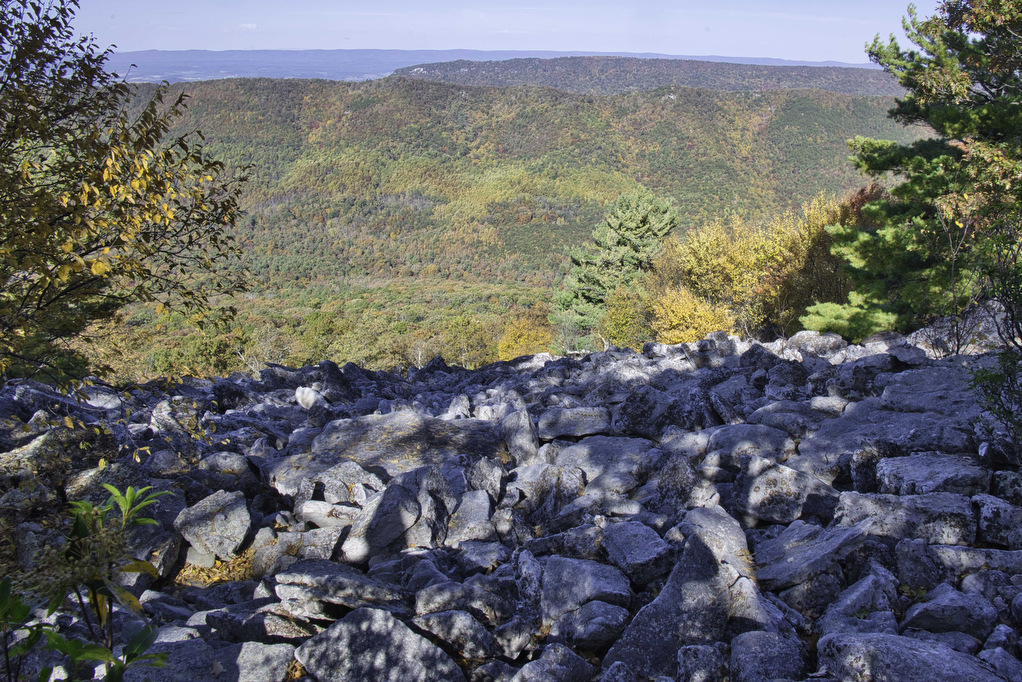
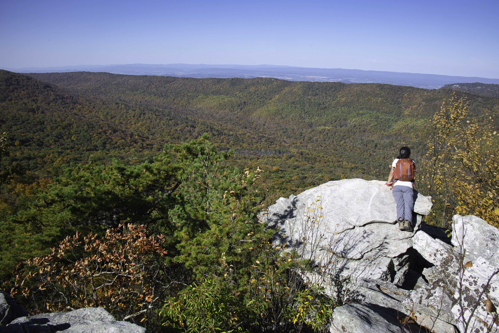
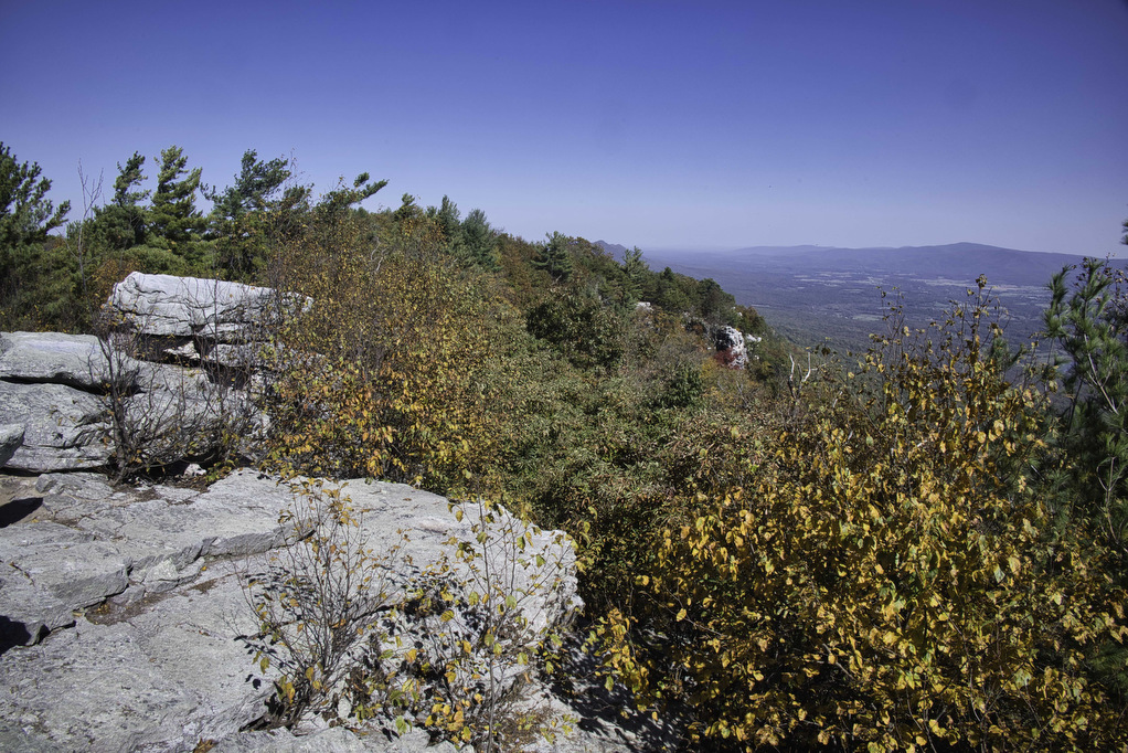
Most of the rocks are stable; however, a few will shift when you apply some weight. Be especially careful if the rocks are wet. Keep climbing upward and eventually you will run out of rocks. At 2,083 feet, the rocky summit has some of the best views in the mid-Atlantic. Great views open up to the east, south, and west. Several rocky ledges offer great vantage points.
Some hikers find getting down to be more challenging than the climb up. Take your time and keep bearing to the left. If you reach the bottom and don’t see the white-blazes, walk southwest (to the left) along the tree line. Return to Peach Orchard Gap and turn right on the blue-blazed Gap Creek Trail, retracing your steps downhill this time.
Scothorn Gap Trail:
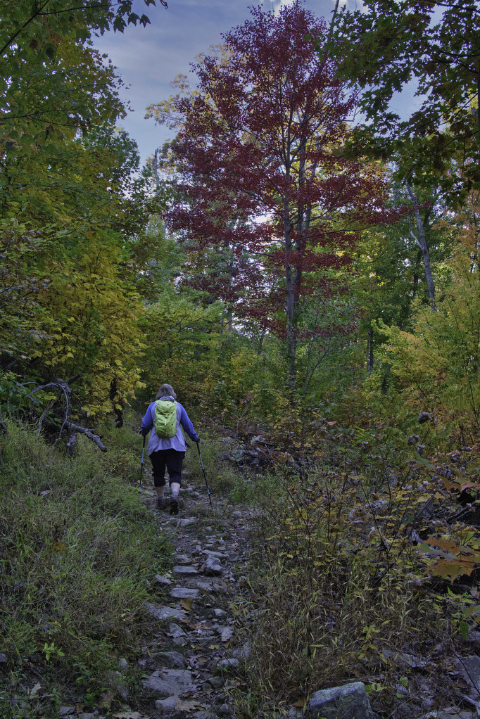
At 2.2 miles, reach a junction with the Scothorn Gap Trail. We passed this junction on the climb up to the knob. Bear left here and follow the yellow-blazed trail as it traverses the ridge. The trail is less rocky but may be overgrown in the warmer months. This section of the trail alternates between a forest canopy and some open sections. There is a slight elevation increase but nothing serious. This is also a popular horse trail so watch your step.
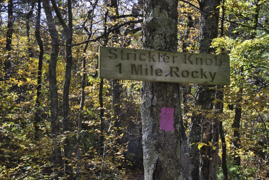
At 3.8 miles reach a four way-trail junction. Bear left here following the orange-blazed Massanutten Trail. A sign at the junction points to the Gap Creek Trail in this direction. At 4.4 miles reach the pink-blazed trail to Strickler Knob.
Strickler Knob:
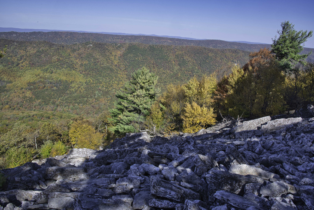
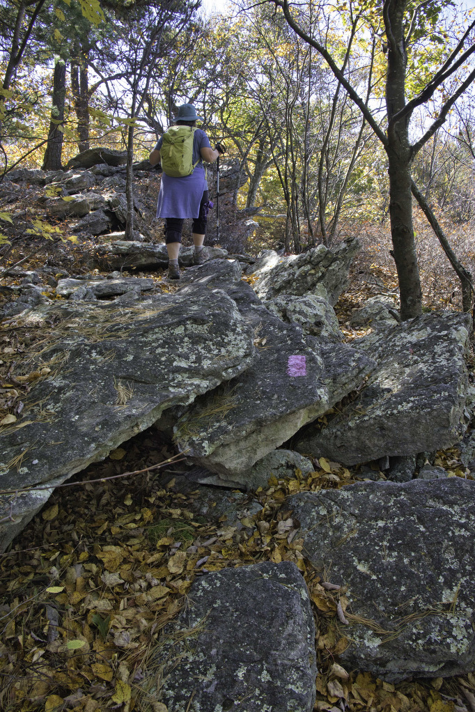
A sign at the trail junction reads “Strickler Knob 1 Mile Rocky”. It’s a small sign and there isn’t room for “extremely” or some other adjective . The distance is closer to 1.5 miles, but it is a small sign. The pink blazes are on trees and rocks every 15 to 30 yards. It’s sometimes difficult to tell the trail from just a pile of rocks so keep on the lookout for pink.
Most of the rocks in this section don’t require hands and feet. Take your time to avoid twisting an ankle or a knee. There are several partial views on your right as you make your way along the rock pile. The rocky trek along the ridgeline doesn’t really ascend or descend significantly.
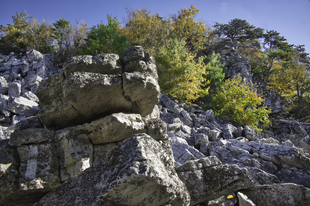
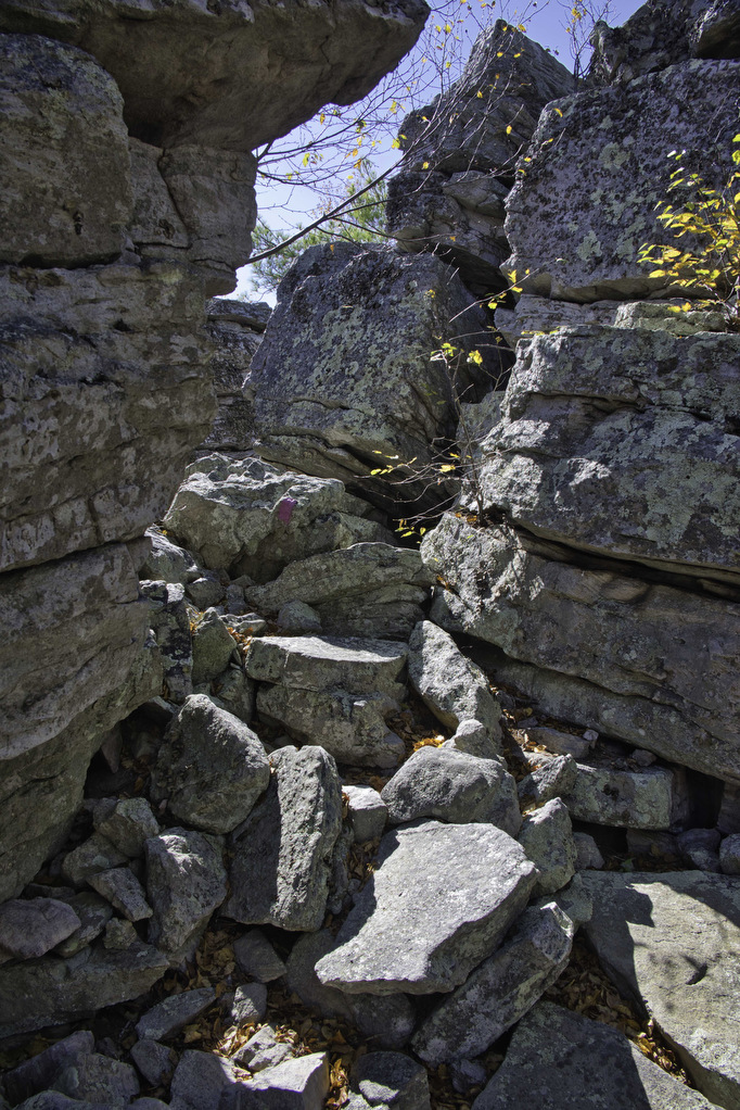
As you get close to the knob, a few sections will require hands and feet and some scrambling. The short vertical sections have ample room for hands and feet as you climb. Your rocky climb will be rewarded when you reach the summit.
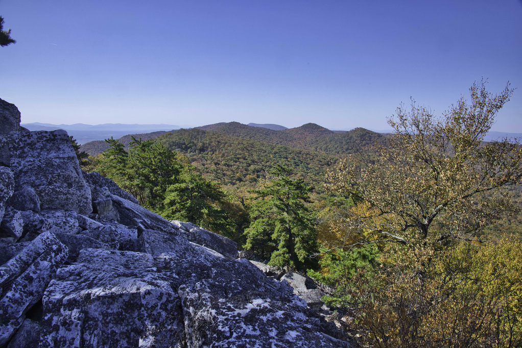
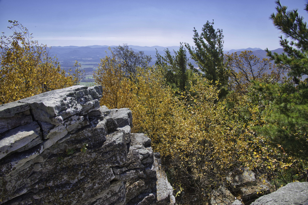
Magnificent vistas open up with panoramic views. To the east are the mountains of Shenandoah National Park. To the west is the Mountain State of West Virginia. The southern ridge of Massanutten Mountain lies to the south. The northern end of Massanutten is partially visible to the north. Enjoy the views, have a snack, and rest for a bit. We still have more hiking ahead of us.
To return, repeat the scramble on the pink trail, turning left on the orange-blazed Massanutten Trail. Bear right at the next junction on the yellow-blazed Scothorn Gap Trail. And finally bear left on the blue-blazed Gap Creek Trail to return to the parking area and your vehicle.
Hike Photos:
Click on an image below for an enlarged view.


Beer Pairing:
There are several options heading west and north of this hike. Woodstock Brewhouse is a great option. We’ve been there a few times and enjoy the beer and food. Just a few miles past Woodstock is Ridge Runner Farm Brewery. harvested food options, live music on weekends, and a variety of beers—both brewed on site as well as guest taps.
Kathy always goes for IPAs and she was pleased with Amaryllis IPA (7% ABV). Brewed with Amarillo, Citra, and Mosaic hops this IPA was nice and bitter—just the way she likes ‘em. Pete really like Ploughman’s Pale Ale (5.4% ABV). Brewed with Cascade, Centennial, and Columbus hops, this beer had just the right notes of pine and fruit.

Hike and drink responsibly. Never drink and drive. Stay safe, be responsible, and leave no trace.