
- Highlights: Mountain top views, large boulders, wildflowers, wildlife
- Distance: 5.2 miles out and back
- Elevation change: 1,750 feet
- Difficulty level: Strenuous
- Trailhead Parking: Flat Top parking area, Blue Ridge Parkway mile post 83.5
- Website: National Park Service
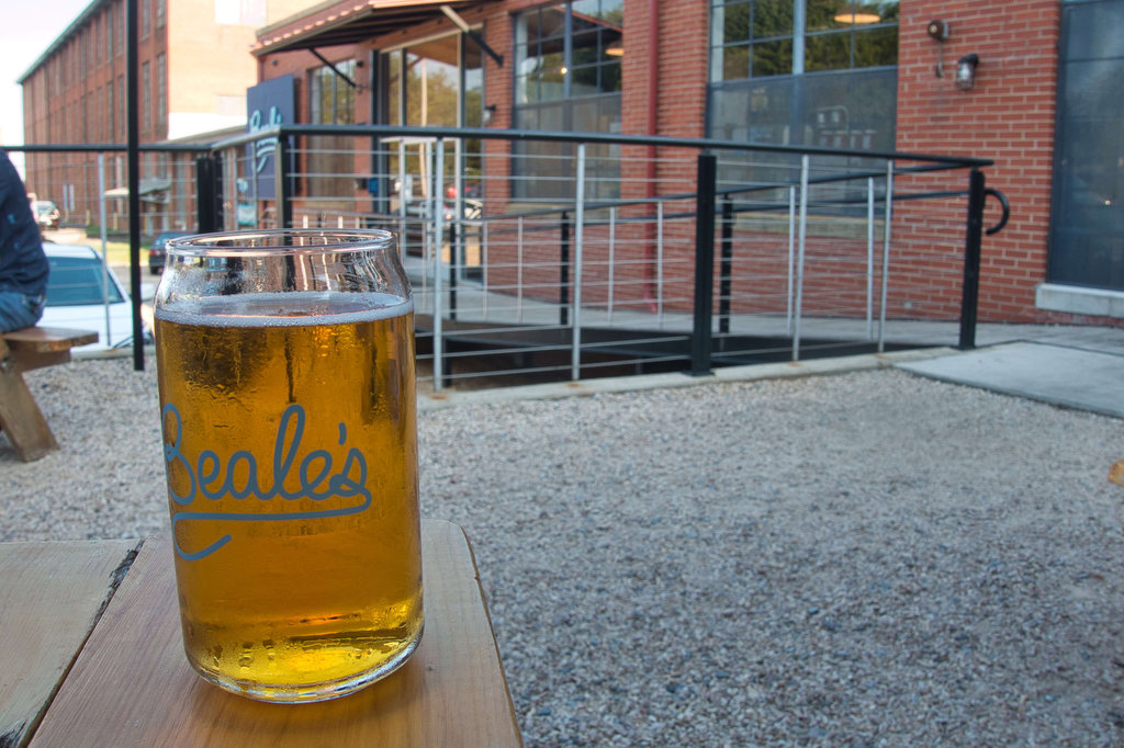
- Beer Pairings: Beale’s Brewery—Purple Mountain Pilsner & Red IPA
The Hike:
The Peaks of Otteris a popular destination on the Blue Ridge Parkway. Three mountains make up the Peaks and Flat Top has the highest elevation at 4,001 feet. The trail is well marked and well maintained and is dog and kid friendly. The Flat Top Trail can be combined with the Fallingwater Cascades Trail located just across the Parkway. These two trail have been designated as a National Recreation Trail.
The Flat Top trailhead is located on the south end of the parking area. The trail continues past the summit and down the other side of the mountain to the Peaks of Otter picnic area which is the southern trailhead. We decided to begin the hike on this side of Flat Top to combine it with the Fallingwater Cascades Trail.
The trail begins with a gradual ascent and becomes rocky and steep as you climb to the summit. Mountain Lauren and rhododendron line the trail. Late spring would be a blaze of color on this trail. Wildflowers are also plentiful along this hike. Large boulders begin to appear on the side of the trail.
Reach a trail junction and sign at 2.1 miles. A short spur trail leads to the left with amazing views. Cross Rock is .1 miles to the left down a very steep and somewhat overgrown trail. The views from the overlook are much better. The summit is .5 miles ahead. Continue climbing the trail as it becomes even steeper and reach The Pinnacle at about 2.3 miles. The Pinnacle is a huge rock formation on the left side of the trail.
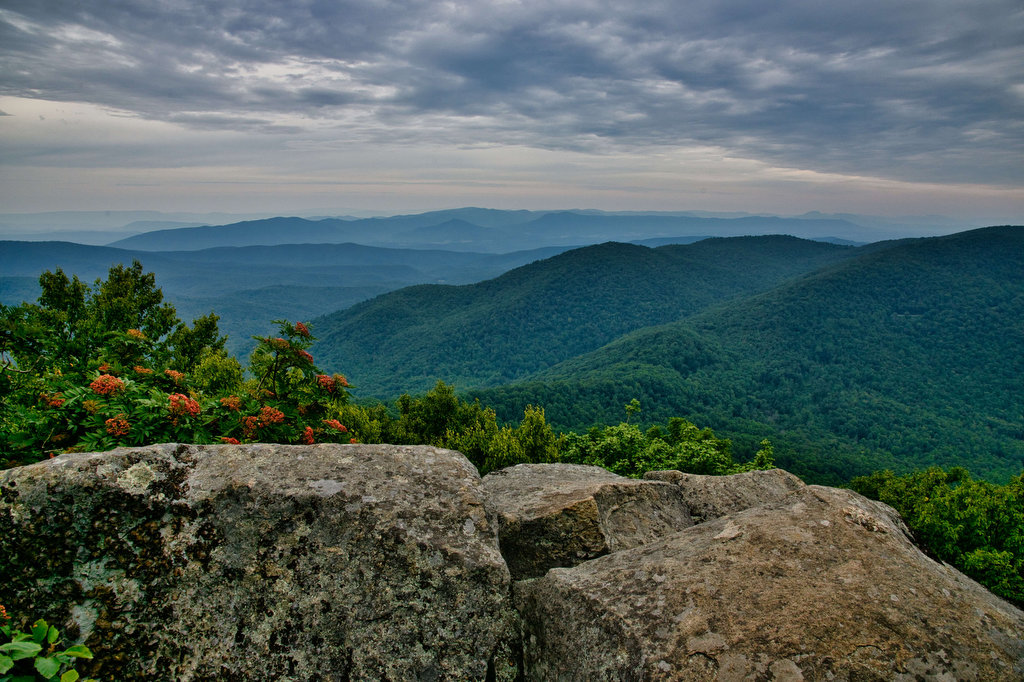
Reach the summit of Flat Top at 2.6 miles. A sign announces you are at an elevation of 4,001 feet. There are no views at the sign. Continue just past the sign to a short unmarked trail on the right leading to views of the south and west. For even better views, return to the Flat Top summit sign and continue past it for about 20 yards to another unmarked spur trail leading off to the right. Climb a few boulders to great views. Return to the main trail and turn right to retrace your steps down the mountain to return to your vehicle.
Hike Photos:
Click on an image below for an enlarged view.
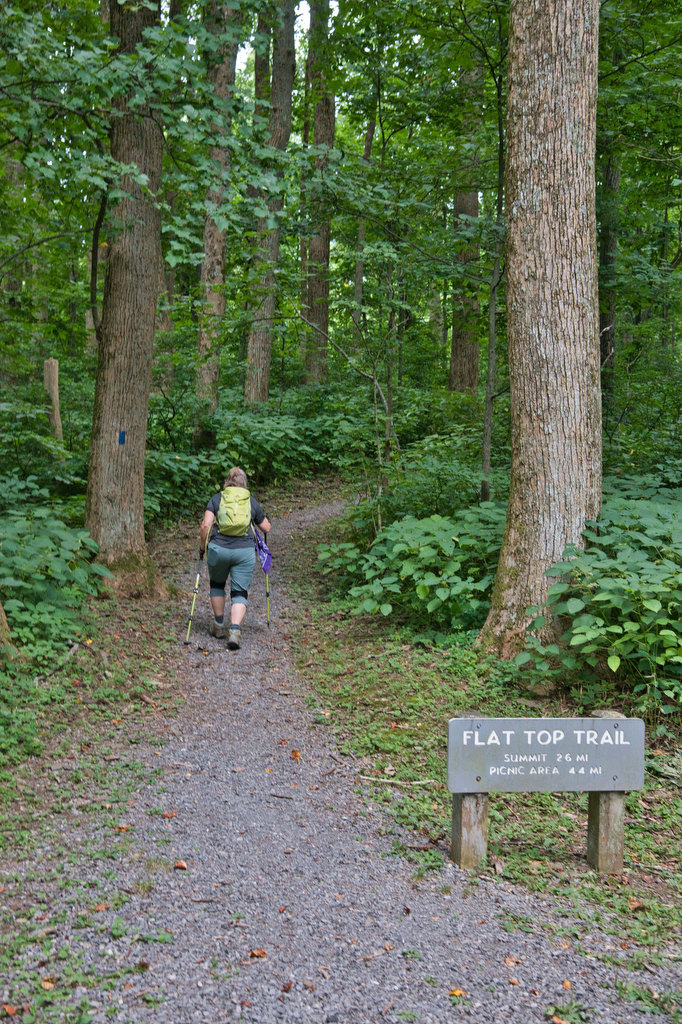
Flat Top Trailhead 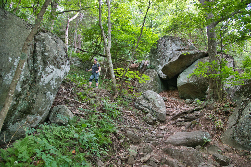
Viewpoint near Cross Rock 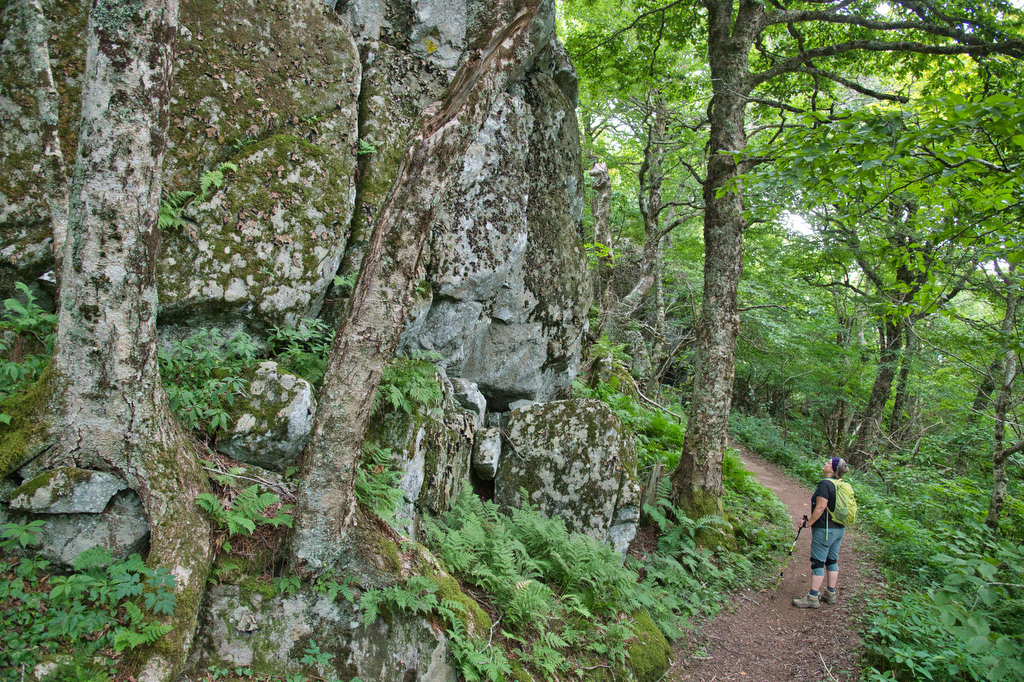
The Pinnacle 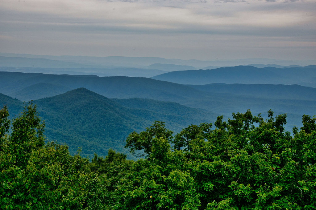
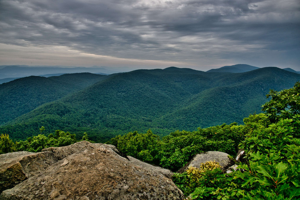
Summit Viewpoint to Southeast 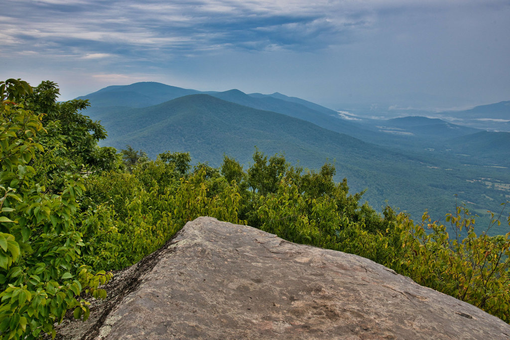
Summit Viewpoint to the Northeast 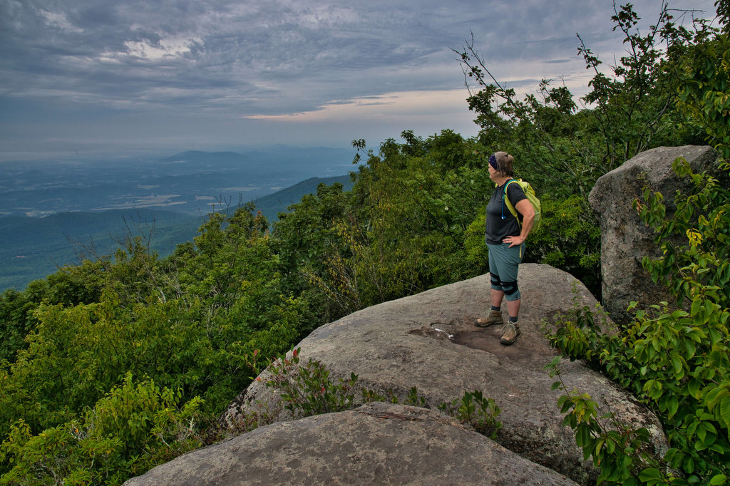
Summit Viewpoint to the Northeast
Beer Pairing:
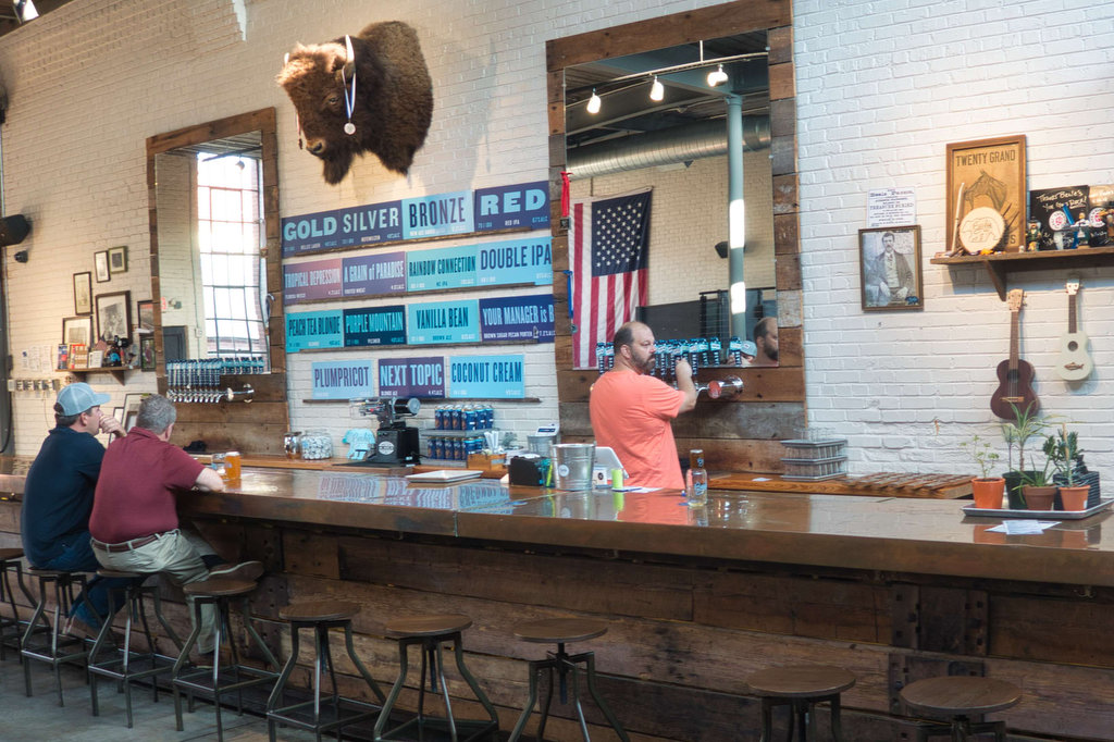
There are several beer options following this hike. The nearby Peaks of Otter Lodge (usually open March to November) has several craft beers on tap with nice views of Abbot Lake and Sharp Top. We recently visited the Lodge after another hike so we decided to venture a little over ten miles into nearby Bedford to visit Beale’s Brewery.
Beale’s brews some really good beer, they have tasty pub fare (the BBQ is really good), and indoor and outdoor seating. The Purple Mountain Pilsner is everything a good pilsner should be: clean and crisp with just a little kick of hoppiness. Red is a west coast-style red IPA with a nice boost of hops providing for a pleasant bitter finish.
Hike and drink responsibly. Never drink and drive. Stay safe and be responsible.