
- Highlights: Appalachian Trail, Harpers Ferry historic district, great views
- Distance: 4.5 miles out and back
- Elevation change: 1,350 feet
- Difficulty level: Moderate/strenuous
- Trailhead Parking: Lower Town Information Center, Harpers Ferry WV, park fee required
- Website: Harpers Ferry National Historical Park
- Beer Pairings: Smoketown Brewing—My Best Girl DIPA & Angler’s Mid Atlantic Steam IPA
The Hike:
This fun hike includes interesting historical elements as well as great views of Harpers Ferry. The trail has steep sections and is well marked and well maintained. There are several trail junctions so a good map will be helpful. Begin this hike at the Park Information Center on Shenandoah Street in Harpers Ferry.
Parking here can be a real challenge. The Park Service provides free shuttle buses from large parking areas outside of the historic district. Another option is to park at a small lot near US 340 and Shenandoah Street, on the north side of the Shenandoah River Bridge. Follow the Appalachian Trail .9 miles into town.
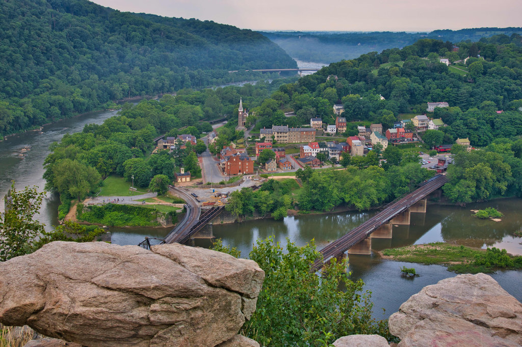
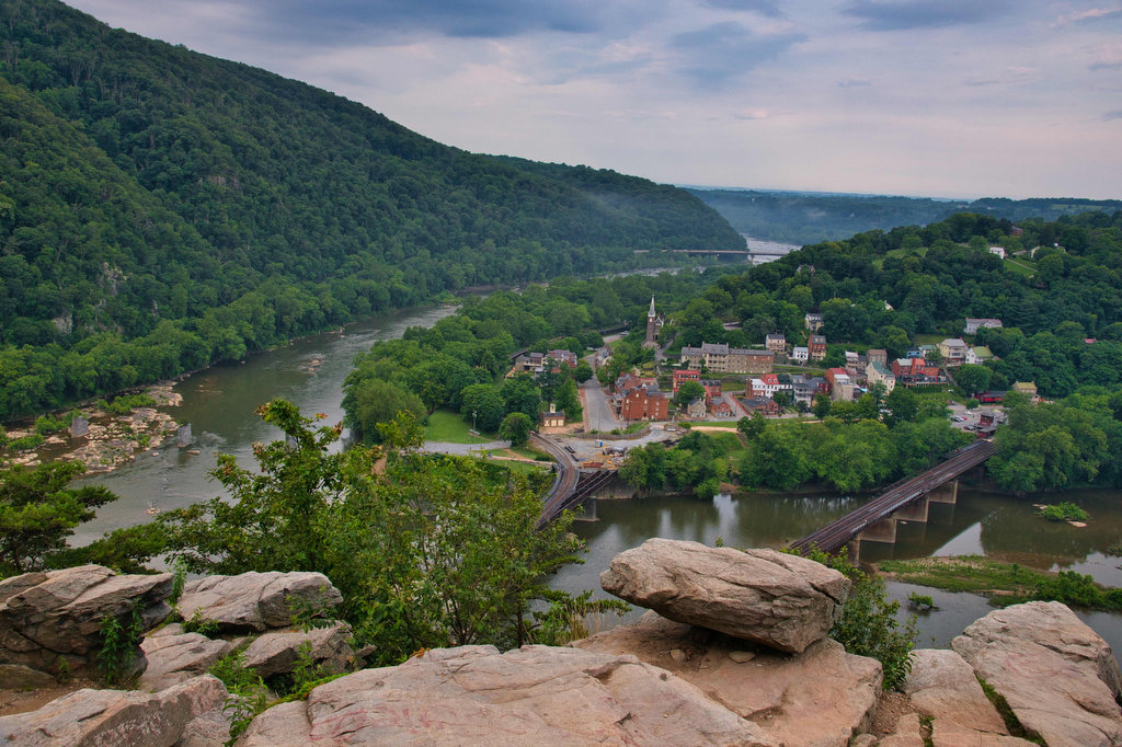
Follow Shenandoah Street toward John Brown’s fort. The Appalachian Trail with its white blazes passes through Harpers Ferry. Follow the gravel roadway to the right and the river overlook. The Potomac is on the left and the Shenandoah River is on your right. The mountain to the right is Loudon Heights. The large rocky mountain across the bridge is Maryland Heights, the destination of this hike.
Cross over the bridge and down the stairs into Maryland. Note, the steps are metal with open grates and some dogs have difficulty walking on this surface. At the bottom of the stairs, the northbound AT and the eastbound C&O Canal Trail both leave to the right. Turn left and follow the C&O Canal towpath. The towpath is a popular biking/hiking/walking trail along the C&O Canal between Georgetown and Cumberland, Maryland, a distance of over 184 miles.
Follow the level towpath between the Potomac and the canal before reaching a footbridge on the right. Take the bridge over the canal and cross the road to the Maryland Heights Trail. A kiosk at the trailhead provides a map and trail information.
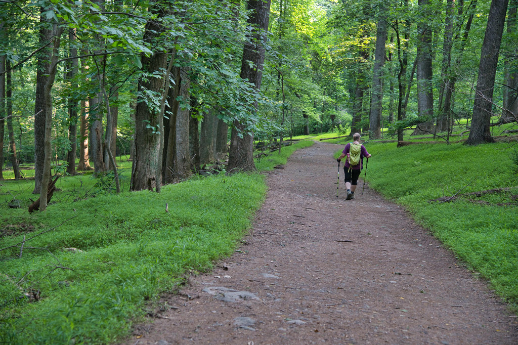
Follow the blue-blazed Combined Trail as it travels steadily uphill. This trail is now used as a fire road. During the Civil War this road was used by the Union Army to bring canons and supplies to the Stone Fort located at the top of Maryland Heights.
The trail reaches the first junction at 1.4 miles. Either way will get you to the cliffs overlook. The trail to the right passes by the ruins of the Naval Battery with limited views of Harpers Ferry. Continue on the path where it rejoins the Combined Trail and turn right.
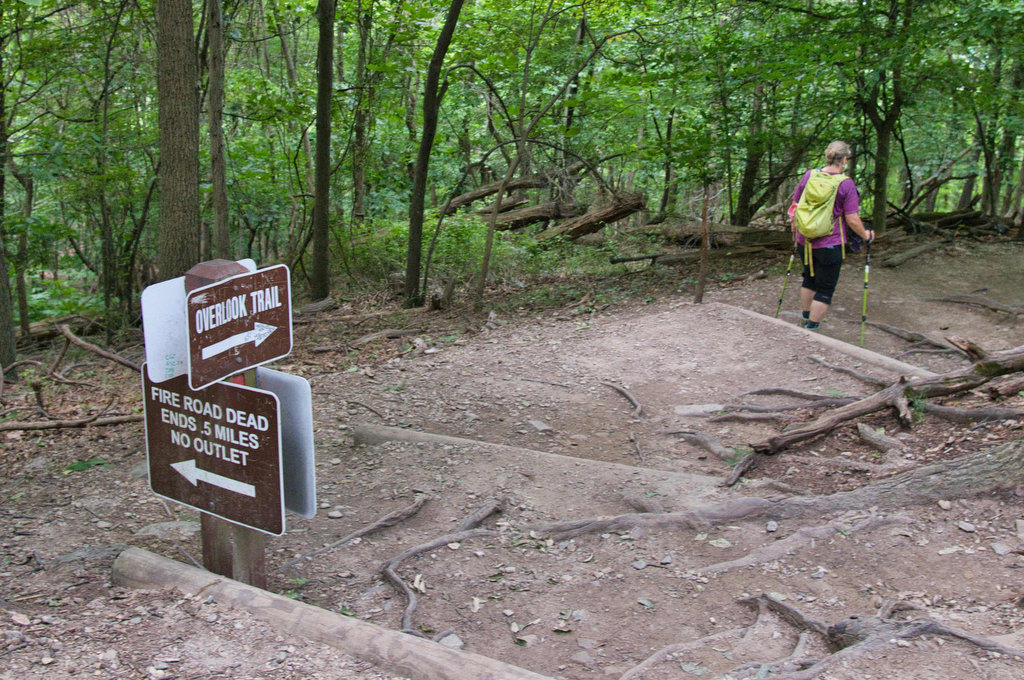
The blaze colors get a bit confusing at this point. In 1.6 miles at the next trail junction, the blue-blazed Stone Fort Trail branches off to the left. Stay straight on what is now a green-blazed Overlook TraIl which shortly becomes red-blazed. Continue straight as the Stone Fort Trail loops back on the left in 1.8 miles.
The trail levels out and begins a descent. Follow the red-blazed Overlook Cliff Trail and at the next junction turn right following the sign to Overlook Trail. The trail becomes steep in places as you work your way down to the overlook. Reach the overlook at 2.2 miles with views of the rivers and Harpers Ferry below.
Retrace your steps uphill to the red trail, turning left at the first junction. Stay straight through all the remaining junctions as you work your way back to the C&O towpath and the bridge back to Harpers Ferry.
Hike Photos:
Click on an image below for an enlarged view.

Harpers Ferry 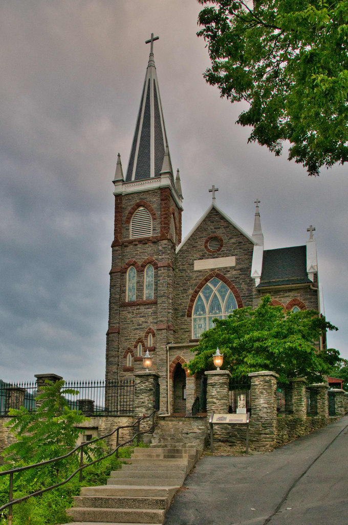
St. Peter’s Church 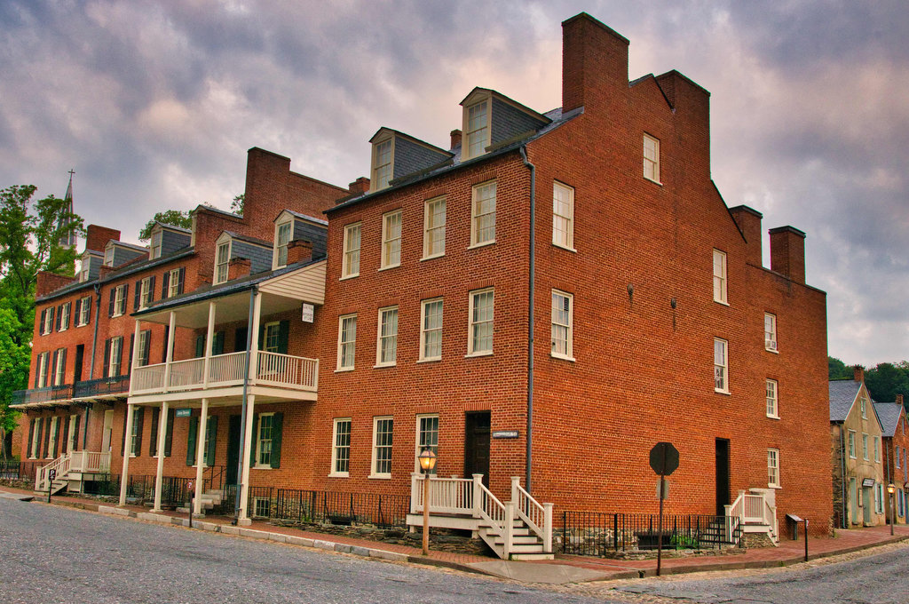
Harpers Ferry Historic District 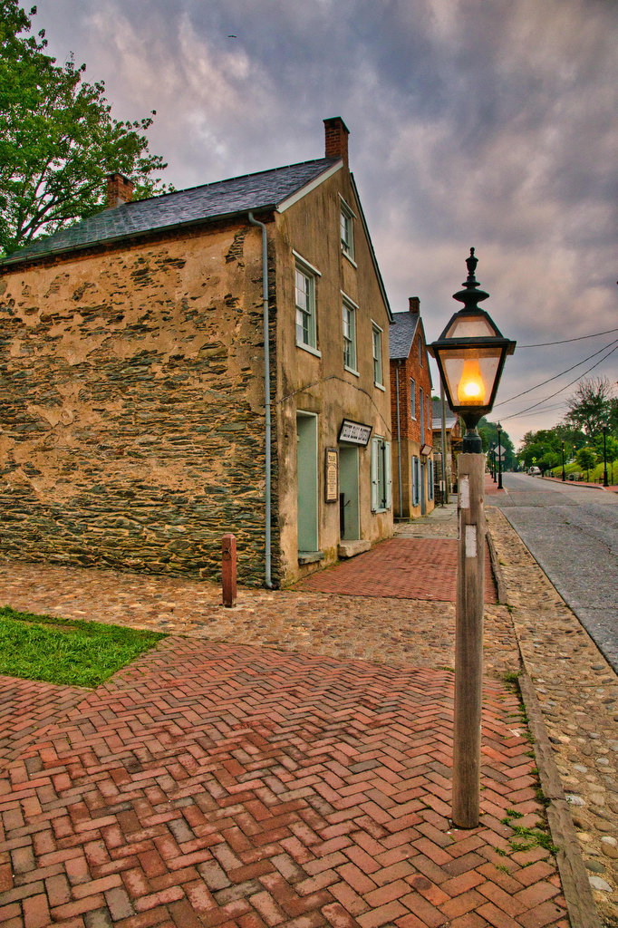
AT Trail Marker in Harpers Ferry 
Maryland Heights and AT Bridge Crossing 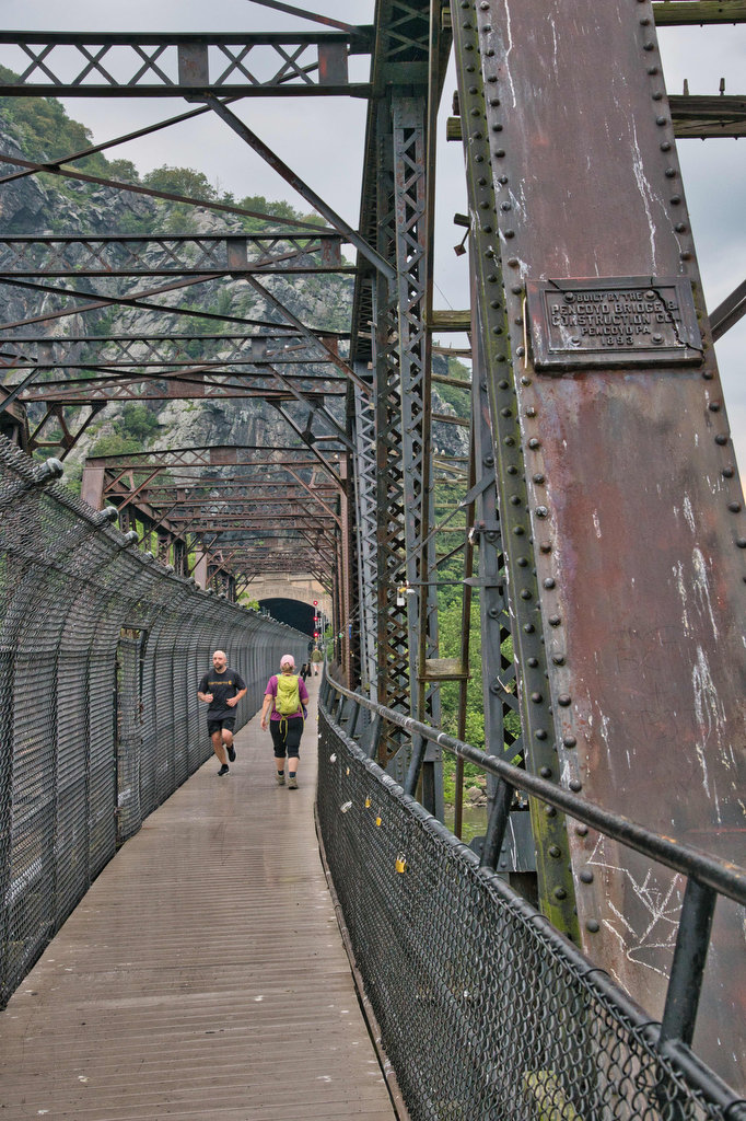
Potomac River AT Bridge 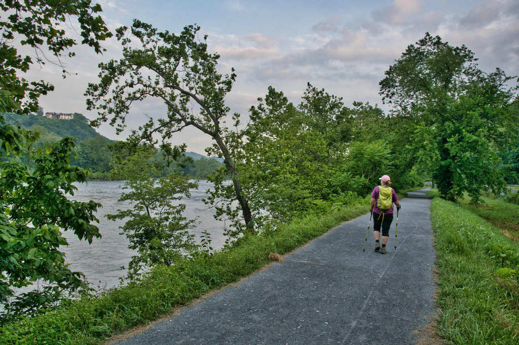
C&O Canal Towpath 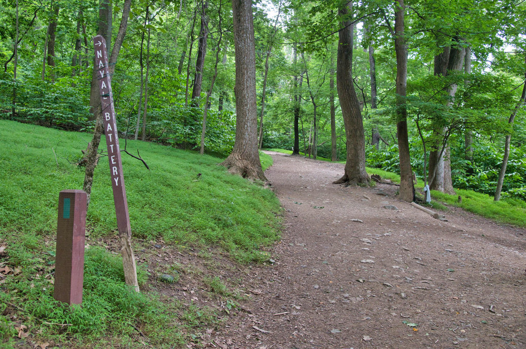
Trail Junction to Naval Battery Overlook 
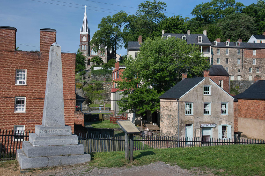
John Brown’s Fort Site
Beer Pairing:
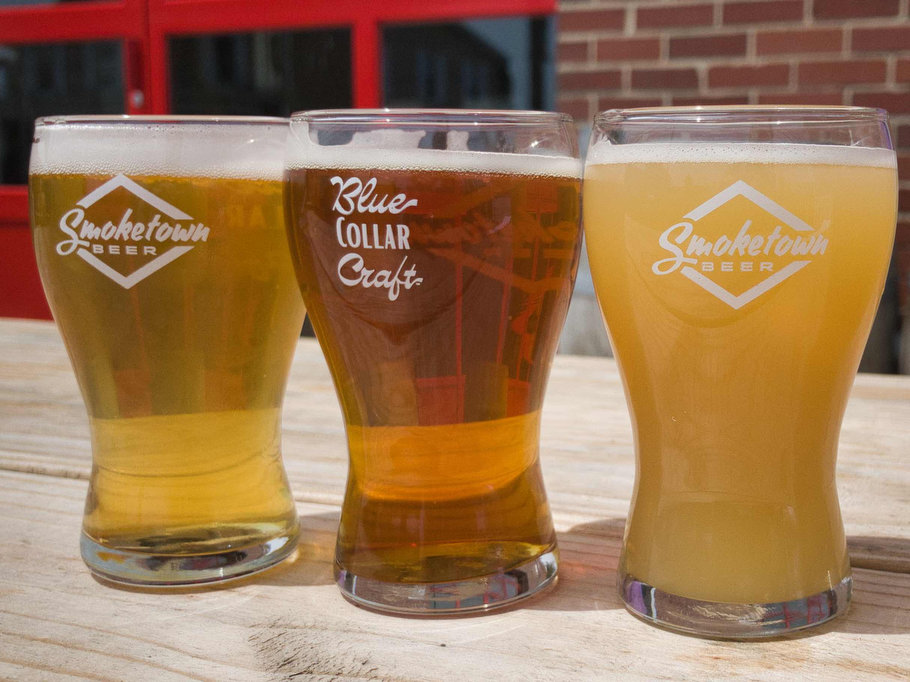
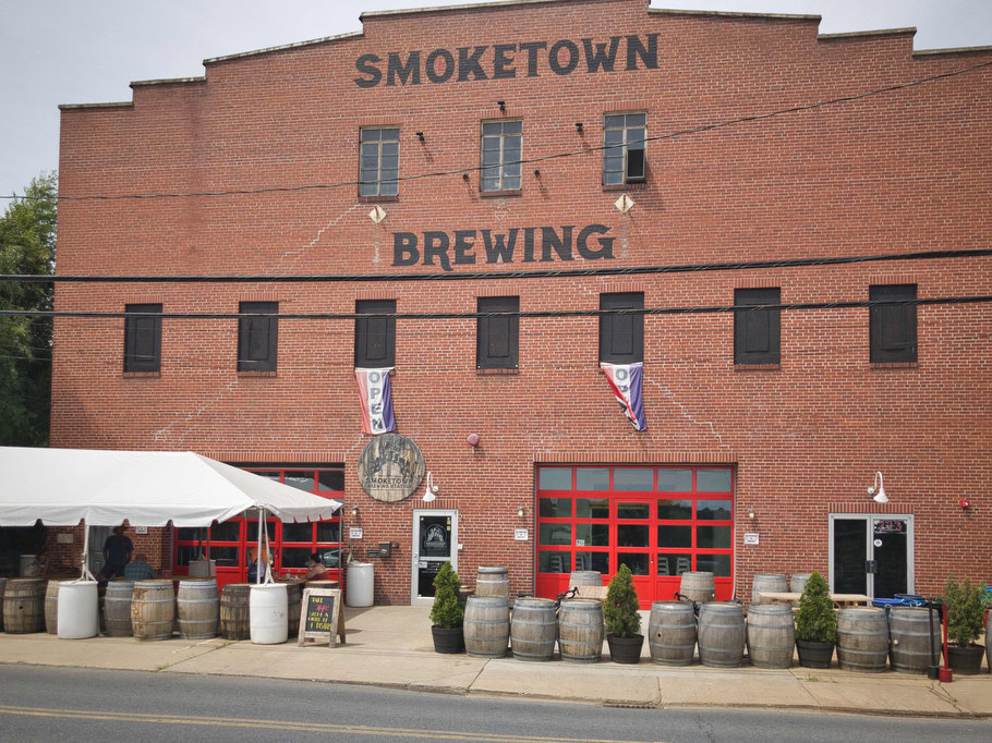
We visited Harpers Ferry Brewing after our Loudon Heights hike. While this is a great brewery located close to Harpers Ferry, for this hike we suggest traveling a few miles further on US 340 to nearby Brunswick Maryland and Smoketown Brewing Station.
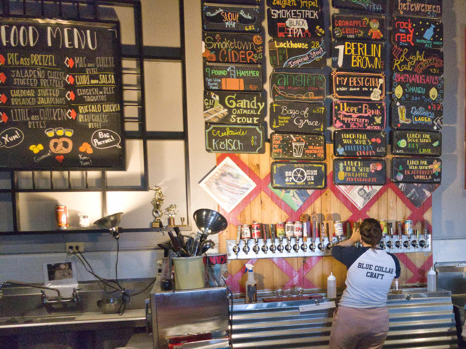
Located in a former fire station, Smoketown brews some great beer, has indoor and outdoor seating, and food trucks are regular visitors. Kathy really liked My Best Girl, a hazy double IPA made with Amarillo and Simco hops. It was nice and hoppy and at 8.5% ABV, it’s a good plan to have a designated driver.
Pete really enjoyed Angler’s Mid Atlantic Steam IPA, a collab beer with Devil’s Backbone. Talus and Strata hops give the right amount of bitterness. Lager yeast, which ferments at a higher temperature, makes it a steam beer similar to Anchor Steam.
Hike and drink responsibly. Never drink and drive. Stay safe and be responsible.