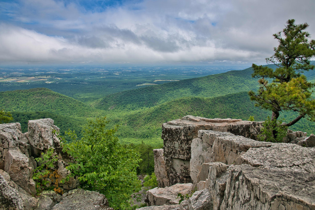
great views

Sharp Top

Highlights: rocky summit, views, fall foliage, rocky summit Distance:  2.8 mile out and back Elevation change: 1,200 feet Difficulty level: Moderate/Difficult Trailhead Parking: Blue Ridge Parkway, mile post 85 Website: National Park Service Beer Pairings: Parkway Brewing : Get Bent IPA & Ravens Roost baltic porter The Hike: This is a great Blue Ridge Parkway […]

Sharp Top Read More »

Mount Rogers

Highlights: wild ponies, wildflowers, wildlife, great views, highest peak in Virginia Distance:  8.9 mile loop Elevation change: 1,300 feet Difficulty level: Moderate/difficult Trailhead Parking: Grayson Highland State Park, Massie Gap parking area; park fee required Website: Grayson Highland State Park Trail Guide Beer Pairings: South Street Brewery Satan’s Pony The Hike: At a height of

Mount Rogers Read More »

Wilburn Ridge via the AT

Highlights: wild ponies, wildflowers, wildlife, great views Distance:  4.0 mile loop Elevation change: 850 feet Difficulty level: Moderate Trailhead Parking: Grayson Highland State Park, Massie Gap parking area; park fee required Website: Grayson Highland State Park Trail Guide Beer Pairings: Damascus Brewery-Preppy Harvard Boy IPA & Beaver Ridge IPA The Hike: This hike is a

Wilburn Ridge via the AT Read More »

Crabtree Falls (Virginia)

Highlights: Highest waterfalls east of the Mississippi, classic Virginia bucket list hike  Distance: 4 mile out and back Elevation change:  1,070 feet Difficulty level: Moderate/strenuous Trailhead Parking: Crabtree Falls day use parking area, off state route 56 in Nelson county VA. $3 parking fee. Website: US Forest Service Beer Pairings: Blue Mountain Native Species pale

Crabtree Falls (Virginia) Read More »