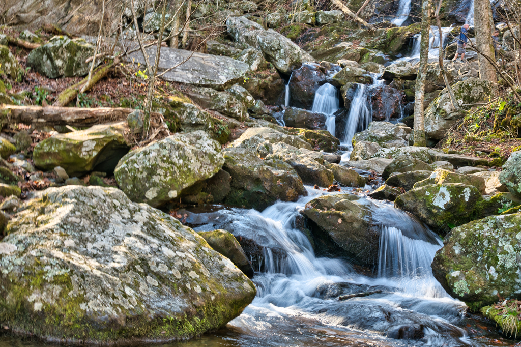
kid friendly

Dark Hollow Falls

Highlights: Waterfalls, Shenandoah National Park Distance:  1.4 mile out and back  Elevation change: 440 feet Difficulty level: Easy Trailhead Parking: Skyline Drive, mile 50.7, Dark Hollow Falls parking area Website: National Park Service Beer Pairings: Starr Hill Brewing Northern Lights IPA & Grateful Pale Ale The Hike: This is a short (but very popular) hike. […]

Dark Hollow Falls Read More »

Max Patch

Highlights: mountain views, bald summit, Appalachian Trail Distance:  1.5 mile loop Elevation change:  288 feet Difficulty level: Easy Trailhead Parking: NC State Route 1182 near Hot Springs NC. See link below for directions. The parking area is small with room for about 15 vehicles. Website: US Forest Service Beer Pairings: Wicked Weed Brewing Pernicious IPA

Max Patch Read More »

Humpback Rocks

Highlights: mountain views, rocky summit, Appalachian Trail Distance:  3.8 out and back Elevation change:  1,120 feet Difficulty level: Moderate/Strenuous Trailhead Parking: Visitor Center, Blue Ridge Parkway mile 5.8 Website: National Park Service Beer Pairings: Pro Re Nata Brewery, Crozet VA Hop Drone IPA & Tapped Out pilsner The Hike: This popular hike can be crowded

Humpback Rocks Read More »

Crabtree Falls (Virginia)

Highlights: Highest waterfalls east of the Mississippi, classic Virginia bucket list hike  Distance: 4 mile out and back Elevation change:  1,070 feet Difficulty level: Moderate/strenuous Trailhead Parking: Crabtree Falls day use parking area, off state route 56 in Nelson county VA. $3 parking fee. Website: US Forest Service Beer Pairings: Blue Mountain Native Species pale

Crabtree Falls (Virginia) Read More »

Grassy Ridge Bald, Jane Bald, and Round Bald on the AT

Highlights: Three bald summits, spectacular views, blaze orange azaleas, Roan Highlands, Appalachian Trail Distance:  4.9 mile out and back Elevation change:  1,030 feet Difficulty level: Moderate Trailhead Parking: Carver’s Gap at the NC/TN state line; Tennessee route 143 and North Carolina route 261 Website: AllTrails Beer Pairings: Sierra Nevada Pale Ale & Dankful IPA The

Grassy Ridge Bald, Jane Bald, and Round Bald on the AT Read More »

The Great Channels

Highlights: amazing rock formations, slot-canyon rock maze, wildflowers  Distance:  6 mile out and back Elevation change:  1,280 feet Difficulty level: Moderate Trailhead Parking: Hayter’s Gap, route 80 Saltville VA. Note the parking area is very small and has spaces for just 10 vehicles. Parking on route 80 is not permitted.  Website: Virginia Dept. of Forestry 

The Great Channels Read More »