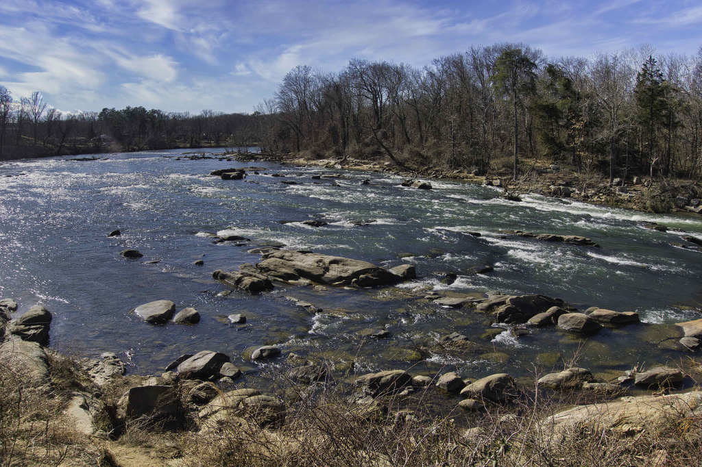
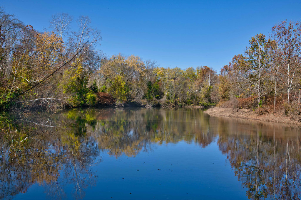
Distance

Mary’s Rock

Highlights: Views, wildlife, birdwatching, Appalachian Trail Distance: 2.9 miles out and back Elevation change: 830 feet Difficulty level: Easy/moderate Trailhead Parking: Meadow Spring parking area, Skyline Drive mile 33.5, park fee required Website: Shenandoah National Park Beer Pairings: Hopkins Ordinary Ale Works—End of the Trail Pale Ale & Sperryville VeryChill Kölsch The Hike: There are […]

Mary’s Rock Read More »

AT: Beagle Gap to Calf Mountain Shelter

Highlights: Meadows, views, wildlife, birdwatching, wildflowers, AT shelter Distance: 4.9 miles out and back Elevation change: 821 feet Difficulty level: Moderate Trailhead Parking: Beagle Gap parking area, Skyline Drive mile 99.5, park fee required Website: Hiking Upward Beer Pairings: Dr. Ho’s Humble Pie—Skipping Rock Kolsch & Blue Mountain Full Nelson The Hike: This hike follows

AT: Beagle Gap to Calf Mountain Shelter Read More »

Windsor Castle Park

Highlights: Historic buildings, wildlife, birdwatching, creek and marsh views Distance: 4.1 miles loop Elevation change: 64 feet Difficulty level: Easy Trailhead Parking: Dan Smith Drive parking area, Smithfield VA Website: Windsor Castle Park Beer Pairings: Wharf Hill Brewing—Holy Brale brown ale & Outage IPA The Hike: Windsor Castle Farm in Smithfield was originally part of

Windsor Castle Park Read More »

Apple Orchard Falls

Highlights: Waterfalls, rock formations, wildflowers, wildlife Distance: 2.8 miles out and back Elevation change: 995 feet Difficulty level: Easy/Moderate Trailhead Parking: Sunset Fields parking area, milepost 78.4 on the Blue Ridge Parkway Website: US Forest Service Beer Pairings: Peaks of Otter Lodge—Free Verse IPA & Gold Lager The Hike: Apple Orchard Falls is a popular

Apple Orchard Falls Read More »

Harkening Hill & Johnson Farm Loop

Highlights: Historic farm, views, rock formations, wildflowers, wildlife Distance: 4.3 mile loop Elevation change: 905 feet Difficulty level: Moderate Trailhead Parking: Peaks of Otter Visitor Center parking area, Blue Ridge Parkway mile post 86 Website: National Park Service Beer Pairings: Apocalypse Ale Works—Enticer Session IPA & D-Stroy IPA The Hike: First of all, Harkening Hill

Harkening Hill & Johnson Farm Loop Read More »

Blue Ridge Tunnel

Highlights: Historic railroad tunnel Distance: 4.6 miles out and back Elevation change: 456 feet Difficulty level: Easy Trailhead Parking: East Trailhead 215 Afton Depot Lane, Afton VA Website: Nelson County Beer Pairings: Wild Man Dan Brewery—Rye She Knows IPA & BoHo Slipper Pilsner The Hike: This easy hike follows the path of a historic railroad

Blue Ridge Tunnel Read More »

Fallingwater Cascades

Highlights: Waterfall, rock formations, wildflowers, wildlife Distance: 1.6 mile loop Elevation change: 410 feet Difficulty level: Easy Trailhead Parking: Flat Top parking area, Blue Ridge Parkway mile post 83.5 Website: National Park Service Beer Pairings: Beale’s Brewery—Purple Mountain Pilsner & Red IPA The Hike: This short hike leads to a waterfall and series of cascades.

Fallingwater Cascades Read More »

Flat Top Mountain

Highlights: Mountain top views, large boulders, wildflowers, wildlife Distance: 5.2 miles out and back Elevation change: 1,750 feet Difficulty level: Strenuous Trailhead Parking: Flat Top parking area, Blue Ridge Parkway mile post 83.5 Website: National Park Service Beer Pairings: Beale’s Brewery—Purple Mountain Pilsner & Red IPA The Hike: The Peaks of Otteris a popular destination

Flat Top Mountain Read More »

Devil’s Marbleyard

Highlights: Amazing rock scramble and great views Distance: 3.8 miles out and back Elevation change: 1,150 feet Difficulty level: Moderate/Strenuous Trailhead Parking: VA 781 (Petites Gap Road) small parking area at Belfast Trailhead, 4.5 miles south of Blue Ridge Parkway Website: US Forest Service Beer Pairings: Great Valley Farm Brewery—IPA & Coffee Stout The Hike:

Devil’s Marbleyard Read More »

Hogback Mountain Loop

Highlights: Nice views, Appalachian Trail, wildflowers, wildlife, fall foliage Distance: 7.1 mile loop Elevation change: 1,123 feet Difficulty level: Moderate/Strenuous Trailhead Parking: Piney River parking area, Skyline Drive mile 22.3, park fee required Website: Shenandoah National Park Beer Pairings: Pen Druid Brewing Co.—Golden Swan Wild Ale & Arkansas Black Sparkling Cider The Hike: We cobbled

Hogback Mountain Loop Read More »