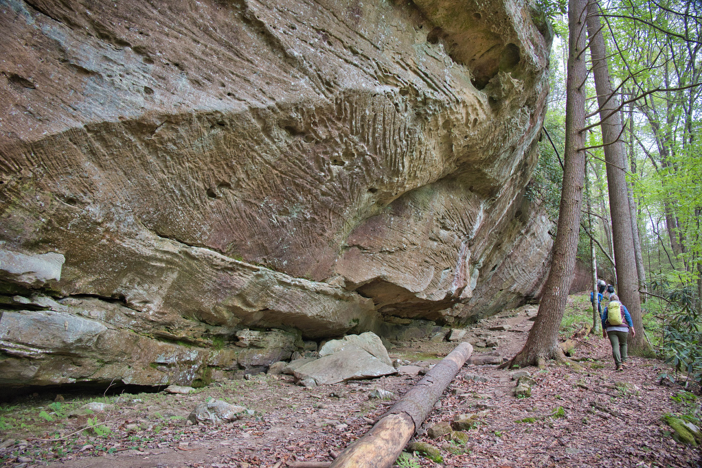
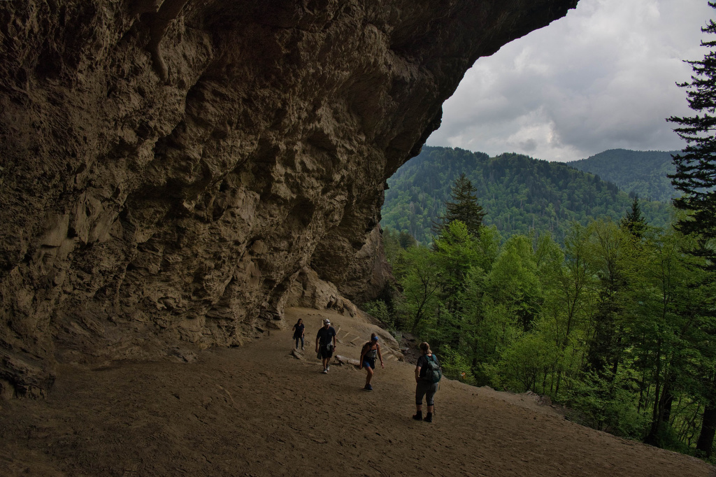
rock formations

Roaring Run Hoop Hole

The Hike: This easy hike passes beside Roaring Run much of the way. We hiked following heavy rains and the stream was full and the falls were spectacular. This loop trail combines the Woodland Trail and the Streamside Trail. Both trails begin near the trail kiosk by the restrooms.  We began the loop by following […]

Roaring Run Hoop Hole Read More »

Carvins Cove & Hay Rock

The Hike: This hike on the Appalachian Trail has great views of Carvins Cove Reservoir and and Hay Rock. The trail is well marked and well maintained thanks to the volunteers with the Roanoke Appalachian Trail Club. A short .2 mile unmarked trail leads from the parking area to the AT. This trail is located

Carvins Cove & Hay Rock Read More »

Duncan Knob & Strickler Knob

Highlights: Great views, two great rock scrambles, Massanutten Mountain Distance: 9.3 miles out and back Elevation Change 1,860 feet Trail Surface: Rocky with a few dirt sections Difficulty Level: Strenuous (distance, elevation gain, extremely rocky sections) Trailhead Parking: Gap Creek Trailhead, Crisman Hollow Road (FR 274) search Google Maps for “Gap Creek Trailhead”. Note: Crisman

Duncan Knob & Strickler Knob Read More »

Reeds Gap to Dripping Rock AT

Highlights: Great views, Cedar Cliffs, Appalachian Trail Distance: 9.6 miles out and back Elevation Change: 831 feet Trail Surface: Dirt with rocky sections Difficulty Level: Moderate/strenuous (distance, rocky sections) Trailhead Parking: Reeds Gap, Blue Ridge Parkway MP 13.7 Website: Virginia Trail Guide Beer Pairings: Skipping Rock Beer Co.—Roasted Pecan Brown Ale & Bru-1 IPA The

Reeds Gap to Dripping Rock AT Read More »

Mary’s Rock AT North

Highlights: Appalachian Trail, amazing views, mountain laurel in June Distance: 3.7 miles out and back Elevation Change: 1,210 feet Trail Surface: Very rocky Difficulty Level: Moderate (rocky surface, elevation gain) Trailhead Parking: Panorama parking area, Skyline Drive MP 31.5; park entrance fee required Website: Shenandoah National Park and AllTrails Beer Pairings: Hawksbill Brewery—Hooray for Luray

Mary’s Rock AT North Read More »

Old Rag Circuit

Highlights: Rock scramble, amazing views Distance: 9.4 mile loop Elevation Change: 2,348 feet Trail Surface: Very rocky Difficulty Level: Very strenuous (rock scramble, distance, elevation)  Trailhead Parking: Old Rag parking area, route 600/Nethers Road off route 231 south of Sperryville; park entrance fee required, hike tickets required, see below Website: Shenandoah National Park and AllTrails

Old Rag Circuit Read More »

White Rock Falls

Highlights: Waterfalls, mountain views Distance: 4.4 mile loop Elevation Change: 886 feet Trail Surface: Dirt with several rocky sections Difficulty Level: Moderate (elevation)  Trailhead Parking: White Rock Gap parking area, Blue Ridge Parkway mile post 18.5 Website: AllTrails Beer Pairings: Brewing Tree Brewing Co.—Chapter 2 IPA & Flip Flop Pils The Hike: Most people like

White Rock Falls Read More »

Tibbet Knob

Highlights: Great views, rocky summit, rock scramble Distance: 3.3 miles out and back Elevation Change: 865 feet Trail Surface: Very rocky Difficulty Level: Moderate (rocky surface, rock scramble)  Trailhead Parking: Wolf Gap Recreation Area, VA state route 675 Website: AllTrails Beer Pairings: Woodstock Brewhouse—North Fork Golden Ale & Beckford Parish Pale Ale The Hike: This

Tibbet Knob Read More »

Buzzard Rock

Highlights: Great views, rocky summit Distance: 4 miles out and back Elevation Change: 631 feet Trail Surface: Very rocky Difficulty Level: Easy/moderate (rocky surface)  Trailhead Parking: Buzzard Rock Trailhead, 3094 Mountain Road, route 619, Lake Frederick VA Website: AllTrails Beer Pairings: PaveMint Smokin’ Taphouse—Lionshead Pilsner & Hazy Tides IPA The Hike: Buzzard Rock is located

Buzzard Rock Read More »

Emerald Pond

Highlights: Great views, mountain pond, Massanutten ridge, fire ant mounds Distance: 8.5 miles out and back Elevation Change: 1,630 feet Trail Surface: Very rocky Difficulty Level: Strenuous (rocky surface, distance, and elevation gain)  Trailhead Parking: Wildflower Trailhead at the site of the former Massanutten Visitor Center, US route 211, 5 miles east of New Market

Emerald Pond Read More »