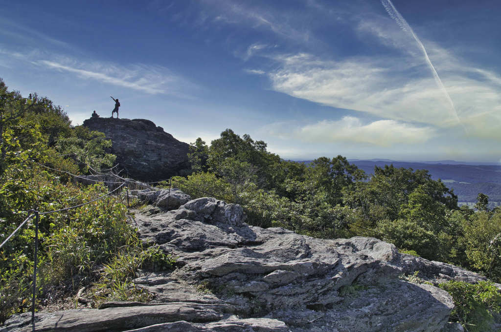
great views

Big Schloss

Highlights: Panoramic views Distance: 4.5 miles out and back Elevation Change: 978 feet Trail Surface: Very rocky Difficulty Level: Moderate/strenuous (rocky surface and steep climb for initial .7 miles)  Trailhead Parking: Wolf Gap Recreation Area, VA state route 675 Website: US Forest Service and AllTrails Beer Pairings: Woodstock Brewhouse—Seven Bender Pale Ale & Massanutten Stout […]

Big Schloss Read More »

Big Devil Stairs

Highlights: AT shelter, mountain and gorge views Distance: 7.5 miles out and back Elevation change: 1,237 feet Difficulty level: Strenuous Trailhead Parking: Keyser Run parking area, Skyline Drive mile post 19.4, park entrance fee required Website: AllTrails Beer Pairings: Tap 29—Are We There Yet? IPA & Pit Stop Pilsner The Hike: Big Devil Stairs is

Big Devil Stairs Read More »

Dobie Mountain & Jack Albright Loop

Highlights: AT shelter,streams, mountain views Distance: 6.7 mile loop Elevation change: 1,301 feet Difficulty level: Moderate/strenuous Trailhead Parking: Humpback Rocks Parking Area, Blue Ridge Parkway, mile post 6 Website: National Park Service and AllTrails Beer Pairings: Basic City 6th Lord IPA & Brother’s Skyline Falls IPA The Hike: This hike begins at the Humpback Rocks

Dobie Mountain & Jack Albright Loop Read More »

Buffalo Mountain Preserve

Highlights: Great views, rare plants, wildlife Distance: 2.2 miles out and back Elevation change: 560 feet Difficulty level: Easy Trailhead Parking: State route 727 near Union VA. The small parking area accommodates about 10 vehicles Website: Virginia Department of Conservation and Recreation Beer Pairings: Buffalo Mountain Brewery—McDaniel’s Scotch Ale & Copperhead IPA The Hike: Buffalo

Buffalo Mountain Preserve Read More »

Long Point, Fayetteville, and Timber Ridge Loop

Highlights: New River Gorge and Bridge views, Rhododendron forest Distance: 4.5 miles out and back Elevation change: 507 feet Difficulty level: Easy/Moderate Trailhead Parking: Long Point trailhead parking, Newton Road, Fayetteville WV Website: New River Gorge National Park Beer Pairings: Bridge Brew Works—New River IPA & Mountain Momma Pale Ale The Hike: New River Gorge

Long Point, Fayetteville, and Timber Ridge Loop Read More »

Endless Wall

Highlights: New River Gorge, great views, rock formations Distance: 3.1 miles loop Elevation change: 384 feet Difficulty level: Easy Trailhead Parking: Lansing-Edmond Road (route 82), north of the Canyon Rim Visitor Center. The Fern Creek Trailhead parking area has room for about 30 vehicles Website: New River Gorge National Park Beer Pairings: Freefolk Brewery—Fayetteville Fog

Endless Wall Read More »

Grandview Rim Trail

Highlights: New River Gorge, great views, rock formations Distance: 4.0 miles out and back Elevation change: 361 feet Difficulty level: Easy/moderate Trailhead Parking: Grandview Visitor Center, New River Gorge National Park, 4700 Grandview Road, Beaver, WV Website: New River Gorge National Park Beer Pairings: Weathered Ground Brewery—Jethro porter & Tallahatchie IPA The Hike: New River

Grandview Rim Trail Read More »

Bearfence Rock Scramble

Highlights: Fantastic views, rock scramble, Appalachian Trail Distance: 1.1 mile loop Elevation change: 217 feet Difficulty level: Moderate with rock scramble, easy without the scramble Trailhead Parking: Skyline Drive Bearfence Trailhead parking area mile 56.4, park fee required Website: Shenandoah National Park Beer Pairings: Octonia Stone Brew Works—Rokuhnite Me Amadeus lager & Worth One’s Basalt

Bearfence Rock Scramble Read More »

Crabtree Falls to The Priest

Highlights: Views, wildflowers, wildlife, waterfalls, Appalachian Trail Distance: 10.5 miles out and back Elevation change: 2,570 feet Difficulty level: Strenuous Trailhead Parking: Crabtree Falls Trailhead parking area, Route 56, Tyro VA, $3 parking fee Website: AllTrails Beer Pairings: Blue Mountain Barrel House—Red Zeppelin Red IPA & Classic Lager The Hike: The Priest is a famous

Crabtree Falls to The Priest Read More »

Dragon’s Tooth

Highlights: Great views, Appalachian Trail, rock scrambles, wildflowers, Triple Crown Distance: 5.5 miles loop Elevation change: 1,340 feet Difficulty level: Strenuous Trailhead Parking: Dragon’s Tooth Trailhead, route 311 Website: Visit Roanoke and Hiking Upward  Beer Pairings: A Few Old Goats Brewing—Oatmeal Stout & Galactic Retribution IPA  The Hike: Dragon’s Tooth was our 3rd Triple Crown

Dragon’s Tooth Read More »