Kid Friendly

Shenandoah River State Park Loop

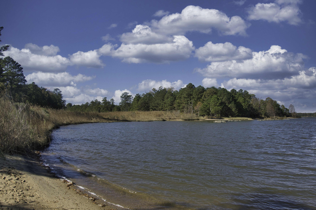
The Hike: Shenandoah River State Park is located just across US 340 from its national park cousin. The park has 5 miles of Shenandoah River South Fork shoreline and over 25 miles of hiking trails. We visited on a rainy day in late March when the Virginia bluebells were at their peak. This loop hike […]

Shenandoah River State Park Loop Read More »

High Rocks Trail

The Hike: This short hike has some great payoffs. Trailhead parking is 2 miles on the right after the Broadway Road (route 640) intersection with route 720. Broadway Road is a gravel, narrow, country road that winds through the Big Survey WMA. There are two small parking areas here. The trailhead is at the rear

High Rocks Trail Read More »

Little Mountain Falls

The Hike: Fairy Stone State Park is one of the original Virginia State Parks from 1936. Stop by the visitor center to pick up a trail map and to learn more about fairy stones. This hike combines several shorter trails so there are numerous junctions. All the trail junctions have signs and the trails are

Little Mountain Falls Read More »

Eagle Rock

Highlights: Great views, Tuscarora Trail Distance: 2.2 miles out and back Elevation Change 489 feet Trail Surface: Mostly dirt with a few rocky sections Difficulty Level: Easy/Moderate (some rocky sections) Trailhead Parking: Eagle Rock Trailhead parking area at the VA/WV state line, Capon Springs Grade, search Google Maps for “Tuscarora Trail Eagle Rock Trailhead” Website:

Eagle Rock Read More »

Browns Gap to Blackrock Summit

Highlights: Great views, Appalachian Trail Distance: 5.4 miles out and back Elevation Change 646 feet Trail Surface: Dirt with rocky sections Difficulty Level: Moderate (distance, rocky sections) Trailhead Parking: Brown’s Gap parking area, Skyline Drive MP 83 Website: AllTrails and Shenandoah National Park Beer Pairings: Champion Brewing Ice House—Hatchback Lyfe IPA & Festbier The Hike:

Browns Gap to Blackrock Summit Read More »

Thunder Ridge to Apple Orchard Mountain

Highlights: Great views, the Guillotine, Appalachian Trail Distance: 5.4 miles out and back Elevation Change: 948 feet Trail Surface: Dirt with rocky sections Difficulty Level: Moderate (distance, rocky sections) Trailhead Parking: Thunder Ridge parking area, Blue Ridge Parkway MP 74.7 Website: AllTrails Beer Pairings: Loose Shoe Brewing Co.—Apprentice Brown Ale & Alpha Mare IPA The

Thunder Ridge to Apple Orchard Mountain Read More »