wildlife

Grandview Rim Trail

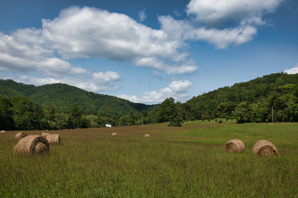
The Hike: New River Gorge became a national park in 2021. The park comprises over 70,000 acres and follows the New River for over 53 miles through some amazing canyons and gorges. This area is well known for white water rafting, rock climbing, mountain biking, and hiking.  This hike begins near the Grandview Visitor Center […]

Grandview Rim Trail Read More »

South River Falls Loop

Highlights: Waterfalls, wildflowers, Appalachian Trail Distance: 4.9 mile loop Elevation change: 1,081 feet Difficulty level: Moderate Trailhead Parking: Skyline Drive South River Picnic Area mile post 63, park fee required. Park near the rest rooms at the far end of the picnic grounds. Website: Shenandoah National Park Beer Pairings: Patch Brewing Co.—Home Field Advantage porter

South River Falls Loop Read More »

Crabtree Falls to The Priest

Highlights: Views, wildflowers, wildlife, waterfalls, Appalachian Trail Distance: 10.5 miles out and back Elevation change: 2,570 feet Difficulty level: Strenuous Trailhead Parking: Crabtree Falls Trailhead parking area, Route 56, Tyro VA, $3 parking fee Website: AllTrails Beer Pairings: Blue Mountain Barrel House—Red Zeppelin Red IPA & Classic Lager The Hike: The Priest is a famous

Crabtree Falls to The Priest Read More »

Thornton River Loop

Highlights: Appalachian Trail, stream crossings, wildflowers, history Distance: 7.8 miles loop Elevation change: 1,780 feet Difficulty level: Strenuous Trailhead Parking: Skyline Drive Thornton River Trailhead parking area mile 25.4, park fee required Website: AllTrails Beer Pairings: Iron Pipe Aleworks—Shapeshifter IPA & Gandalf the Haze IPA  The Hike: This hike doesn’t have amazing views or spectacular

Thornton River Loop Read More »

Dragon’s Tooth

Highlights: Great views, Appalachian Trail, rock scrambles, wildflowers, Triple Crown Distance: 5.5 miles loop Elevation change: 1,340 feet Difficulty level: Strenuous Trailhead Parking: Dragon’s Tooth Trailhead, route 311 Website: Visit Roanoke and Hiking Upward  Beer Pairings: A Few Old Goats Brewing—Oatmeal Stout & Galactic Retribution IPA  The Hike: Dragon’s Tooth was our 3rd Triple Crown

Dragon’s Tooth Read More »

Tinker Cliffs

Highlights: Great views, Appalachian Trail, wildflowers, Triple Crown Distance: 7.5 miles out and back Elevation change: 1,810 feet Difficulty level: Strenuous Trailhead Parking: Andy Layne Trail Parking, Catawba Road route 779 Website: Visit Roanoke and AllTrails Beer Pairings: Parkway Brewing Co.—Triple A Red Ale & Grapefruit Get Bent Mountain IPA  The Hike: Tinker Cliffs is

Tinker Cliffs Read More »

Rock Castle Gorge

Highlights: Great views, meadows, cascades, wildflowers, birdwatching, historic buildings Distance: 11.2 mile loop Elevation change: 2,226 feet Difficulty level: Strenuous Trailhead Parking: CC Camp Lane route 605, Floyd VA; alternate trailhead Blue Ridge Parkway mile 168, Saddle Overlook parking area Website: Hiking Upward and Blue Ridge Parkway, National Park Service Beer Pairings: Buffalo Mountain Brewery—McDaniel’s

Rock Castle Gorge Read More »

Dutch Gap Conservation Area

Highlights: River and lagoon views, birdwatching, wildlife, wildflowers Distance: 5 mile loop Elevation change: 30 feet Difficulty level: Easy/moderate Trailhead Parking: Citie of Henricus parking area,  341 Henricus Park Road, Chester VA Website: Chesterfield County Beer Pairings: Molly’s Blind Dog Brewery—Charlie’s Brown Ale & Train Wreck IPA The Hike: Dutch Gap is a nearly 800

Dutch Gap Conservation Area Read More »

Three Ridges: Reeds Gap to Tye River

Highlights: Great views, Appalachian Trail, wildflowers, stream crossings Distance: 10.8 miles one way Elevation change: 2,231 feet Difficulty level: Strenuous Trailhead Parking: Reeds (Reids) Gap, Beech Grove Road, route 664 and Blue Ridge Parkway Website: AllTrails Beer Pairings: Wild Wolf Brewery—Nelsonite Brown Ale & Notorious H.O.P. IPA The Hike: Several of our friends have hiked

Three Ridges: Reeds Gap to Tye River Read More »

Fortune’s Cove Preserve

Highlights: Mountain views, wildlife, wildflowers, stream crossings Distance: 3.7 miles loop Elevation change: 790 feet Difficulty level: Easy/Moderate Trailhead Parking: Route 651, Fortune’s Cove Lane, Lovingston VA Website: Fortune’s Cove Preserve  Beer Pairings: Wood Ridge Farm Brewery—Hop Notch IPA & Mr. Brown Stout The Hike: Fortune’s Cove is a hidden gem located about 40 miles

Fortune’s Cove Preserve Read More »