Kid Friendly

AT: Beagle Gap to Calf Mountain Shelter

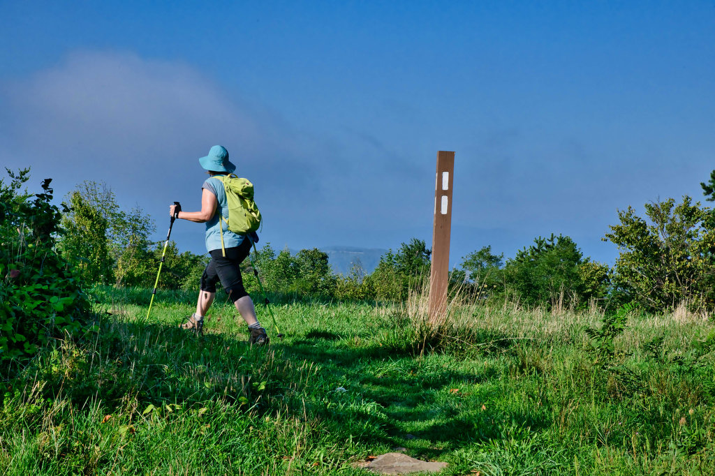
Highlights: Meadows, views, wildlife, birdwatching, wildflowers, AT shelter Distance: 4.9 miles out and back Elevation change: 821 feet Difficulty level: Moderate Trailhead Parking: Beagle Gap parking area, Skyline Drive mile 99.5, park fee required Website: Hiking Upward Beer Pairings: Dr. Ho’s Humble Pie—Skipping Rock Kolsch & Blue Mountain Full Nelson The Hike: This hike follows […]

AT: Beagle Gap to Calf Mountain Shelter Read More »

Windsor Castle Park

Highlights: Historic buildings, wildlife, birdwatching, creek and marsh views Distance: 4.1 miles loop Elevation change: 64 feet Difficulty level: Easy Trailhead Parking: Dan Smith Drive parking area, Smithfield VA Website: Windsor Castle Park Beer Pairings: Wharf Hill Brewing—Holy Brale brown ale & Outage IPA The Hike: Windsor Castle Farm in Smithfield was originally part of

Windsor Castle Park Read More »

Apple Orchard Falls

Highlights: Waterfalls, rock formations, wildflowers, wildlife Distance: 2.8 miles out and back Elevation change: 995 feet Difficulty level: Easy/Moderate Trailhead Parking: Sunset Fields parking area, milepost 78.4 on the Blue Ridge Parkway Website: US Forest Service Beer Pairings: Peaks of Otter Lodge—Free Verse IPA & Gold Lager The Hike: Apple Orchard Falls is a popular

Apple Orchard Falls Read More »

Harkening Hill & Johnson Farm Loop

Highlights: Historic farm, views, rock formations, wildflowers, wildlife Distance: 4.3 mile loop Elevation change: 905 feet Difficulty level: Moderate Trailhead Parking: Peaks of Otter Visitor Center parking area, Blue Ridge Parkway mile post 86 Website: National Park Service Beer Pairings: Apocalypse Ale Works—Enticer Session IPA & D-Stroy IPA The Hike: First of all, Harkening Hill

Harkening Hill & Johnson Farm Loop Read More »

Blue Ridge Tunnel

Highlights: Historic railroad tunnel Distance: 4.6 miles out and back Elevation change: 456 feet Difficulty level: Easy Trailhead Parking: East Trailhead 215 Afton Depot Lane, Afton VA Website: Nelson County Beer Pairings: Wild Man Dan Brewery—Rye She Knows IPA & BoHo Slipper Pilsner The Hike: This easy hike follows the path of a historic railroad

Blue Ridge Tunnel Read More »

Fallingwater Cascades

Highlights: Waterfall, rock formations, wildflowers, wildlife Distance: 1.6 mile loop Elevation change: 410 feet Difficulty level: Easy Trailhead Parking: Flat Top parking area, Blue Ridge Parkway mile post 83.5 Website: National Park Service Beer Pairings: Beale’s Brewery—Purple Mountain Pilsner & Red IPA The Hike: This short hike leads to a waterfall and series of cascades.

Fallingwater Cascades Read More »

Flat Top Mountain

Highlights: Mountain top views, large boulders, wildflowers, wildlife Distance: 5.2 miles out and back Elevation change: 1,750 feet Difficulty level: Strenuous Trailhead Parking: Flat Top parking area, Blue Ridge Parkway mile post 83.5 Website: National Park Service Beer Pairings: Beale’s Brewery—Purple Mountain Pilsner & Red IPA The Hike: The Peaks of Otteris a popular destination

Flat Top Mountain Read More »

Maryland Heights

Highlights: Appalachian Trail, Harpers Ferry historic district, great views Distance: 4.5 miles out and back Elevation change: 1,350 feet Difficulty level: Moderate/strenuous Trailhead Parking: Lower Town Information Center, Harpers Ferry WV, park fee required Website: Harpers Ferry National Historical Park Beer Pairings: Smoketown Brewing—My Best Girl DIPA & Angler’s Mid Atlantic Steam IPA The Hike:

Maryland Heights Read More »

Queen’s Garden & Navajo Loop

Highlights: Rock formations, amazing views Distance: 2.9 mile loop Elevation change: 600 feet Difficulty level: Easy/Moderate Trailhead Parking: Sunset Point overlook, park shuttle stop # 11 Website: Bryce National Park Beer Pairings: Bryce Canyon Lodge—Wasatch 1st Amendment Lager & Squatters Full Suspension Pale Ale The Hike: Keeping with our western theme, we have been to

Queen’s Garden & Navajo Loop Read More »

Breaks Interstate Park Loop

Highlights: Great views, wildlife, wildflowers, rock formations Distance: 3.6 mile loop Elevation change: 380 feet Difficulty level: Moderate Trailhead Parking: Commission Circle (route 702) to Picnic Shelter # 2 parking area Website: Breaks Interstate Park Beer Pairings: Adventure Brewery—Expedition IPA and Rod & Reel Pilsner The Hike: Breaks Interstate Park is called “the Grand Canyon

Breaks Interstate Park Loop Read More »