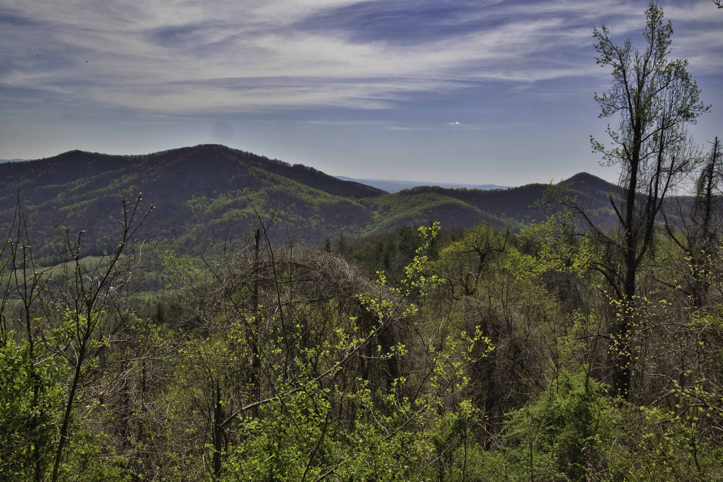
stream crossing

Big Devil Stairs

Highlights: AT shelter, mountain and gorge views Distance: 7.5 miles out and back Elevation change: 1,237 feet Difficulty level: Strenuous Trailhead Parking: Keyser Run parking area, Skyline Drive mile post 19.4, park entrance fee required Website: AllTrails Beer Pairings: Tap 29—Are We There Yet? IPA & Pit Stop Pilsner The Hike: Big Devil Stairs is […]

Big Devil Stairs Read More »

Dobie Mountain & Jack Albright Loop

Highlights: AT shelter,streams, mountain views Distance: 6.7 mile loop Elevation change: 1,301 feet Difficulty level: Moderate/strenuous Trailhead Parking: Humpback Rocks Parking Area, Blue Ridge Parkway, mile post 6 Website: National Park Service and AllTrails Beer Pairings: Basic City 6th Lord IPA & Brother’s Skyline Falls IPA The Hike: This hike begins at the Humpback Rocks

Dobie Mountain & Jack Albright Loop Read More »

Little Flat Mountain

Highlights: Wildflowers, streams, mountain views Distance: 4.5 mile loop Elevation change: 1,263 feet Difficulty level: Moderate/strenuous Trailhead Parking: Patricia Ann Byrom Forest Preserve Park, 6610 Blackwells Hollow Road, Crozet, VA  Website: Albemarle County and AllTrails Beer Pairings: Skipping Rock Beer Co. Amber Lager & Bell’s Brewery Two Hearted Ale The Hike: This fun hike is

Little Flat Mountain Read More »

Texas Beach

Highlights: James River, bird watching Distance: 3.6 miles out and back Elevation change: 128 feet Difficulty level: Easy Trailhead Parking: North Bank Park, 1941 Texas Ave., Richmond VA Website: James River Park and AllTrails  Beer Pairings: Strangeways Brewing, Scott’s Addition—Zappa On Strat IPA & Less Than Zero IPA The Hike: Texas Beach is a popular

Texas Beach Read More »

South River Falls Loop

Highlights: Waterfalls, wildflowers, Appalachian Trail Distance: 4.9 mile loop Elevation change: 1,081 feet Difficulty level: Moderate Trailhead Parking: Skyline Drive South River Picnic Area mile post 63, park fee required. Park near the rest rooms at the far end of the picnic grounds. Website: Shenandoah National Park Beer Pairings: Patch Brewing Co.—Home Field Advantage porter

South River Falls Loop Read More »

Thornton River Loop

Highlights: Appalachian Trail, stream crossings, wildflowers, history Distance: 7.8 miles loop Elevation change: 1,780 feet Difficulty level: Strenuous Trailhead Parking: Skyline Drive Thornton River Trailhead parking area mile 25.4, park fee required Website: AllTrails Beer Pairings: Iron Pipe Aleworks—Shapeshifter IPA & Gandalf the Haze IPA  The Hike: This hike doesn’t have amazing views or spectacular

Thornton River Loop Read More »

Dragon’s Tooth

Highlights: Great views, Appalachian Trail, rock scrambles, wildflowers, Triple Crown Distance: 5.5 miles loop Elevation change: 1,340 feet Difficulty level: Strenuous Trailhead Parking: Dragon’s Tooth Trailhead, route 311 Website: Visit Roanoke and Hiking Upward  Beer Pairings: A Few Old Goats Brewing—Oatmeal Stout & Galactic Retribution IPA  The Hike: Dragon’s Tooth was our 3rd Triple Crown

Dragon’s Tooth Read More »

Rock Castle Gorge

Highlights: Great views, meadows, cascades, wildflowers, birdwatching, historic buildings Distance: 11.2 mile loop Elevation change: 2,226 feet Difficulty level: Strenuous Trailhead Parking: CC Camp Lane route 605, Floyd VA; alternate trailhead Blue Ridge Parkway mile 168, Saddle Overlook parking area Website: Hiking Upward and Blue Ridge Parkway, National Park Service Beer Pairings: Buffalo Mountain Brewery—McDaniel’s

Rock Castle Gorge Read More »

Three Ridges: Reeds Gap to Tye River

Highlights: Great views, Appalachian Trail, wildflowers, stream crossings Distance: 10.8 miles one way Elevation change: 2,231 feet Difficulty level: Strenuous Trailhead Parking: Reeds (Reids) Gap, Beech Grove Road, route 664 and Blue Ridge Parkway Website: AllTrails Beer Pairings: Wild Wolf Brewery—Nelsonite Brown Ale & Notorious H.O.P. IPA The Hike: Several of our friends have hiked

Three Ridges: Reeds Gap to Tye River Read More »

Apple Orchard Falls

Highlights: Waterfalls, rock formations, wildflowers, wildlife Distance: 2.8 miles out and back Elevation change: 995 feet Difficulty level: Easy/Moderate Trailhead Parking: Sunset Fields parking area, milepost 78.4 on the Blue Ridge Parkway Website: US Forest Service Beer Pairings: Peaks of Otter Lodge—Free Verse IPA & Gold Lager The Hike: Apple Orchard Falls is a popular

Apple Orchard Falls Read More »